About 350 seafront properties were given until 9am to evacuate.
Police are monitoring sites around the city's south coast, picking up people walking along the waterfront and encouraging others to evacuate.
"If you have not left the evacuation zones, you do so at your own risk. Emergency services will not be sent out to evacuated areas," Wellington Region Emergency Management Office said after the 9am deadline passed.
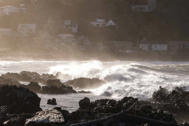
MetService has issued a heavy swell warning for Cape Terawhiti to Turakirae Head in Wellington, and Turakirae Head to Mataikona in Wairarapa.
The forecaster says southerly combined waves could rise to 9.5 to 10.5 metres late Tuesday morning, before easing midday.
On the Wellington south coast, waves are forecast to rise to 8 to 9 metres by Tuesday afternoon, then easing Tuesday night, with a pale period of 12-14 seconds.
Wellington City Mayor Andrew Little declared a state of emergency for the region's southern and eastern wards on Monday afternoon.
Then, at 6.30pm, Wellington Civil Defence issued a mandatory evacuation order for waterfront properties in Ōwhiro Bay, Island Bay, Houghton Bay and Breaker Bay - Lyall Bay is not included in the order.
Interislander and Bluebridge have cancelled Cook Strait ferry sailings.
Plane tips over in strong winds
A Golden Bay Air plane tipped on its side at Wellington Airport this morning in a gust of wind.
Chief executive Richard Molloy said the plane won't be used again today.

"There's no damage as far as I know, but we still need to get it check before we go anywhere."
The plane is lighter without anyone in it, Molloy said.
Anyone due to fly to Takaka today was being put on a flight to Nelson and shuttled over the Takaka Hill, he said.