Major highways in the South have reopened after heavy snow and ice earlier today. It meant a day off school for some, while others hit the slopes.
This morning's severe conditions also included freezing and thick fog, making many roads hazardous.
By 10am, the Arrowtown and Poolburn primary schools in Central Otago were closed for Thursday and a flight into Queenstown had to be turned back to Auckland late in the morning due to the wintry blast.
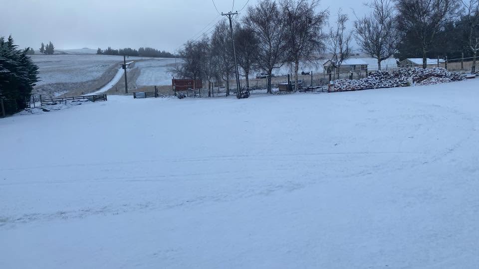
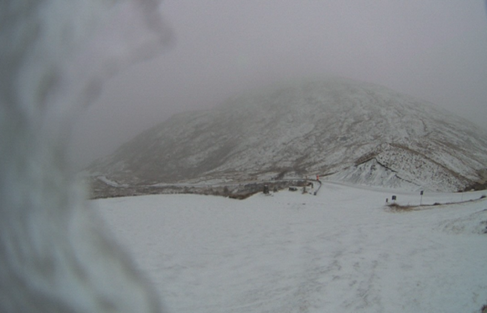
But it was good news for skiers, with a decent amount of snow falling at Coronet Peak and The Remarkables in Queenstown.
The New Zealand Transport Agency advised that State Highway 8 between Omarama and Tarras (including the Lindis Pass), and SH85 between Lauder and Wedderburn in Otago was now open.
However, people were asked to travel these routes with care due to the remaining presence of ice and grit.
Part of the Crown Range Road, linking Queenstown and Wānaka, closed from early this morning had also reopened.
However, Danseys Pass in Central Otago remained shut.
With the wintry blast moving up the South Island, area warnings for snow and ice were now place for SH8 between Fairlie and Twizel and SH80 between Lake Pukaki and Aoraki/Mount Cook, a spokesman for NZTA said this afternoon.
MetService said road snowfall warnings have been issued for the Lindis Pass (SH8) in Otago, and Canterbury's Porters Pass, Arthur's Pass (both SH73) and the Lewis Pass (SH7).
Snow showers and snow was expected to settle on roads until tomorrow. Motorists were urged to take extra care travelling on highways, especially those at higher elevations.
Central Otago
It was a chilly start in Central Otago today, with temperatures ranging from -1°C to 5°C and fog blanketing most of the network and thick in low-lying areas.
Caution was advised on Maniototo roads, as black ice and snow was affecting the Ida Valley - Omakau Rd from Oterehua, as well as Naseby, Becks and St Bathans.
Crews were snow clearing and applying grit in these areas, a spokesman for the Central Otago District Council said.
Queenstown snow good news for ski fields
It was snowing in Queenstown and ice was expected, particularly in Arrowtown, Dalefield and Arthurs Point areas.
Queenstown Hill, Fernhill and Glenorchy Rd have damp to wet roads, with frost forming and would be slippery in places.
Heavy snow had been reported in Kingston and south towards Lumsden, and it snowed overnight in the Cardrona Valley.
Meanwhile, Queenstown ski fields are celebrating the cold snap.
The Remarkables website today advised it would open its learner ski slopes on Saturday after getting a 10cm dump of snow in the past 24 hours.
There had also been a decent amount of snow at Coronet Peak this morning enabling people to take to the slopes.

In Upper Clutha, Wānaka and Hāwea it was around -2°C early this morning, with damp conditions and icy patches also likely.
"Please travel with care and be prepared for changing conditions."

Southland
In Southland, there was snow to road level on the Milford Road (SH94) with freezing conditions early this morning, but it has been cleared.
The highway would close from Homer Tunnel (East Portal) to Homer Tunnel (West Portal) from 6.30pm today until 4am tomorrow for scheduled maintenance, with an opening for clearing traffic at 9pm today.

Snowfall warnings for alpine roads
Lindis Pass (SH8)
Snow showers are possible above about 500 metres from 8am until 2pm today. Another 1cm to 2cm of snow could accumulate on the road above 800 metres at times with lesser amounts to 500 metres.
Arthur's Pass (SH73)
From noon until 10pm today: Showers falling as snow above 800 metres, lowering to 600 metres in the afternoon. Up to 2cm of snow is possible about the summit.
Porters Pass (SH73)
From noon until 11pm today: Showers falling as snow above 800 metres is forecast, lowering to 400-500 metres in the afternoon. Expect 5cm to 10cm to accumulate about the summit and 1cm to 4cm down to 400-500 metres.
Lewis Pass (SH7)
From 10am today until 3am on Friday: Periods of rain falling as snow above 800 metres, snow lowering to 500 metres late this afternoon. Expect 1cm to 2cm of snow to accumulate near the summit this morning, then a further 1cm to 3cm from late afternoon through to early on Friday. East of the summit accumulations may reach 5cm above 500 metres.
- Allied Media