
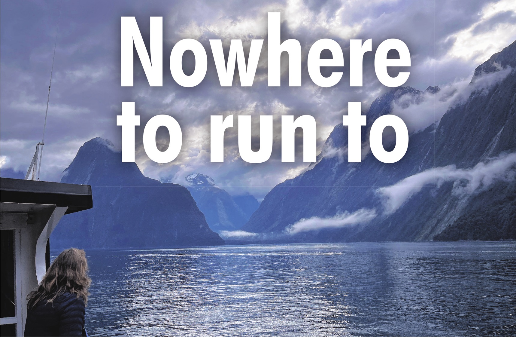
Patches of sun filter through the cloud hanging over Piopiotahi-Milford Sound to splash across the broadening silver line of the Tasman Sea.
Mitre Peak, wrapped modestly in mist, has disappeared into our wake, as our boat pushes out into the open sea’s churning swells, which laugh at our clumsy efforts to wall the deck.
Before the captain of the MV Sinbad turns her round, we can see a feature even more important than Mitre Peak to the story of one of the world’s best-known fiords.
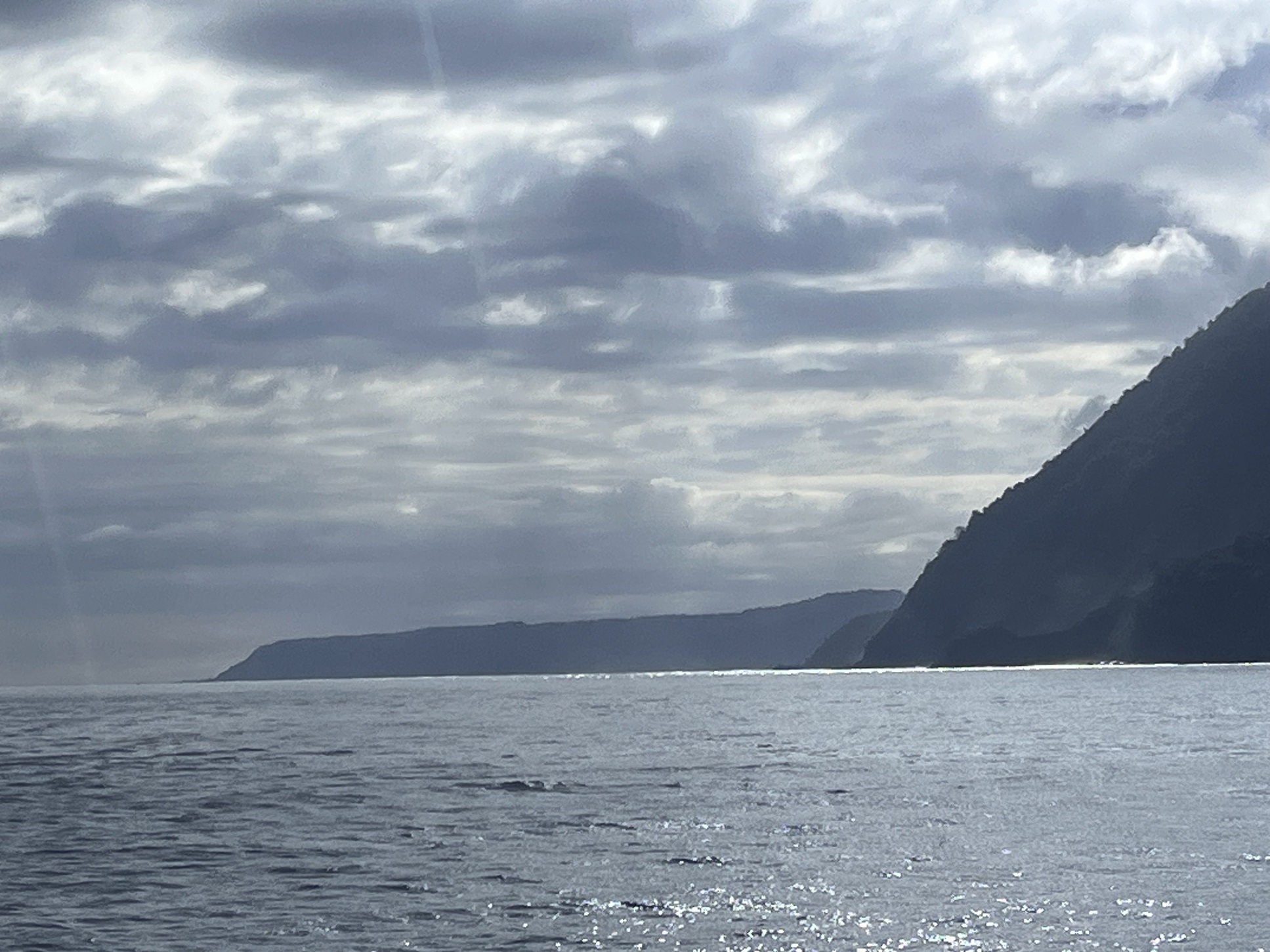
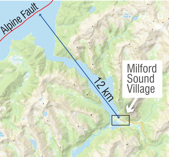
Ahead a few kilometres on the right, between Stripe Point and Yates Point, the Alpine Fault ends its more than 600km journey through the land from St Arnaud in the Nelson Lakes.
At the mouth of the fiord, it plunges into the ocean and continues to head southwest, marking the tectonic boundary between the Pacific Plate to the east and the Australian Plate to the west.
The fault last ruptured in 1717, generating an earthquake of about magnitude 8.1. Scientists have calculated it is due or even overdue to rupture again, giving a 75% chance of that happening in the next 50 years.
An Alpine Fault-generated tsunami in the fiord is a huge concern, given close to 1 million people visit every year and contribute about $200 million annually to the regional economy. Fiordland is New Zealand’s national park most visited by international tourists, about 21% of them travelling there each year.
As hard and fixed as the almost vertical cliffs of Milford Sound appear, plunging 2000m or more from the peaks down to the sea floor, severe shaking in previous quakes has peeled away vast quantities of metamorphic and igneous rock, mainly gneiss and granite.
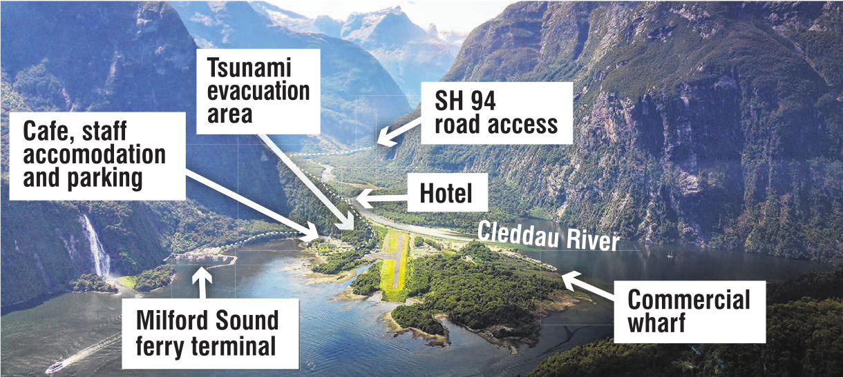
If you were there when that happened, where would you go? Modelling suggests a tsunami wave would swamp the village within two to seven minutes and reach at least 17m above sea-level.
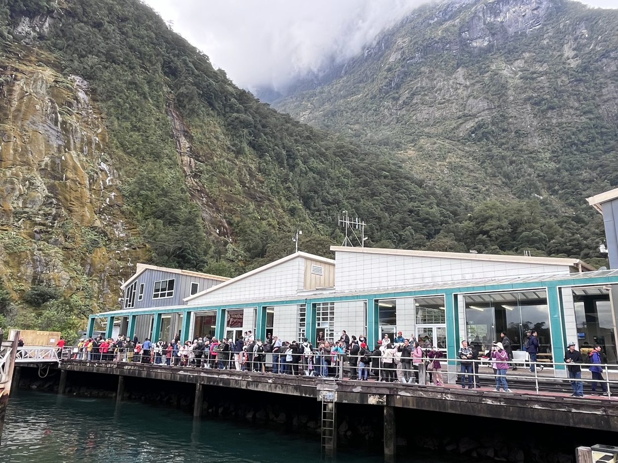
On an off-peak day there are commonly upwards of 1500 people visiting Milford Sound, almost twice as many in summer, more than a couple of hundred tourists milling about by the waterside on the visitor terminal wharf waiting for cruises.
Kiwis recognise that "long or strong, get gone" is sound advice in a tsunami-prone location, although in a major Alpine Fault quake strong shaking in Milford Sound could last several minutes, soaking up crucial escape time.
"Drop, cover and hold" is the other key message.
However, the University of Canterbury’s Dr Tom Robinson, a senior lecturer in disaster risk and resilience, says officially approved messaging of what to do in a large earthquake is somewhat unhelpful here.
"Instead of ‘drop, cover and hold’, people should immediately move inland and towards higher ground as quickly as possible," he says.
"At Milford Sound, you definitely don’t want to wait until the shaking has finished to go.
"If a tsunami does occur in Milford Sound, we won’t have long, so moving as soon as possible is our best chance. I would be doing my best to move to high ground as quickly as possible — whether I would be able to is another question.
A tsunami in the fiord on a normal day would be a horrifying event causing mass fatalities, according to Canterbury University adjunct professor Tim Davies, an expert in geohazards and disaster management.
"In the worst-case scenario you could wipe out a couple of thousand people in Milford. It’s dreadful. Including people on cruise ships, because there are often cruise ships in Milford.
"There are computer simulations of what the wave climate is like in Milford after a big landslide and it’s just like a washing machine. The waves are coming from all directions."
Such a nightmare situation seems unreal on a day like this. The fiord is calm and the clouds are hanging low against the mountains. The drizzle is largely, but not completely, holding off.
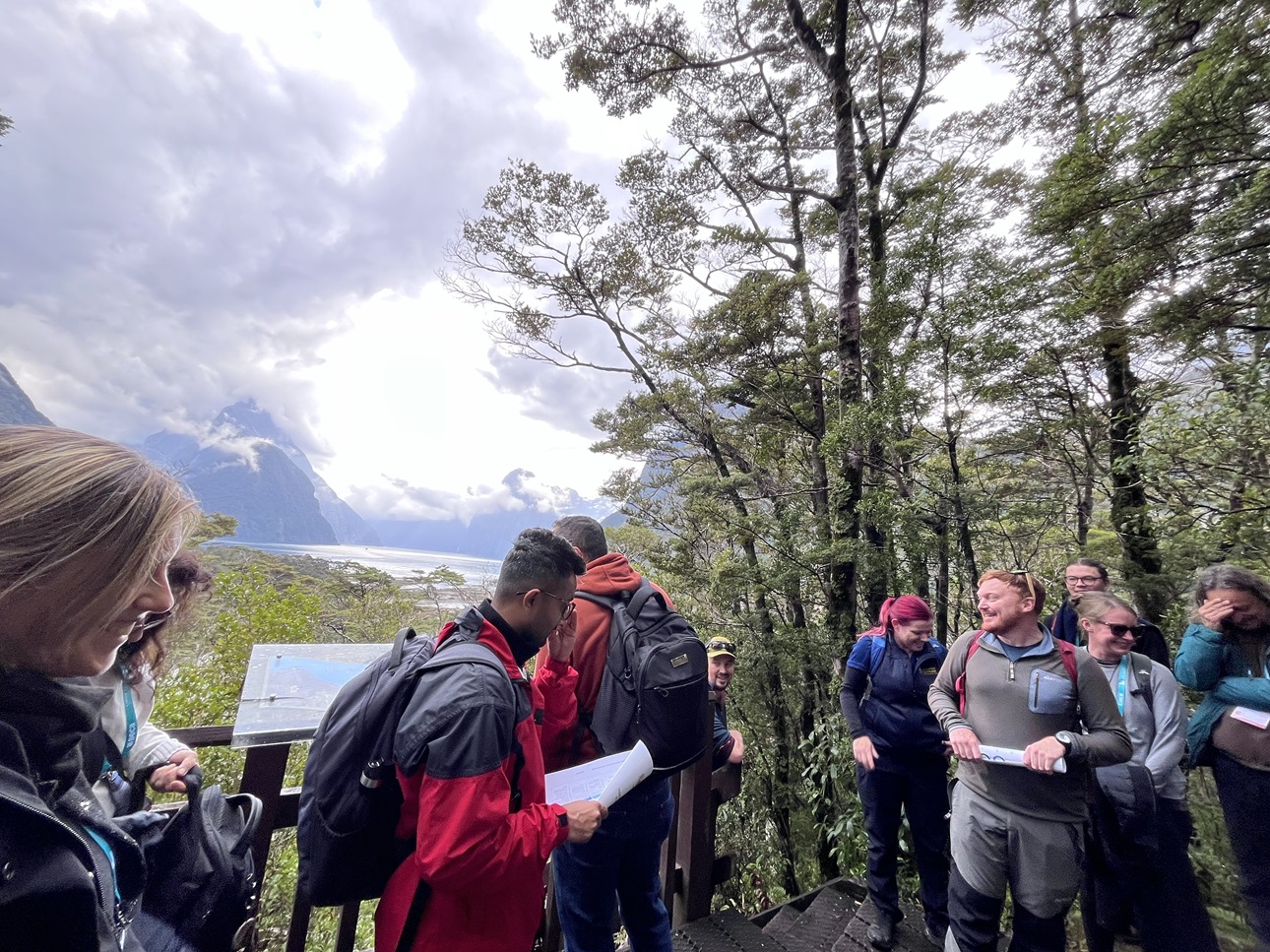
About 30 of us are here in Piopiotahi for a four-hour field trip, as part of the international Landslide Risk and Geo-Education conference.
It’s a great day to be a visitor. It’s a better day to be a sandfly. Even covered head to toe, they’re on your hands, in your ears, up your nose. A few brave people in shorts will soon regret their clothing choice.
You get a couple of free minutes standing on the same spot before a swirl arises from the nearby bush. Time to move on.
In Māori legend, Hine-nui-te-pō, the goddess of the underworld, is said to have created sandflies and released them into Milford Sound to chase humans away, fearing it was so beautiful they would want to stay forever.
It should be high enough up the hillside into the bush to be safe from rising water, but there are no guarantees. Even if it were advertised as a tsunami safe-zone, it is hard to imagine many hundreds of people running here in time and managing to clamber at speed up this hard-to-find, narrow, rocky track.
According to our field guide, written by Robinson and Canterbury University post-doctoral fellow Dr Mat Darling, wave speeds in Milford Sound could be anywhere between 100kmh and 200kmh. However, most people aged 15 to 64 cannot stand up in water flowing at more than about 5kmh, "suggesting the chance of survival is close to 0".
We’ve also been given the slightly better news that, given the likelihood of a landslide-induced tsunami in the fiord is about 0.66% in any one year, the chance it will happen during our short stay is 0.0003%, or three in a million, which certainly seems in our favour.
Understanding the risk to the life of individuals and to wider society, in terms of reputational damage, is critical to determining if those levels are what is regarded as "tolerable". Risk is defined as the impact of the event multiplied by how frequently it occurs.
The annual individual fatality risk for the up to 200 staff working at Milford Sound every day has been calculated as similar to working in the mining or forestry sector. For someone visiting for a day, that risk is more than two orders of magnitude lower, estimated as about the same as doing a bungy jump.
The Department of Conservation has considered visitor-risk tolerance for various sites and classifies the risk to an individual visiting the fiord as between "moderate" and "substantial".
In terms of societal risk, New Zealand does not have a legislative framework for assessing it and what may be tolerable. Researchers here have used the United Kingdom’s Health and Safety Executive tolerance guidelines for Milford Sound and found 87% of the days in their study exceeded that tolerance threshold.
They discovered that while travel restrictions due to Covid-19 lowered risk beneath the threshold, the resurgence of domestic and international visitors is now pushing it further beyond tolerable levels.
"There’s a worst-case scenario in Milford Sound, sometime around 12.30pm-1pm. Some of the best-case scenarios we can model are in the middle of the night.
"It’s not just thinking about what’s on land — we’ve got lots of vessels going around in circles. [We’re] thinking about how those vessels perform ... thinking about, ‘how do we handle some of these larger cruise ships, which typically come into Milford Sound in the early hours of the morning and the late hours of the evening?’
"That could be a vessel with 5000 people on it. Just thinking about that from an emergency management perspective is another piece we need to work through. So, as you can tell, welcome to the most complicated piece of New Zealand’s risk, in my opinion."
Davies says the risk at Milford Sound is "two or three times higher than the risk at White Island, mainly because so many more people go there".
"With all my reservations about quantifying risk, the risk at Milford is 10,000 times higher than acceptable. It’s even worse than Whakaari. The government has banned people from going there, they’ve shut it down.
"What I’ve learned is the government is taking this very, very seriously. The problem is, the only viable solution is to shut the place down — that’s the only way we’re going to get the risk down to an acceptable level. And I understand that there’s no way that’s going to happen."
Conservation Minister Tama Potaka told The Weekend Mix closing the destination to visitors was not an option.
"The focus is on understanding risks properly, ensuring visitors are informed, operators are prepared and emergency management arrangements are robust.
"A collective Piopiotahi Milford Sound Collective Hazard Risk Communications Strategy was released in April and is now being implemented. This includes updating visitor information, websites, signage, maps, brochures and frontline staff training, while also working with tourism operators and international travel partners to ensure visitors receive clear and consistent information before they arrive."
Any future decisions about closing Milford Sound would need to be "evidence-based, proportionate and carefully considered in collaboration with agencies, operators, emergency management experts and the local community", Potaka says.
Safety is a shared responsibility, tourism operators and agencies having obligations under the Health and Safety at Work Act to "take reasonable steps to manage known risks".
Emergency Management Southland’s principal emergency management adviser, Tracey Fraser, says there has to be a high-trust approach with local operators.
"Everyone has to buy-in to act in everyone’s best interests, rather than seeing all the staff running for it and leaving all the tourists behind.
"Lots of people don’t realise, for the amount of people that come here every day you would potentially expect to see the same infrastructure you’d strike in a small town anywhere across New Zealand, be that a medical centre or a mini supermarket. Yet none of that’s in here.
"Essentially, when you left Te Anau, you left your last medical treatment place behind. It can take hours and hours for St John to get in here.
"In a Milford-only event, like we had in 2020 with the floods, then, yes, the rest of Southland and wider New Zealand can assist fairly quickly. But if we were to have an event like the Alpine Fault, Milford Sound, in the grand scheme of the South Island being affected by a major earthquake, might be well down the list, depending on how Otago and Canterbury have been hit."

"Inability to evacuate is not a behavioural issue but a structural one. The limited number, capacity and accessibility of evacuation sites, combined with distance from key locations such as the ferry terminal and congestion effects, mean that more than 95% of people are unable to evacuate in time.
"As most visitors to Milford Sound are international tourists, it’s questionable how many know what natural warning signs to look out for."
While we were on the viewing platform, the point was also made that because many visitors came from countries where people have implicit trust in the government and operators, they believe that if something is open it must be safe.
According to the field guide, another study in 2015 discovered that for every metre climbed up to 16m above sea-level, the chance of being killed by a tsunami dropped by 11%. Above that, every extra metre decreased that likelihood by 46%.
However, as we had made our way up to the platform, we gained an appreciation that the steep hillsides and dense bush would make that very difficult indeed.
The only other option is to go back along State Highway 94 away from the water, but getting far enough away and high enough, quickly enough, to avoid the swash zone would also be extremely problematic.
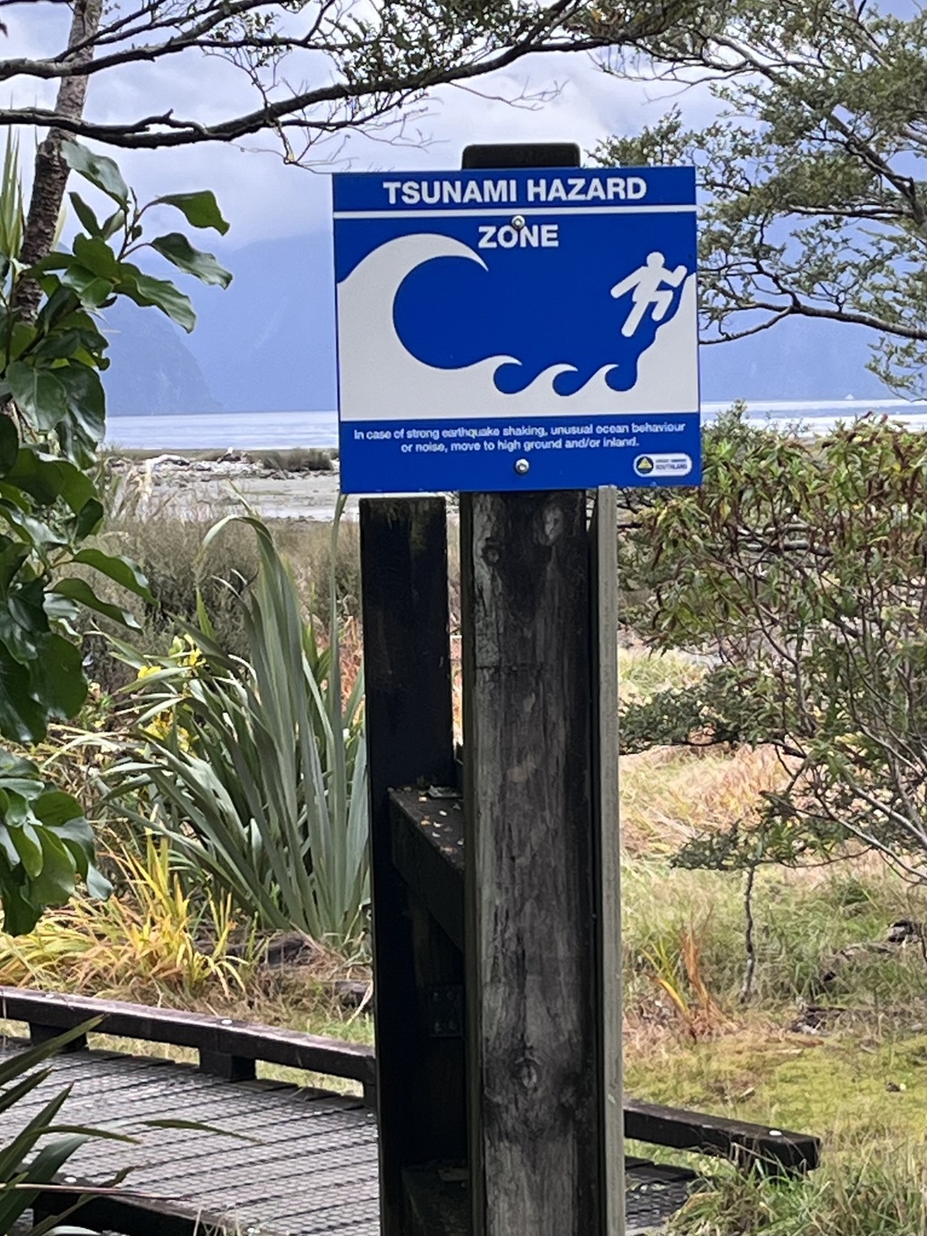
So, what safety advice do visitors to the fiord receive about tsunami?
Inside the visitor terminal, a Tiaki Promise sign says: "Understand the natural hazards of this environment". But this is in the "Be Prepared" section and probably referring more to how quickly the weather can change than an earthquake or tsunami.
Chief executive Dave Beeche says risk-warning messages have been integrated "throughout our entire booking process, including website landing pages, booking pages, the checkout process, booking confirmation emails, and contact centre procedures".
"Our team is also working with trade partners, online travel agencies and visitor centres to extend the messaging across every possible booking touchpoint for guests travelling to Piopiotahi."
The RealNZ website features detailed advice about natural hazards in the fiord and makes it clear that any large earthquake or landslide may cause a tsunami which "pose a risk to life".
Milford Sound Tourism Ltd chief executive Haylee Preston applauds recent research on the risk.
MSTL is responsible for much of the core infrastructure in the fiord and employs 25 staff, most of whom live there. It operates the harbour, the wharves, the visitor terminal and parking areas, and manages by Doc concession and sub-licences the six tourism cruise operators.
"All of us who operate in here have a responsibility to make sure that our infrastructure, safety systems and environmental management keep pace, because while this place is stunning, it’s also dynamic and challenging.
"We deal with storms, flooding, snow, avalanches, landslide-generated tsunamis, and the Alpine Fault runs right past the entrance of the sound. Good times.
"We’ve got limited evacuation options, less-than-perfect cell coverage, multinational, multilingual visitors travelling here in a range of ways that makes communicating risk clearly and responsibility a real challenge, but it’s essential. People need to be able to make informed decisions about what level of risk they’re comfortable with before they come here."
"A lot of the operators in there are already showing leadership of how they communicate all natural hazard information. Like in any industry, 99.9% are going to do the right thing.
"Visitors need clear, simple, aligned information, no matter who they talk to or what they read. This work helps ensure we’re all speaking with one voice.
"We still need more science to fully quantify and manage this risk. What we have agreed, though, is that there should be no lag in communicating what we know."
The bus winds up SH94, past huge historic landslides, deep bush and fast-flowing rivers. The water skips down the perpendicular rock slopes that peak as far above your head as your neck allows you to see. You cannot fully understand this place without being here.
As mind-blowingly beautiful as it is, a sigh of relief on reaching the western portal of the Homer Tunnel reflects its dangers too.
The sandflies have seen off another bunch.
Tsunami far from the sea
Strong earthquake-shaking leading to major landslides and faults rupturing on a lake-bed can also generate the equivalent of tsunami within inland bodies of water.
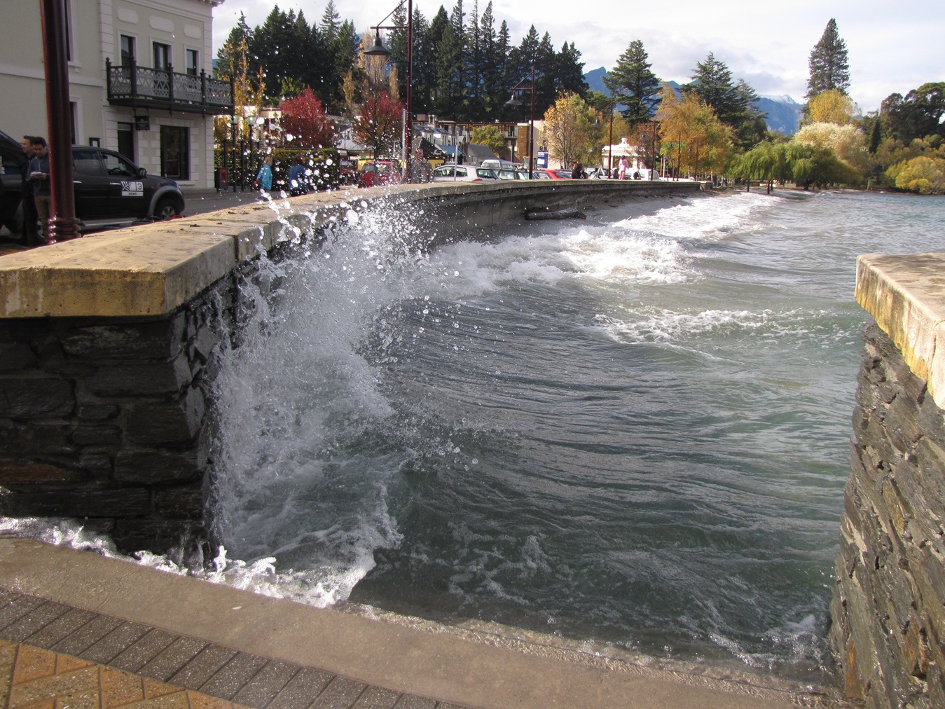
Otago Regional Council senior natural hazards analyst Tim van Woerden says bathymetry data has revealed landslide deposits on the floor of Lake Wakatipu.
An eight-month lake-tsunami study with Earth Sciences New Zealand is about to begin, working out where, and how big, landslides into Lake Wakatipu might be.
"They can run that in their modelling and say, if it enters the lake, this is how it would cause a wave, which would then propagate out across the lake, and they can show how high it might be and how much warning time you might have from when the landslide hit the lake to it reaching the other side."
Currently, there is little information as to how high that wave might be, but it would most likely be "something you’d measure in metres".
That would leave residents close to Lake Wakatipu potentially in the tsunami zone, and probably also those around the fringes of Lake Wānaka, van Woerden says.
The information from the study will be fed into emergency management responses.
Lakes are also prone to seiches, a regular sloshing of water back and forth, rather than a travelling wave, similar to being in a bath tub.
These are less likely to be life-threatening and probably only a matter of tens of centimetres high, but could still be damaging if they keep rolling in, flooding areas of land next to the shore, and dragging back into the lake again.


