
The proposal for the programme has been developed jointly by the Dunedin City Council and the Otago Regional Council as part of the South Dunedin Future programme.
The city council will discuss the proposed strategy at a meeting of the planning and environment committee tomorrow, while the regional council will discuss it at the meeting of its strategy and planning committee next Wednesday.
If the draft plan is approved by both committees, the programme’s next step would be to transition to a delivery stage over a four-year process.
While the proposed plan would not provide pathways to deliver solutions until 2026, it notes there would be no requirement to wait until the programme was finalised to begin influencing business-as-usual decision-making at the council.
The core budget for the plan is expected to be $920,000 each year, $500,000 of which would come from the city council and the rest from the regional council.
The executive summary report accompanying the draft plan suggests climate adaptation might work across four areas: adapting to hazards, creating barrier infrastructure, managing retreat and avoiding future development in high-risk areas.
While the report stresses it is not yet known how South Dunedin might adapt to a changing climate, it suggests one possible outcome of the proposed programme could be deintensification of high-risk areas of South Dunedin, with intensification in other areas to compensate.
Over decades the "current mosaic of land use" in South Dunedin might be reshaped into a less evenly developed form, with parks, wetlands and open water courses which might flood periodically.
Greater intensification in other parts could be enabled by additional infrastructure and could possibly result in mid-rise residential, commercial and industrial use.
The draft plan notes the South Dunedin area is particularly vulnerable to natural hazards, including storm surges, tsunamis, run-off flooding and liquefaction, which are likely to be exacerbated by climate change as it was built on a former wetland.
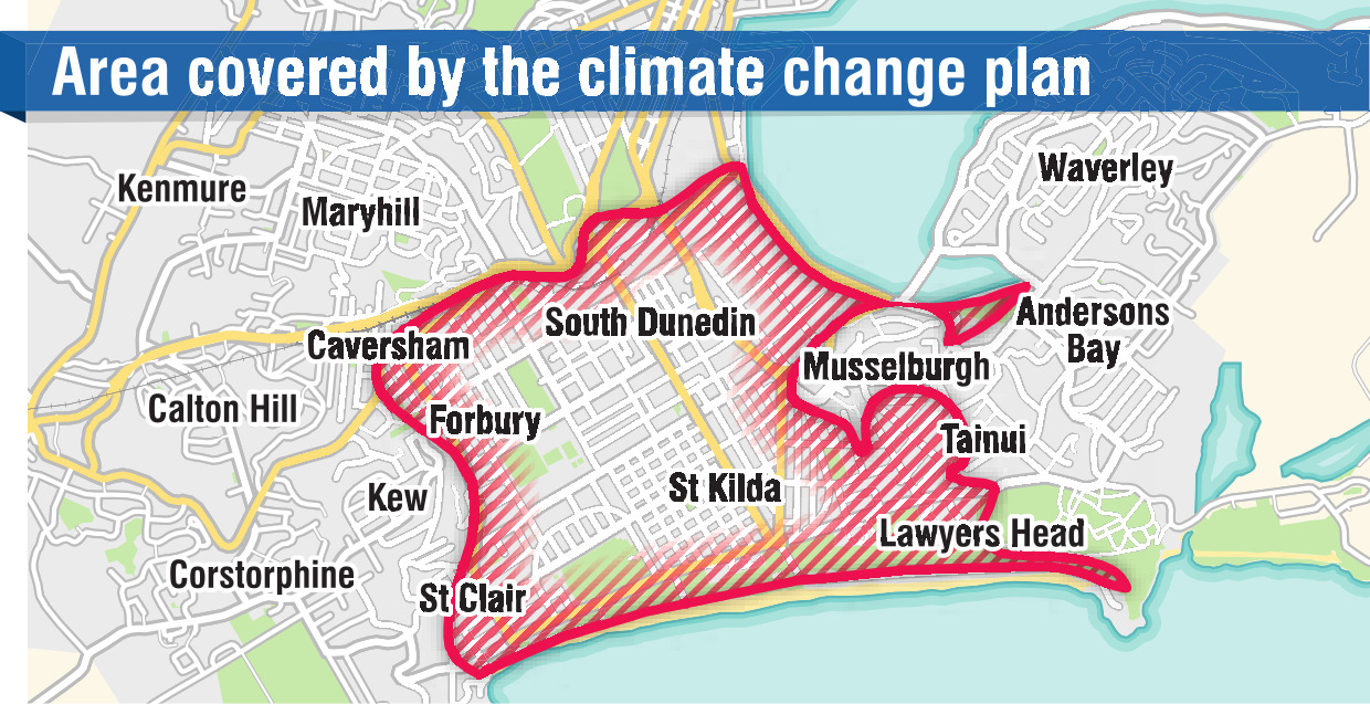
The low-lying area covered by the plan includes the land from the south side of the Oval to Lawyers Head, encompassing Caversham, South Dunedin, Forbury, St Kilda, St Clair and parts of Andersons Bay and Tainui.
An estimated 12,000 residents call the area home.
Councillors have the option of adopting the recommended approach, which would give the programme a dedicated staff and operating budget, and an alternative approach which would continue the status quo of the programme being delivered through business-as-usual functions of the councils.


