
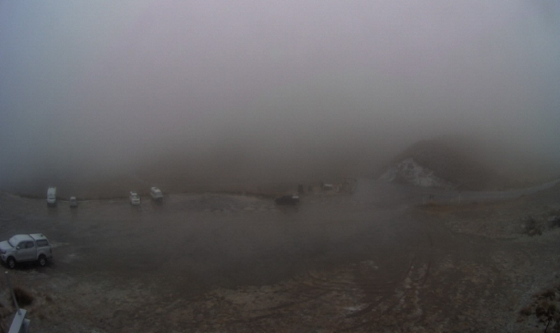
A period of snow showers was expected about the top of the road, linking Queenstown and Wānaka, from 6am until noon. Up to 2cm may accumulate, Met Service said.
Meanwhile, a complex low and associated fronts and troughs move slowly over New Zealand today, bringing rain and potential severe gales to parts of the country.
A heavy rain warning has been issued for the Kaikoura Coast and ranges and north Canterbury ranges, east of Lake Sumner, from 10pm tonight until 11pm tomorrow.
Expect 100 to 130mm of rain, but 150 to 200mm was possible for the Seaward Kaikoura Range. Peak rates of 20 to 30mm/h were expected tomorrow morning. MetService said there was a moderate chance of upgrading this to a Red Warning, its highest.
Streams and rivers may rise rapidly. Surface flooding, slips, and difficult driving conditions were possible.
A heavy rain watch has been issued for Canterbury south of the Rakaia River, excluding the Mackenzie Basin, until 1pm today.
On the West Coat, severe gales have been forecast for the Buller, Grey and Westland.
Southeast winds may approach severe gale in exposed places from 9am tomorrow until 9am on Tuesday, MetService advised.
- Allied Media


