Adding to the problem is the rapidly increasing number of post-Covid tourists coming to the region, specifically to visit those areas.
University of Otago School of Geography researcher Prof Nicolas Cullen is leading an international team of researchers on a project aimed at developing a mapping system to help manage avalanche risks in New Zealand’s mountains, which aims to avoid potential harm and fatalities.
The NZ Avalanche Advisory provides widely recognised guidance on snow conditions and avalanche hazards across 13 alpine forecasting regions.
However, these regions covered large geographic areas, so more detailed topographic mapping tools were needed to further support users by helping identify smaller pockets of terrain and refine back-country travel decisions.
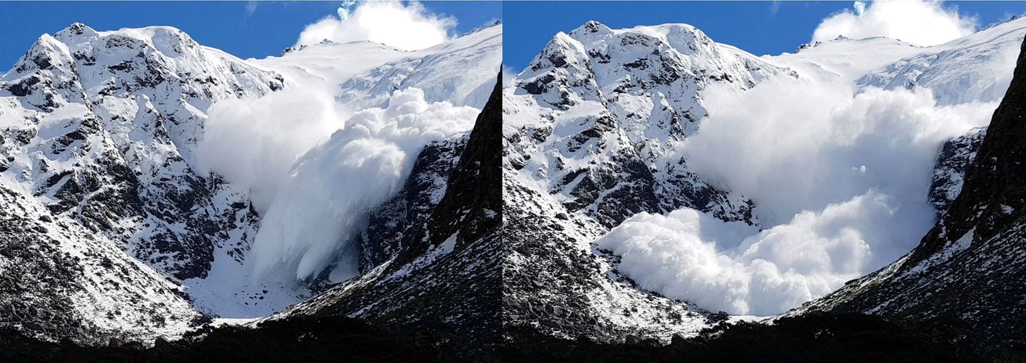
Prof Cullen said avalanche risk was a complex interaction involving snowpack, weather, terrain and people, where terrain was the only factor that remained constant over time.
Project team researchers from the University of Otago School of Surveying, Earth Sciences New Zealand, Antarctica New Zealand, the WSL Institute for Snow and Avalanche Research (Switzerland), the Mountain Safety Council, the Department of Conservation, Otago Polytechnic and the Chugach National Forest Avalanche Centre (Alaska) were now using the data to develop a system called NZ-mATES (New Zealand mountain Avalanche Terrain Exposure Scale).
The system uses high-resolution elevation data and complex geometric calculations to analyse the slope and curvature of mountains and their features, the potential for trapping and holding wind-blown snow, and many other characteristics.
NZ-mATES would then use this information to identify locations where an avalanche might start, travel and dissipate, and calculate the risks accordingly.
School of Geography PhD student and mapping system development leader Philip Elder said once NZ-mATES was up and running online, it would simplify the detailed topographic data of complex terrain into easy-to-understand categories, helping both recreational and professional users stay safe and informed while travelling through southern mountain ranges.
It would be managed by the Mountain Safety Council and Department of Conservation, he said.


