Dunedin appears to be over the worst of today’s weather, but an orange heavy wain warning remains in place until later this evening.
In an update late this afternoon the Dunedin City Council said the rain was now easing and flows through its networks were dropping.
It came after MetService updated an orange heavy rain warning to cover six hours from 4pm to 10pm. An earlier warning was due to lapse at 7pm.
The forecaster said to expect 15 to 25mm of rain on top of what had already fallen, with peak intensities of 5 to 10mm/h.
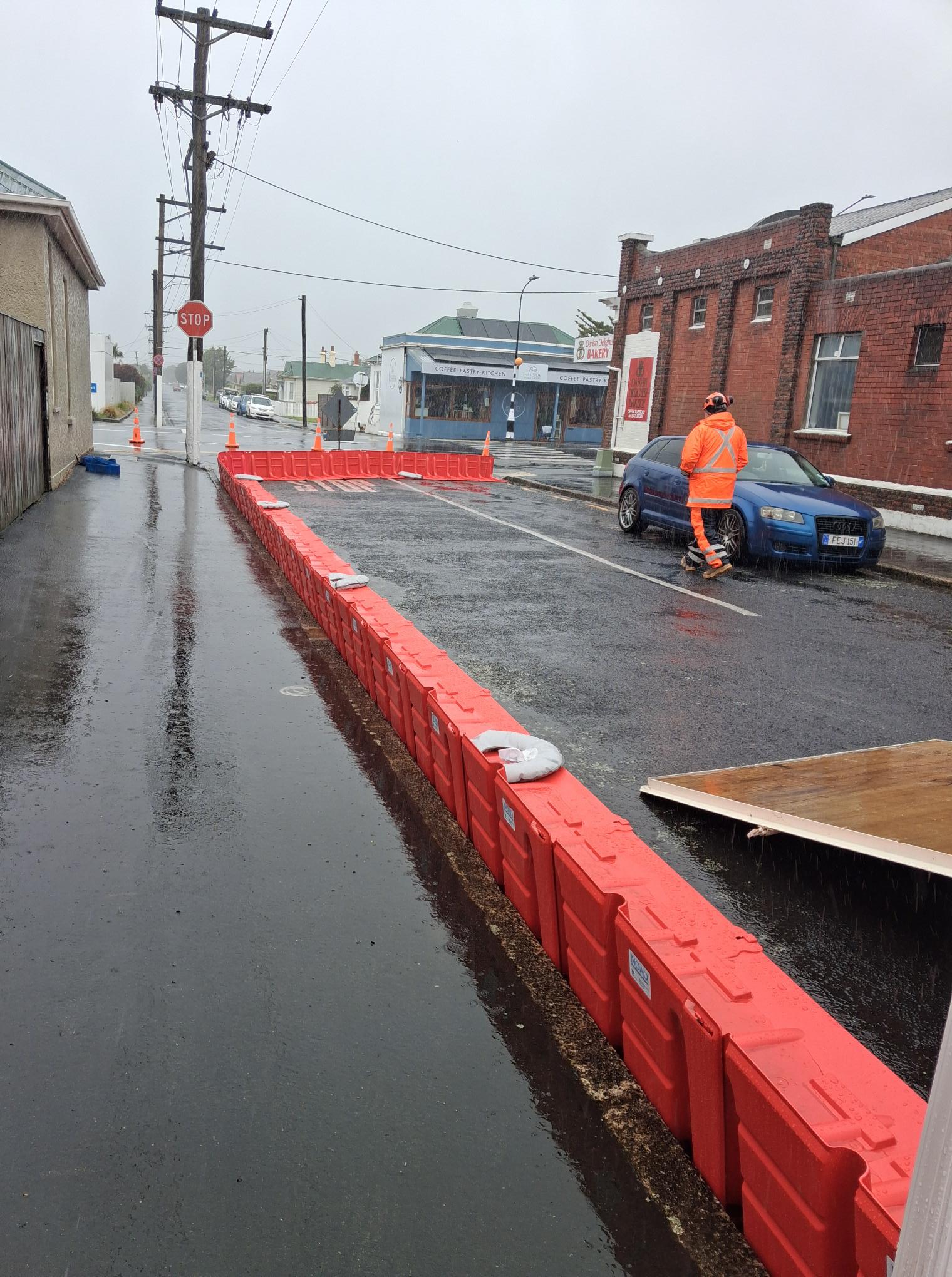
The DCC earlier said it had deployed "wet weather overflow" barriers in South Dunedin's Surrey St "as a trial". These would remain in place overnight "as a precaution".
The barriers were acquired by the DCC late last year and were designed to divert wet weather overflow away from properties.
DCC city services general manager Scott MacLean said the council was continuing to monitor the city’s 3 Waters and roading networks – which were performing as expected – while putting a number of precautionary measures in place.
This includes maximising pumping through the Portobello pumping station and activating an overflow at the Tahuna wastewater treatment plant, which allows partially treated and heavily diluted flows to be released into the ocean.
“These precautionary measures are helping alleviate pressure on the city’s stormwater and wastewater networks, particularly in South Dunedin, by freeing up additional capacity in both," Mr MacLean said.
Despite some localised reports of of surcharging in high-risk areas of South Dunedin, including Surrey St, the steps taken to free up network capacity appeared to be working.
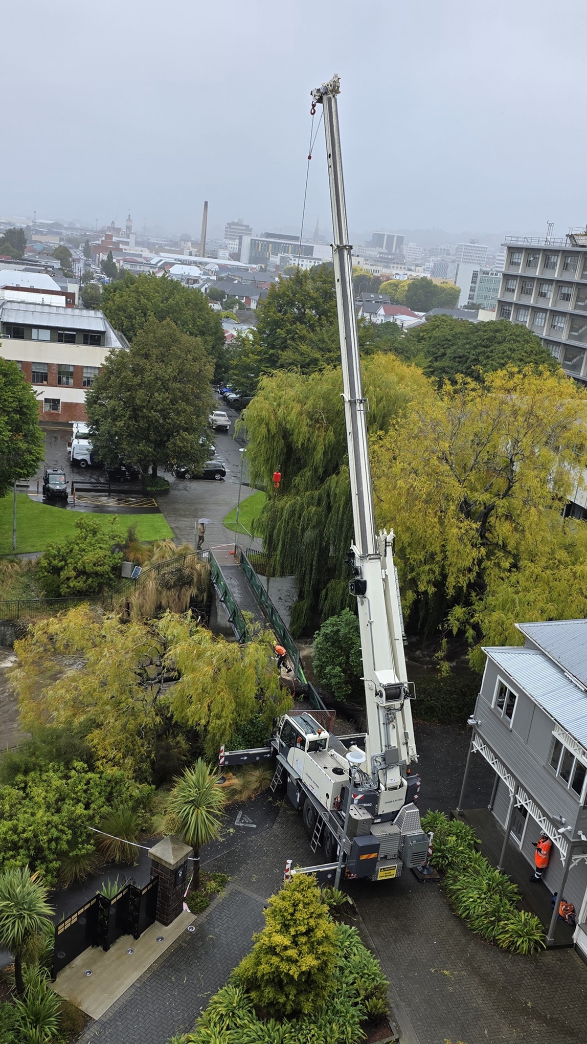
Meanwhile, at the University of Otago, a large tree fell on a footbridge that crosses the Water of Leith on Leith Walk.
A large crane was brought on site to move the tree and the bridge is closed until further notice. People were advised to avoid the area.
“Otago Regional Council is closely monitoring rainfall and river levels in the Dunedin and Lower Taieri catchments. Rainfall totals in these catchments are expected to reach between 70-100mm.
"While there has been a lot of rain, flood infrastructure is doing its job and performing as expected. Rivers are expected to be contained within their channels,” ORC duty flood officer Lauren Harrex said.
“At this stage, we do not expect widespread issues from river and streams, but conditions can change, and we will monitor closely.
"People in Dunedin and Lower Taieri Plain should stay up to date with weather conditions. Should the situation worsen, we are ready to act.”
"Bags, sand and shovels are available on site, but we encourage people to come ready to fill their own bags.
"We’re continuing to monitor the situation and we’ll provide further updates as needed."
The DCC also reminded people not to swim or collect shellfish at the city's beaches for the next 24 hours.
As of about 4.30pm, two roads in Dunedin were closed due to flooding - Ashmore St in Halfway Bush and Old Brighton Rd.
MetService meteorologist Alanna Burrows said yesterday a watch for heavy rain and severe gales had been issued for the eastern South Island, as a deep low east of the country tracks slowly southwards.
"We’ve had this low pressure system centred just offshore to the east of the North Island and it’s drawn a huge amount of moisture down from the tropics.
"So it’s this big moisture-laden low with tropical air wrapped around it.
"It’s pushing slowly southwards and as it does so, it’s pushing lots of bands of rain across the country and that’s why we’re starting to see that heavy rainfall.
"We’ve seen it over the North Island, and then as it tracks southwards we’re expecting that heavy rain to push into the east coast of the South Island."

Heavy rain was also expected to fall further north to Oamaru, but to a lesser extent.
She said it had been "fairly dry" for Dunedin so far this year.
"So by comparison, this is definitely going to be a wet day for Dunedin and it could quite likely be the wettest day you’ve seen so far this year."

"There’s definitely a heightened awareness at the moment, given all the other impacts around the country."