

Kaikōura District Council has told those who have evacuated their homes not to return home tonight.
The town is cut off in both directions for the night with State Highway One closed between Waipara in Canterbury and Ward in Marlborough due to flooding.
A detour is available but will take significantly longer and may be subject to closures or restrictions.
For those that do need to travel, northbound traffic on SH1 at Waipara can follow State Highway 7 to Springs Junction, then onto State Highway 65 and State Highway 6 through Nelson, onto State Highway 62 near Blenheim and then turning back on SH1 at Spring Creek. The reverse applies for southbound traffic.
NZTA warned those choosing to use the detour to be prepared for possible flooding, slips or delays.
Evacuations ramping up in Kaikōura
Kaikōura District Council said emergency services were door knocking residents in the Hawthorn Road and Gillings Lane areas due to rising water levels and ongoing flood risk.
Residents in those areas should be prepared to leave if requested by emergency services and follow all instructions from responders on the ground, the council said.
Anyone requiring welfare support or emergency accommodation is advised to go to the Kaikōura Memorial Hall, which is operating as the community welfare centre.
More than 130 people who evacuated their homes in and around Kaikōura earlier today are sheltering at Takahanga Marae.

Firefighters and police have helped to evacuate people from Rorrisons Road, West End, Beach Road and Grays Lane.
New Life Church was operating as a Community Support Centre for evacuees but Kaikōura District Council said the premises may not be able to provide overnight accommodation.
"We are looking at alternative options for a place to stay overnight and will keep you informed.
"Please check in with friends and family as an alternative."
As current locations for shelter become full, The Memorial Hall will be the next available evacuation centre from 5pm this evening.
The Kōwhai River breached its banks about 10.26am and flooding was expected to follow a similar path to the 1993 flood.
Mayor Craig Mackle said both the Kōwhai River and Middle Creek north of the town were in flood.
"It hasn't quite hit town but it's coming. The Kōwhai has breached, the bank seems to be stopping the main part of it now, but I don't know how long that'll last.
"Downers yard is underwater and its creeping across the farm there now, so while we have a bit of time at the moment, if that second bank goes, it's going to be a whole different story.
"Get to higher ground, stay home if you can stay home."
Mackle said contractors were working to keep the Kōwhai River mouth open to help floodwaters drain.
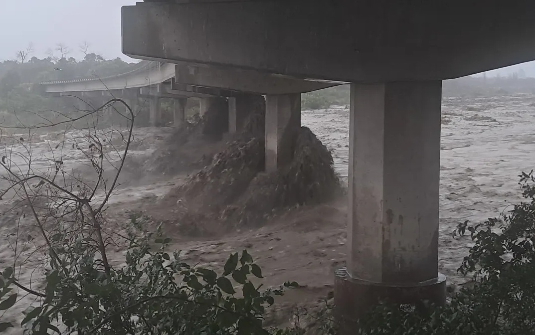
A MainPower spokesperson said they were "closely monitoring and will commence repairs when it is safe to do so".
An outage on the Inland Rd in Kaikōura affecting 44 customers was expected to take several days to restore due to the severity of the damage.
200mm of rain near Kaikōura
MetService this afternoon said almost 200 millimetres of rain had fallen near Kaikōura in the last 24 hours.
Many rain stations had recorded more than 100mm in the past 24 hours, with a station near Kaikōura reporting more than 25mm in an hour.
MetService said some rivers had already exceeded their one in 10-year flood flows due to the rain intensity and the hilly terrain.
Nearby, the Hurunui District Council said it was ready to open an emergency operations centre if weather conditions deteriorated.
District mayor Marie Black said the northern parts of the district, including Hanmer Springs, Waiau and around Cheviot, appeared to be the most affected.
Drivers were earlier being warned of the potential for travel disruptions and road closures in the region today.
A red heavy rain warning remains in place until early tomorrow morning for Marlborough and Canterbury between Ward and Hanmer and southeast of the Awatere Valley, including the Kaikōura ranges.
Orange heavy rain warnings are also in place for Marlborough about and north of Blenheim, and Tasman District about and west of Motueka.

St John was called to the scene about 3.30am and said firefighters were working to rescue the person.
In an update just before 8am fire officials said the occupant was rescued about 7am.
Their Specialist Water Rescue Team members then responded to a two-vehicle crash on the Inland Kaikoura Road which left two people seriously hurt.
The people were trapped in vehicles by flooding near the Cribb Creek Bridge, as the creek had overflowed.
In an update just before 9am police advised the the Inland Kaikoura Road was now closed.
"Cribb Creek has burst its banks and Cribb Creek Bridge is unsafe to drive along.
"Stay home if it's not necessary to travel."
Elsewhere, the wild weather has closed several highways, including SH1 from Waipara in Canterbury to Ward in Marlborough, and NZ Transport Agency Waka Kotahi (NZTA) says further disruption is expected today. SH1 will remain closed overnight.
Amid the bad weather, the Kaikōura District Council was urging people to postpone travel plans to the area.
The district is under a red level rain warning and it’s expected to last for 36 to 48 hours bringing 250 up to 600mm of rain, primarily to the Inland Range.
The council says its Civil Defence team has been working since Sunday afternoon to understand the potential impacts as well as doing all possible advance mitigation.
It warned of rising waterways, slippery road conditions, surface flooding and slips.
"If you see rising water, act immediately and move to higher ground. Floodwater can carry debris.
"We ask you to take care, do not travel unless it is strictly necessary and take care on roads at all times. Please reconsider postponing your travel plans for 48 hours during these school holidays."
NZTA says road users should drive to the conditions, expect weather hazards, and be prepared for road closures at short notice. With bad weather also affecting North Canterbury and the West Coast, travel in these regions may also be affected.


