

MetService yesterday issued road snowfall warnings for Southland’s State Highway 94 as well as the Lindis Pass (SH8) in Central Otago, and the Crown Range Road, linking Queenstown and Wānaka.
Further north, warnings remain in place for the Haast Pass (SH6), Arthur’s Pass (SH73) and the Lewis Pass (SH7).
In Dunedin it'll be a sunny start to the day but that won't last - with heavy, thundery showers and hail forecast for the afternoon.
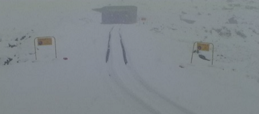
Milford Road
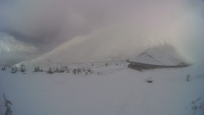
By Friday afternoon, heavy snow had fallen about the Homer Tunnel on the Milford Road, which closed at 5pm yesterday.
The state highway would remain shut today, with snow showers expected until early evening and up to 8cm of snow could settle above 600m, MetService said.
It was likely SH94 would reopen mid-morning on Saturday after snow-clearing work, but was likely to close again at 4pm, due to an increasing hazard of avalanche, and it may stay closed again on Sunday, Milford Road Alliance advised.
Heavy rain and snow down to 600m has been forecast for the Homer Tunnel area until Wednesday.
Some snow did fall overnight on the Lindis and Haast Passes, "but not enough to make a snowball, as it’s just turned to slush", he said. Kingston recorded the lowest temperature this morning at 1°C.
MetService said occasional snow showers were likely again for the Crown Range until late this afternoon, with up to 2cm settling on the road down to 700m.
In Central Otago, a "skiff of snow" passed over the High Country and the Danseys Pass Road from the gates past the Danseys Hotel was now restricted to 4WD vehicles. This was likely remain in place throughout the weekend, a spokeswoman for the Central Otago District Council said this morning.
In Canterbury, more snow showers were forecast for Arthur's Pass (SH73) on Friday afternoon, where 2cm could accumulate on the road down to 800m. Snow was also expected to affect the Lewis Pass (SH7) in the evening and 2cm may settle near the summit at times.
Strong wind watch
A strong-wind watch has been issued for large parts of the South Island at the weekend.
MetService said northwest winds may approach severe gales in exposed places in Fiordland, Southland, Stewart Island and inland Otago on Sunday from 9am until 4pm.
A burst of strong northwesterly winds was also expected to affect the High Country and foothills of the Canterbury Plains from 2pm until midnight on Sunday, and may approach severe gale in exposed places.
These watches may become warnings, MetService advised.
- Allied Media


