
Niwa meteorologist Seth Carrier said it was illustrated by the fact that no location had a record high or low mean temperature for the month.
Temperatures were above average or well above average in much of Canterbury and eastern Otago, below average in the central and lower West Coast area and near average for much of interior Otago and Southland.
Rainfall was above normal or well above normal in interior South Canterbury, below normal or well below normal in coastal Canterbury, the upper West Coast, and much of Otago and Southland, and near normal elsewhere.
Soil moisture levels were higher than normal across northern and central Canterbury, interior Otago and the lower West Coast area, below normal in coastal and central Canterbury and Western Southland and normal elsewhere.
Mr Carrier said the month was characterised by higher than normal mean sea level pressure over the Tasman Sea and the North Island, and lower than normal pressure located south of New Zealand.
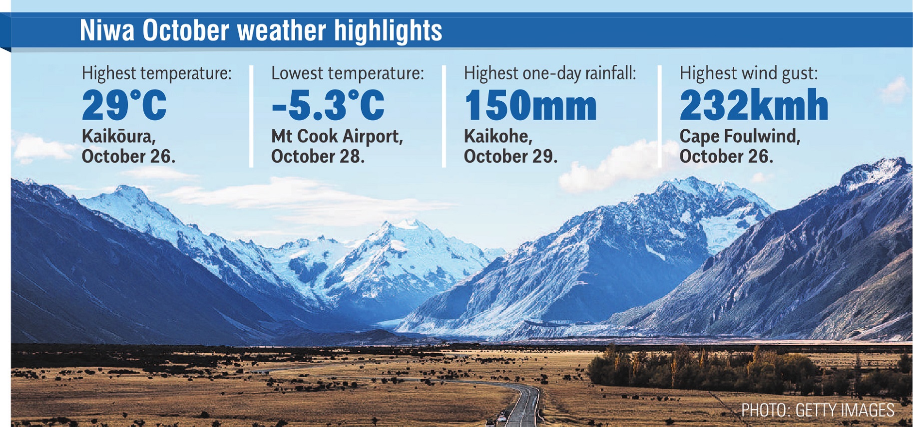
"In fact, there were several strong-to-damaging wind events through the month that affected the South Island and lower North Island.
"The month also featured periodic fronts from the Southern Ocean which brought occasional cold spells and even low-elevation snow to the South Island.
"This included snow to lake level in Queenstown and flurries in Dunedin’s CBD on October 27."
Of the six main New Zealand centres in October, Auckland was the warmest and least sunny, Christchurch was the coolest and sunniest, Tauranga was the wettest and Dunedin the driest.


