Niwa's latest long-range forecast shows temperatures over the next three months are likely to be ‘‘near average’’.
Niwa National Climate Centre meteorologist Ben Noll said that did not necessarily mean it would be cold.
‘‘I think I can brighten the day of the fine folks in the southern region a little bit.
‘‘From next week, you will be having some more favourable weather patterns for enjoying those outdoor activities.
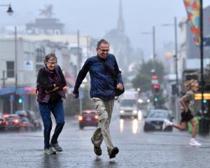
‘‘There will be less rainfall, a little bit less wind, along with warmer temperatures compared with what we’ve been having.
‘‘We’re heading in a better direction as we go through the rest of January.’’
Mr Noll said between January and March, air pressure was forecast to be lower than normal to the west and south of New Zealand, and there would be higher-than-normal air pressure north of the country.
‘‘This is expected to be associated with a westerly to southwesterly air flow anomaly on average, but the dissipation of other climate drivers suggests that westerlies might become less robust and even give way to periodic northeasterly winds, particularly during February.’’
In coastal Otago, temperatures were most likely to be near average; rainfall totals were most likely to be near normal; and soil moisture levels and river flows were equally likely to be below normal or near normal.
Southland and inland Otago temperatures were about equally likely to be near average or below average; rainfall totals were about equally likely to be above normal or near normal; and soil moisture levels and river flows were most likely to be near normal, he said.