A deep low is moving away to the east of the country but watches and warnings associated with the system are still in force for many places.
Snow and flooding affected several highways this morning, and MetService says more snow and strong winds are on the way.
The forecaster said snow could reach warning criteria above about 500 metres for inland parts of Otago and south Canterbury going into tomorrow.

In addition, on Wednesday, it is likely severe south-to-southwest gales will hit exposed parts of coastal Otago and Canterbury.
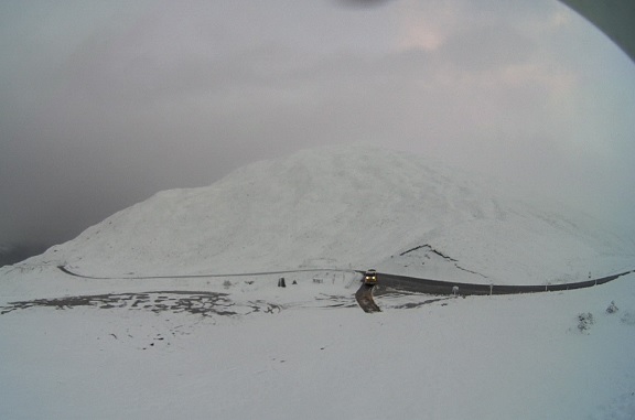
Waka Kotahi NZ Transport Agency earlier advised of weather-related issues on southern highways today, including snow on State Highway 85 Omakau-Kyeburn, SH8 the Lindis Pass and SH94 the Milford Road.
The Central Otago District Council reported isolated flooding around its network and snow in the Maniototo and Manuherikia areas, and motorists were urged to take care. Danseys Pass road is closed owing to snow.

Heavy rain has caused flooding on the West Coast and State Highway 6 was closed for a time by a slip near Punakaiki.
Conditions look set to improve later in the week.
During Thursday and Friday, a ridge of high pressure would move on to the country from the west, MetService said.
This ridge would then move away to the east on Saturday, allowing a strengthening and moist northerly flow to develop over New Zealand.
However, there was unlikely to be severe weather associated with this on Saturday at this stage.