
A severe thunderstorm near Hindon has eased and the wider thunderstorms warning for Otago has been lifted, MetService says.
Otago residents were earlier warned to brace for severe thunderstorms bringing very heavy rain and large hail this evening.
MetService says that is a still a possibility but the warning for the Otago radar area was lifted at 5.53pm.
Weather radar had detected severe thunderstorms near Middlemarch, Clarks Junction and Sutton about 4.30pm.
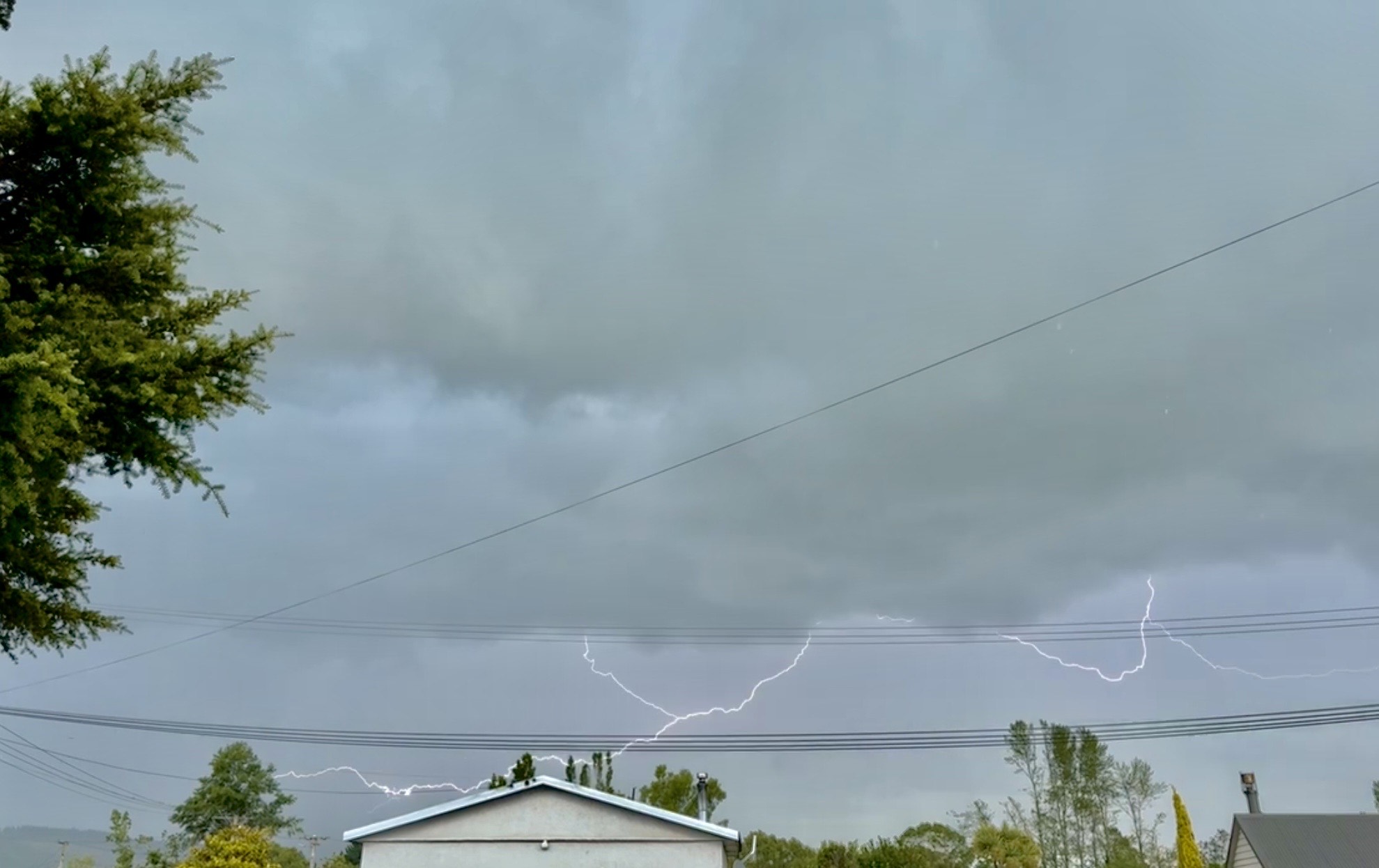
MetService said the storms were likely to be accompanied by very heavy rain and large hail.
“Very heavy rain can cause surface and/or flash flooding about streams, gullies and urban areas, and make driving conditions extremely hazardous,” MetService said.
Large hail could also cause significant damage to crops, orchards, vines, glasshouses and vehicles.
Meteorologist Devlin Lynden earlier said much of the South Island was under a "moderate risk" of thunderstorms, mainly in the afternoon and evening.
The storms were expected to bring localised heavy rain with intensities of 10mm per hour to 25mm per hour.
"There is also definitely the risk of quite large hail - 5mm to 20mm in diameter - so if you’re getting 20mm hail falling on you, that’s quite damaging.
"It’s definitely one to keep an eye on."
He said it had the potential to damage farm crops and fruit in orchards and vineyards.
"There is a risk all the way inland to Central Otago, all the way up to Cromwell, Roxburgh - all those areas where they grow fruit.
"I’m sure orchardists will be keeping an eye on that situation and hoping for the best."
An Emergency Management Otago spokeswoman said heavy rain was expected between 6pm and 8pm today, and the organisation was keeping a close eye on the situation.
Large hail stones may be damaging and the rain may cause surface flooding at this stage, but the organisation would give as much notice as possible if major flooding was to occur about Dunedin.
Mr Lynden said thunderstorms were created by convection-type storms, which occurred when hot air from the ground rose and mixed with very cold air in the atmosphere.
When the warm air met the cold air, the moisture in the warm air condensed into rain, which created large thunderstorm clouds.
"If the warm air goes up fast enough, it can cause quite strong updrafts.
"Imagine wind going vertically up, it suspends the raindrops and causes them to freeze, and then that is what causes the hail to happen."
If the updrafts were strong enough, it could also cause tornadoes, he said.
"Thunderstorms are very dynamic and there is often a risk of tornadoes associated with that type of activity.
"In our modelling, we don’t have a risk for small tornadoes, but there is always the risk with those types of convective storms.
"So be on the lookout for those as well," he said.
Yesterday’s turbulent weather on the West Coast and in Fiordland and the Lakes district also caused flight disruptions at Queenstown Airport, including two flight cancellations.


