
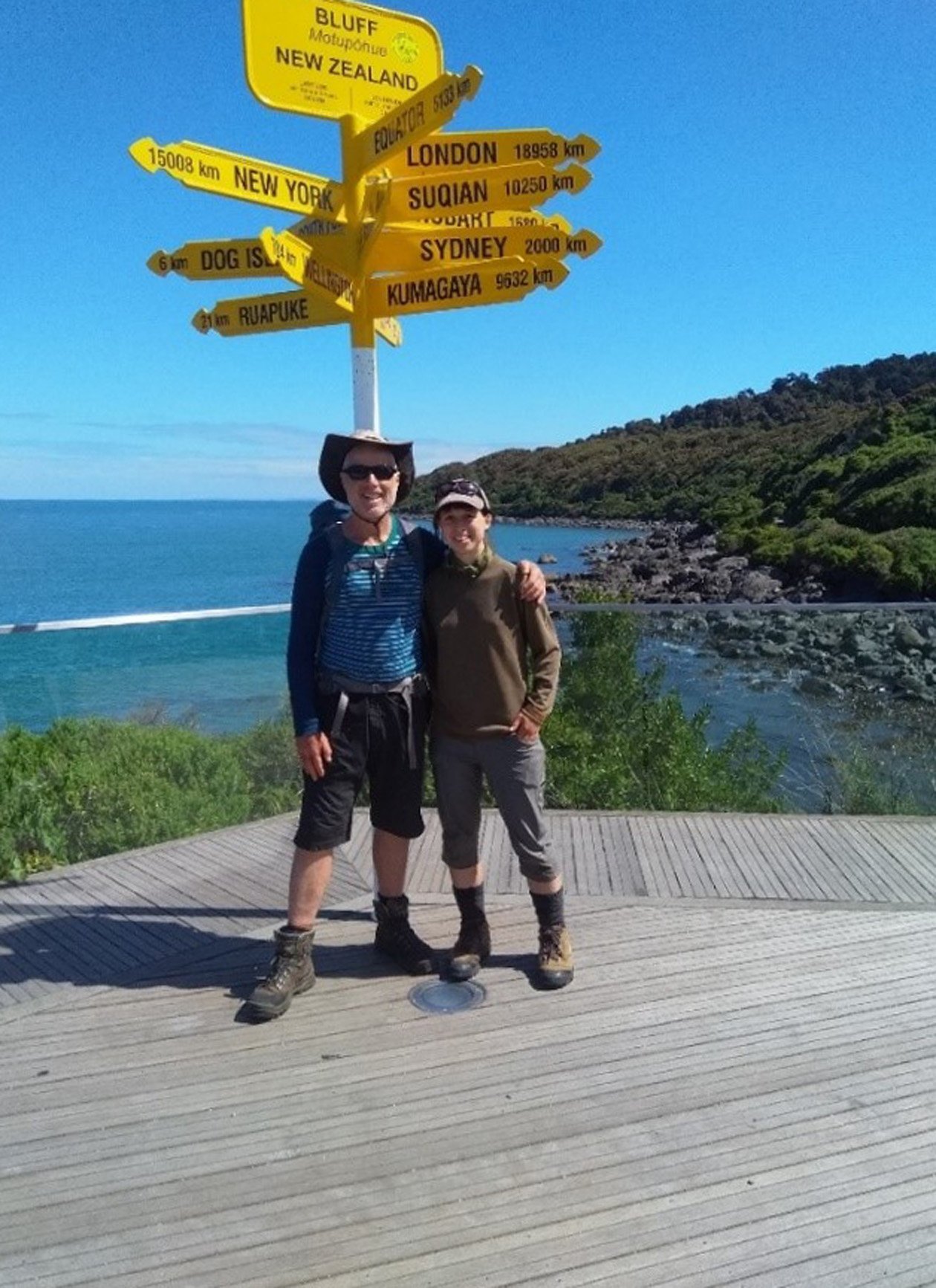
Dunedin man Bryan Scott, an Otago regional councillor, has written a book on his adventures walking the South Island leg of the Te Araroa Trail, My Trail, Te Wai Pounamu. Here he shares an edited extract from the book.
My Trail
Te Araroa, the Long Path
Te Wai Pounamu, the South Island
Trek long distances
New horizons, people and land.
Trekking is in my blood
My ancestors made it here
Initially just an adventure
I love this place and its history.
Captivated by those before me
Maori in their pursuit of pounamu
Pioneers in search of gold
I sense their energy in the passes.
Trekking south from bow to stern
I experience stressed rivers and fauna
Rivers are our old pathways
We need to restore their mana.
Where is the trail taking me?
It has become a dear friend
It mentors and challenges me
I trust it will never end.
- Bryan Scott

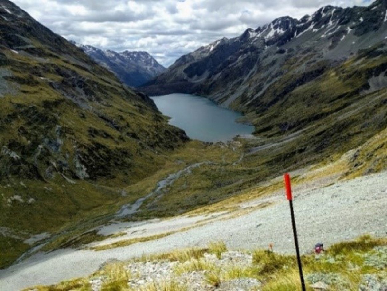
Te Hoiere (Pelorus River)
Day 4, 16 December 2019 - 27km.
My mind wanders as I start walking today, to a recent memory from when I dropped off food parcels in Arthurs Pass and Westport in preparation for this adventure. Driving north through Waikouaiti, I picked up a hitchhiker standing by the road.
When I asked her what she did, she said, ‘‘I am a working girl’’, to which I replied, ‘‘That's great, I am a working guy’’. After settling into the car, I then realised exactly what she was saying. If still unclear, it became startlingly obvious when she showed me the fifty-dollar note she had earned from her previous ride. Quite the businesswoman, not only was she able to allocate time for core activities, she had also collected some drugs earlier in the day. If that did not work out, she had a backup supply of gas canisters in her bag, which she opened to show me!
Aghast, I wondered what I had let myself in for, as perspiration accumulated on my forehead. While my initial reaction was to stop and drop her off, frankly I was uncertain of how she would react. Clearly the horse had already bolted and maybe I should just let it go where it wanted to go. Eventually we settled into an understanding of acceptance to swap our respective tales. While I struggled for advice to give her, I eventually said, ‘‘Go find yourself a decent trail. That’s what I’m going to do.’’
Back in the moment, it is now my turn to experience trucks and cars whizz by as I walk alongside the Havelock Highway, although I have no intention of hitchhiking today. I wonder if the people in the vehicles are heading somewhere important and what I am missing out on. Two kilometres later I deviate to the right, down roads off the main highway, just as it begins to rain. While my progress is literally dampened, this also provides some relief to the heat of the day.
Last night’s fish and chips sustenance has clearly worn off and my stomach begins to rumble. Once the rain stops, I settle in beside the road for a much-anticipated breakfast. Waiting for the billy to boil, I use this time to read my guidebook as I am not convinced that the loop of side roads I’m on makes any sense. Detouring northwest instead of south, it turns out that this is all part of the trail as it twists and turns. Cleaning up after breakfast, I repack my gear and am soon on my way.
Approaching Daltons Bridge, I search for a path forward when a middle-aged woman jumps out of her car parked close by. She is from Cornwall and her husband is somewhere up-river looking for a desirable fishing spot. Good natured, she offers me a biscuit, which I politely decline. As we chat, I look out for the trail and finally spot a stile hidden behind her car. Ouch. It is time for us to go our respective ways and be on our lonesomes again.
The local landowners have granted access through their paddocks via a marked route on the true left of the Pelorus River. While I say thank you to these landowners, I generally take this gift with a grain of salt as I like to think that we all have some right to roam wherever we choose, as long as we leave things as we find them and are respectful. At the very least, we should be able to access a Queen’s Chain (20m) public margin alongside the waterway.
Tragically, the ‘‘NZ Ministry for the Environment 2020 Freshwater Report’’ confirms that most of the rivers in farming and urban areas are polluted (over acceptable environmental limits) in Aotearoa. Many studies at national, regional and catchment level show the concentrations of nitrogen, phosphorus, sediment and E.coli in rivers all increase as the area of farmland upstream increases (Larned et al, 2018). Also, most rivers in the urban land-cover class are polluted with nutrients and suspended sediment, and many are polluted with pathogens and heavy metals.
If there is one piece of good news in this sorry story, it is that river degradation is now at a point where it cannot go unnoticed, and key stakeholders such as government, Maori, councils, industry, banks, farmers and the community have been propelled into action, at least to some degree. A key part of this journey for me is to witness first-hand the state of our environment and to use this experience to contribute to a better future. We have to do a whole lot better.
Leaving the Te Hoiere River in the distance, I walk the marked trail through a busy farm. Ten kilometres later, I arrive at a fork in the trail at a reserve of podocarp and beech forest, where one sign shows 1200m and the other 900m to apparently the same destination. Unfortunately, I choose the path that I later discover is the wrong one and I hope that this is not the start of a bigger trend.
The Pelorus Bridge settlement has an amazing cafe filled with pies and more pies of all different varieties. I choose a venison one and a large long-white coffee, as well as an apple in an endeavour to also eat healthily.

Giving away soup sachets, a cheese pack, pepper and two freeze-dried meals to Chrystal, I try to lighten my load as much as I can. I hope this equates to the grand sum of 1kg, although my pack does not feel any lighter. I dread the thought that maybe I am simply getting weaker.
Emma hitchhikes back to Nelson, taking her positive energy and good nature with her. A car quickly squeals to a stop to give her a lift and I cannot imagine that happening for me.
Chrystal and I are now on our own, plodding 14km along the road as it turns towards the start of the Pelorus River Track. Alternating leads on the side of the road, it is our turn to look like hitchhikers as a logging truck stops. Sticking his head out the open door, the trucker looks down at me, but I say ‘‘Sorry mate, I am walking all the way’’. Wow, where did that come from, I wonder? Maybe it is just my ego, or maybe it is just the way it was always going to be. For goodness sake, if a 90-year-old A.H. Reed could walk the entire length of Aotearoa, then so can I!
It is dark as we reach the end of the road and we search to find a campsite quickly. Ten minutes into the bush, a good site miraculously appears that is level and not far from the river so we can get water. Racing to cook and eat our meals while it is still light, we dive into our respective tents before the sky literally opens to release a torrent of rain upon us.
Te Araroa facts
• Its name means ‘‘the long pathway’’.
• It is a hike along the length of New Zealand.
• Te Araroa officially opened on December 3, 2011.
• It covers 3000km from north to south.
• At an average of 25km a day, the trail takes 120 days to walk - four months.
• North Island route is just over 1600km long, South Island just under 1400km.
• By 2018, more than 1000 through- walkers completed the whole trail.
• It is recommended to walk from north to south, but the Auckland leg cannot be walked due to Covid- 19 restrictions at present.


