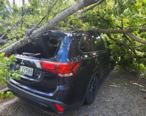
Southerners are being urged to batten down the hatches as gale-force winds, and possibly tornadoes, are expected to hit the region today.
A MetService spokesman said a "very strong west-to-southwest flow" would develop over New Zealand in the morning, and might approach severe gale in exposed places around Dunedin, Clutha, Southland (south of Gore) and Stewart Island.
The winds were expected to be at their strongest from 7am until 5pm.
A trough might also bring thunderstorms to parts of the South during the afternoon and evening — particularly in parts of coastal Southland and Clutha during the afternoon.
"These thunderstorms will generate localised heavy rain, strong wind gusts, small hail and possibly one or two small tornadoes."
It was possible the thunderstorms could become severe, he said.
MetService last night issued an orange strong wind warning for Dunedin southeast of Middlemarch, Clutha southeast of Tapanui, Southland about and south of Gore, and Stewart Island, saying severe gale west-to-southwest winds could reach up to 120kmh in exposed places.
There was also a strong wind watch for North Otago, Central Otago south of Cromwell, Southern Lakes south of Arrowtown, and remaining parts of Dunedin Clutha and Southland outside the warning area. The watch covered six hours from 11am to 5pm and has now been lifted as southwest gales have eased.
The winds were expected to ease tomorrow, the spokesman said.
More snow was also forecast for higher parts of Otago and Southland, and road snowfall warnings have been issued for the Crown Range Road and the Milford Road (State Highway 94).
An NZ Transport Agency Waka Kotahi spokesman said contractors would have resources ready to respond to snow on the highways, and roads might be closed where necessary for peoples’ safety.