A strange day indeed. Most peculiar, mama

The Kings High School first hockey team had a hit-around on the hockey turf playing ''skins''...
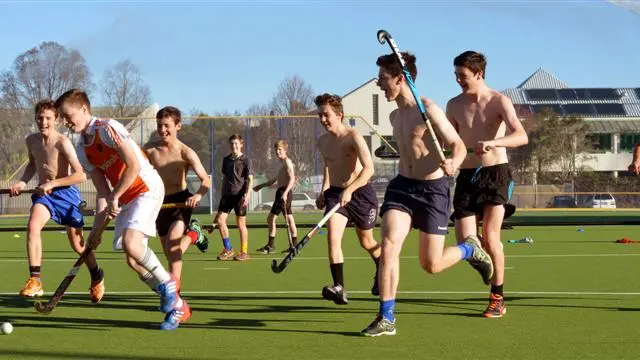
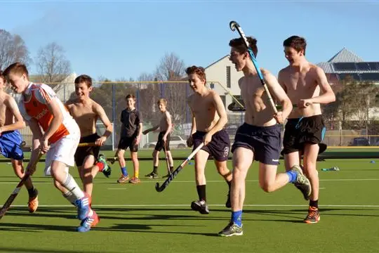
The Kings High School first hockey team had a hit-around on the hockey turf playing ''skins'' versus ''shirts'' in yesterday's warm weather. Dylan Thomas (15) controls the ball for the shirts. Photos by Stephen Jaquiery
Senior Constable Lox Kellas takes a look at a yacht which broke its moorings and washed into the...
Senior Constable Lox Kellas takes a look at a yacht which broke its moorings and washed into the sea wall at Edwards Bay on Wednesday night.
Ian Blair scrapes the bottom of his yacht Mapatu, which washed ashore at Latham Bay, Portobello,...
Ian Blair scrapes the bottom of his yacht Mapatu, which washed ashore at Latham Bay, Portobello, after breaking its moorings on Wednesday night.

Make the most of the unusually warm, windy conditions - it'll soon be back to winter.

That's the advice from MetService forecasters, who warn yesterday's temperature highs - a record-breaking 20.2degC in Oamaru, 19degC at Dunedin airport and 18.8degC in the city (the fourth-highest July temperature recorded in the city) - won't continue.

''You really need to enjoy the temperatures this week because it will change back again tomorrow,'' MetService meteorologist John Law said.

The cause of the warmth? A persistent northwest flow which brought wet weather to the West Coast and windy conditions to the east, he said.

As crazy weather days go, yesterday will take some beating.

Wind in the morning gusted to 60kmh in Dunedin and the average wind speed at Taiaroa Head overnight was 70kmh.

Two boat owners woke yesterday morning to find their boats off Otago Peninsula moorings - in one case washed up on the sea wall.

The strongest wind for the region was recorded at Swampy Summit, on the hilly outskirts of Dunedin, which had gusts of 150kmh early in the morning.

Mr Law said warnings of northwest gales in exposed places extended into tomorrow morning. That airstream resulted in temperatures rising into the high teens in many parts of eastern New Zealand, he said.

The weekend would bring a return to cooler temperatures as a southerly change raced up the country, bringing periods of heavy rain, he said.

''The weekend looks like one where we all see some rain, and a return to snow about the hills in the South Island,'' Mr Law said.

There should be some drier weather in the far south on Sunday.

Temperatures also rose inland yesterday - Alexandra and Queenstown recorded 17degC and 14degC respectively yesterday - but snow fell in the mountains. Treble Cone Skifield and Cardrona Alpine Resort were closed yesterday because of snowfalls of about 20cm.

The Remarkables received 10cm of snow overnight, and at Coronet Peak it snowed before the sun came out - then it rained.

Strong winds caused two flights bound for Queenstown Airport to be diverted to Christchurch yesterday afternoon.

Wind also contributed to Waimate losing electricity at 7.48am for about 45 minutes.

Add a Comment


Advertisement