KEY POINTS
- Cyclone Gabrielle, now a “severe Category 3 storm”, is forecast to be one of the most serious storms to hit NZ this century, bringing up to 300mm of rain and 150km/h winds that could cause widespread damage to North Island regions. Severe gusts could damage buildings, down trees and cause power cuts
- Large waves and a storm surge are expected to affect northern and eastern coastlines from Sunday. Massive waves between five and seven metres or more have been predicted
- People should stock at least three days’ worth of supplies, including medication, water and food
- Auckland Emergency Management is finalising a number of civil defence centres and evacuation shelters for people and their pets
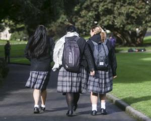
- Secondary schools around Auckland will this weekend be considering whether to close campuses on Monday or Tuesday
- University of Auckland campuses will be closed on Monday and Tuesday as a precaution
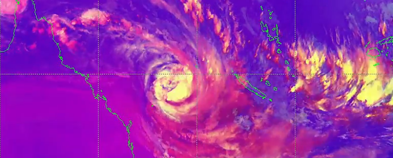
The tropical cyclone hurtling toward New Zealand is now expected to bring dangerous conditions to more North Island regions, and parts of the South Island.
The latest MetService update now shows that Cyclone Gabrielle, which has been upgraded to a Category 3 storm and packed with 140km/h plus winds and a month’s worth of rain, will now impact from the top of the North Island to the top of the South Island for the first part of next week.
This afternoon the first monster wave alert was issued, with seven-metre-high waves expected to pound the south-east coast of the North Island on Tuesday night.
Speaking at an update today, Auckland Emergency Management’s Rachel Kelleher said they continue to work with partner agencies to ensure anything that can be done to prepare for the cyclone is being done.
Kelleher said as well as continuing to work on the current flood response, a number of civil defence centres and evacuation shelters for people and their pets were being finalised.
The locations will be available on the Auckland Emergency Management website when confirmed.
She asked people to check on neighbours, especially the elderly and vulnerable.
Kelleher said they wanted to remind people the impact of this weather system may be different to late January’s devastating flooding, and there may be an additional risk from storm surges.
She acknowledged the “immense efforts” of emergency response teams.
Trees could block roads and people should think ahead about how they would cook food without power.
“Now is the time not to be complacent,” she said.
Kelleher said sandbagging can be used to block doorways, drains and other areas of properties for a short period of time. But other things include clearing gutters and drains.
On Friday, tropical Cyclone Gabrielle was hitting New Caledonia.
MetService meteorologist Georgina Griffiths said it was currently “behaving”. Monday and Tuesday were the days Aucklanders, in particular, “should prepare for now”.
The worst-case scenario is that the cyclone tracks “pretty close” to Auckland. But even if it is further away, the region would still be affected due to existing vulnerabilities and its reach.
Griffiths said the most impactful weather would be later Monday and Tuesday when Auckland could expect heavier rain and all of the region was at risk of severe gales on Tuesday.
Given the already saturated soils, she said the winds were a problem for trees and powerlines. She asked that Aucklanders tie down objects such as trampolines.
The concern, Griffiths said, was exacerbating existing slips and they would not know until Sunday which areas in Auckland would be most affected.
On the difference between the communication prior to this event and last week's, she said the cyclone was a “long way” away, and thunderstorms, like the previous event, were more difficult to forecast.
“The bigger the beast, the easier to forecast”.
Lastly, she warned that “heavy” swells would be coming on Monday and peaking on Tuesday.