
MetService has again issued heavy rain warnings for Tasman - a region still recovering from recent storms. A weather front, moving east across the country, is expected to bring up to 180mm of rain to the region.
There were orange rain warnings in place for Tasman east and south of Motueka, Nelson and Marlborough west of Havelock, and north of the Wairau River, through to Tuesday evening.
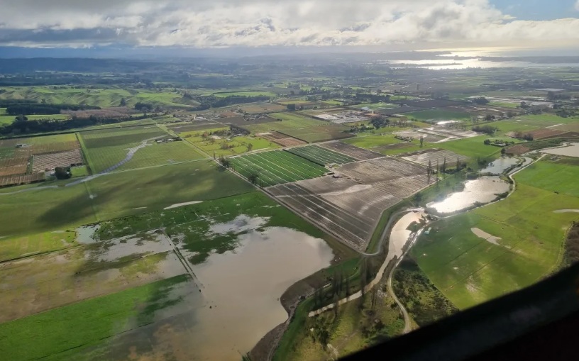
Mayor Tim King said there was potential for the Waiiti and upper Motueka Gorge catchments to be affected by heavy rain - again.
He said much of the region remained vulnerable after the two devastating flood events, two weeks apart.
"So the advice is, as it has been unfortunately now for the last kind of four or five weeks, is have a plan - be prepared if you need to or you have concerns, particularly about your house or home or where you're living.
"Make decisions to maybe spend the night somewhere else, or a day somewhere else over Tuesday."
He said people should think carefully before travelling across the region on Tuesday and that there could be pre-emptive road closures given the forecast wind.
An Emergency Operations Centre will be activated Monday evening to monitor the situation overnight and into Tuesday.
In Nelson, contractors are working on the cliff above State Highway 6 on Rocks Rd, to prevent further slips and debris fall ahead of the weather forecast for Tuesday.
NZ Transport Agency Waka Kotahi system manager for Nelson/Tasman Rob Service said abseilers were installing bidim material - a geotextile material designed to help prevent erosion - along the cliff face in areas where slips have recently occurred.
The highway along Rocks Rd has been closed several times in the last month, after heavy rain caused slips, debris and rock to fall on the state highway.
Service said further work would also be done at the road level to help protect road users and the public. Water-filled safety barriers would be extended further south towards Magazine Point to reduce the risk of debris falls reaching the road.
Meteorologist Mmathapelo Makgabutlane told Morning Report on Monday there was a moderate chance of the warnings being upgraded to red.
"We've just been under this period of those weather fronts moving through bringing heavy rain as well as strong winds.
"And as we saw with the last one, those rainfall amounts maybe weren't the biggest, but they still had the potential to bring those impacts."
Heavy rain and flooding hit the area in June, and the ground was still sodden when more rain arrived a week later, prompting evacuations, then again later in the July.
"It is really tied to how much rain we're expecting and what the expected impact from that rain will be," Makgabutlane explained.
"Even if it doesn't get upgraded to a red warning that area is still quite sensitive, looking at what's happened over the last couple of weeks, and definitely still want to keep a very close eye on."
Forecasters should have a better idea later on Monday as more information was collected.
"Tuesday is the day when we're expecting that front to move through. That warning starts around [2am], so yeah, that overnight early morning Tuesday and throughout the day as that weather system passes through."
It should clear by the end of the day.
In the North Island there were strong wind warnings across Northland, Coromandel and Bay of Plenty expected on Tuesday. Coromandel residents might also get heavy rain, with a high chance of it reaching warning level.
A heavy rain warning was already in place for Taranaki Maunga and a heavy rain watch for the central mountain ranges, while strong winds were possible to the south.
While it had been for the most part a warm winter, that comfort brought with it wetter conditions.
"It's very similar to what we've been seeing over the last few weeks, and I'm sure people would have been feeling - apart from last week, it was quite cold last week - but prior to that, it was quite warm or relatively warm for this time of year," Makgabutlane said.
"These northerly airflows [are] what we're feeling bringing those warmer temperatures as well as this moist airflow that's been bringing all of this rain."


