He said he abhorred using map-defined terms to describe all or parts of New Zealand, and Civis sympathises.
Why is New Zealand "down under" simply because northern mapmakers got in first? Why must Southland be the "bottom" of the South Island? And why are Australia and New Zealand the Antipodes — when it could just as easily be the other way around?

Perhaps blame northern-led exploration and a lingering sense of historical superiority complex.
In ancient Egypt, "up" meant east, where the sun rose. Early Islamic maps placed south at the top, as most Muslim cultures lay north of Mecca and looked south toward it.
Then came Mercator’s 1569 world map, reportedly the first to account for Earth’s curvature. North happened to be at the top — and it stayed there.
We in the south have reason to feel aggrieved. "Good" is often linked with "up", and so, inevitably, is "north."
Psychologist Brian Meier, of Pennsylvania, found that people unconsciously process positive words as if they were spatially higher.
When shown a map of a fictional city, significantly more people chose to live in the north. Another group was asked to map social status — with predictable results: the poorest lived in the south.
Would Invercargill’s image to outsiders be rosier if it lay in the "high north" rather than the "deep south"? After all, Dr Meier’s north-good association disappeared when the map was flipped.
* * *
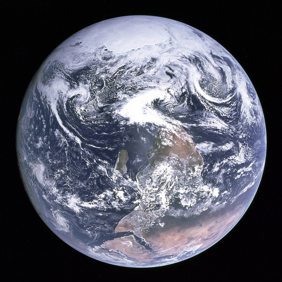
From space, Earth has no top or bottom. Northern bias shows even in one of the most widely circulated photographs: the "Blue Marble" image of Earth, taken on December 7, 1972. The astronauts had the South Pole facing up, but Nasa flipped the picture for public release, making it more conventional.
The astronauts thought Earth resembled a glass marble. The image, and its name, became a lodestone for the environmental movement.
* * *
Civis is intrigued by New Zealand’s antipodes. Dunedin’s lies near a town in northwest Spain called Carino.
Invercargill’s antipode is in the ocean west of France, while the tip of the North Island reaches into Africa. In reverse, London sits about 800km south of the Chatham Islands.
* * *
The previous geographic anomalies column noted the European bias behind terms like Middle East and Far East. Close to home, West Otago also seems misnamed. It lies south of "Central" Otago, and much of the province is further west than its biggest town, Tapanui.
In defence of the "west", though, the district is west of Otago’s traditional main centre, Dunedin, and east of its Southland border.
* * *
The Mercator projection has produced its own famous distortions, exaggerating countries near the poles and diminishing those near the equator. Greenland appears nearly as large as Africa: it is 14.4 times smaller.
Shapes distort away from the equator, and straight lines aren’t the shortest path, though this matters little over short distances.
Our view of the world is skewed by conventional depictions in more ways than we realise. Why not look again with fresh eyes — and not just by turning our maps upside down?


