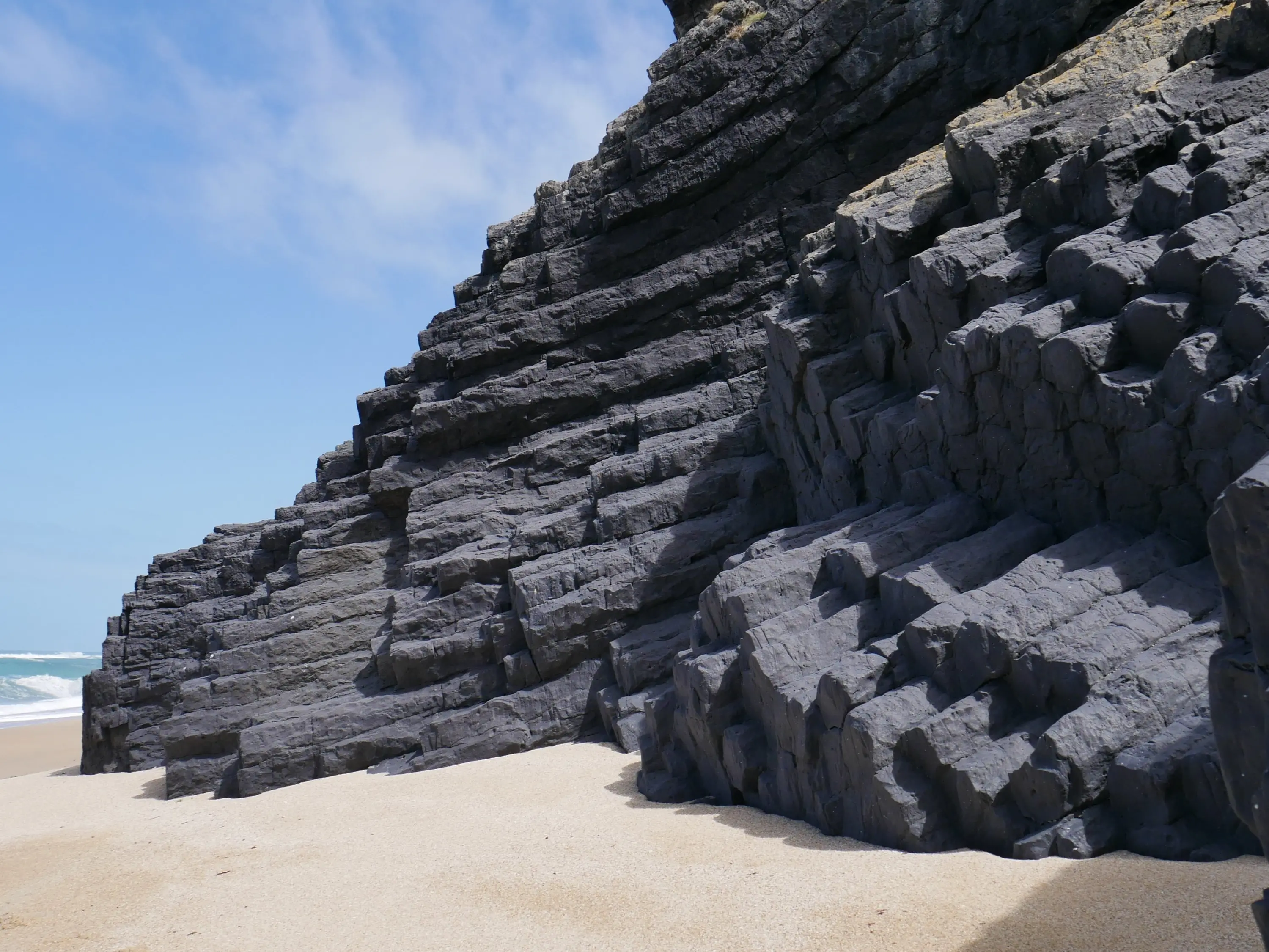
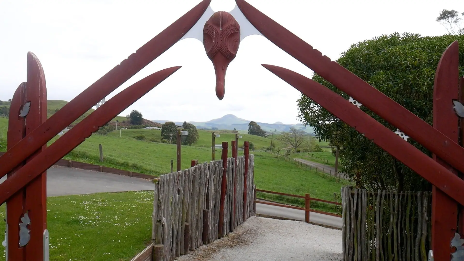
PHOTO
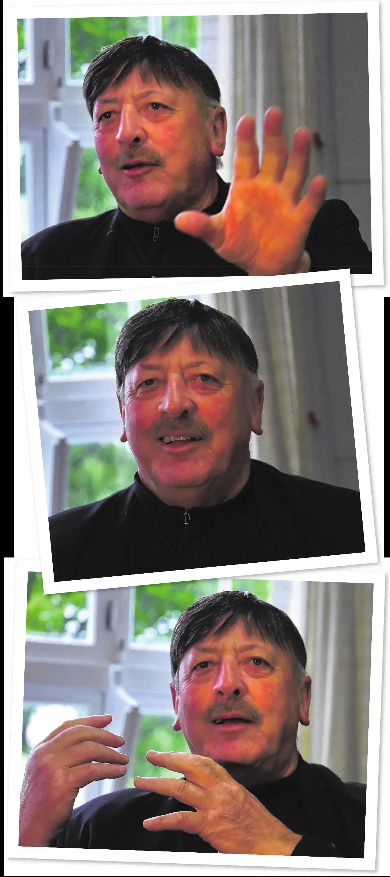
The names that adorn the southeast coast of Te Waipounamu warm the land, Puketeraki kaumatua Matapura Ellison tells Tom McKinlay and Luke Chapman.
Ko Aoraki te mauka
Ko Waitaki te awa
Ko te Tai o Ārai-te-uru te takutai moana
Ko Matapura ahau.
So, we’re in Kāi Tahu country, Matapura Ellison’s pepeha leaves no room for doubt.
He has named Aoraki Mt Cook as his mauka (mountain), the towering peak that stands above all else on Te Waipounamu - and given it its Kāi Tahu ‘‘k’’.
‘‘In a modern geopolitical context, it’s the bastion of Kāi Tahutanga, being the largest mauka in the land. And therefore we fly that flag as a point of tribal mana,’’ he explains.
The pepeha then begins to zoom in. He names Waitaki, so we’re moving south, and then Te Tai o Ārai-te-uru, placing the focus squarely on a stretch of the southeast coast.
‘‘In the context of the pepeha,’’ Ellison explains of the latter ‘‘it’s a reflection of a kotahitanga between the three marae of Ārai-te-uru, of the Ārai-te-uru rohe - Ōtākau, Pukeraki and Moeraki. And that’s essentially reflecting some commonality, political commonality, and some historical commonality as well.’’
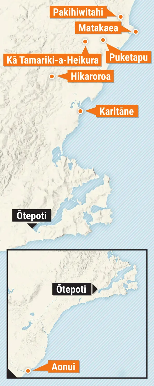
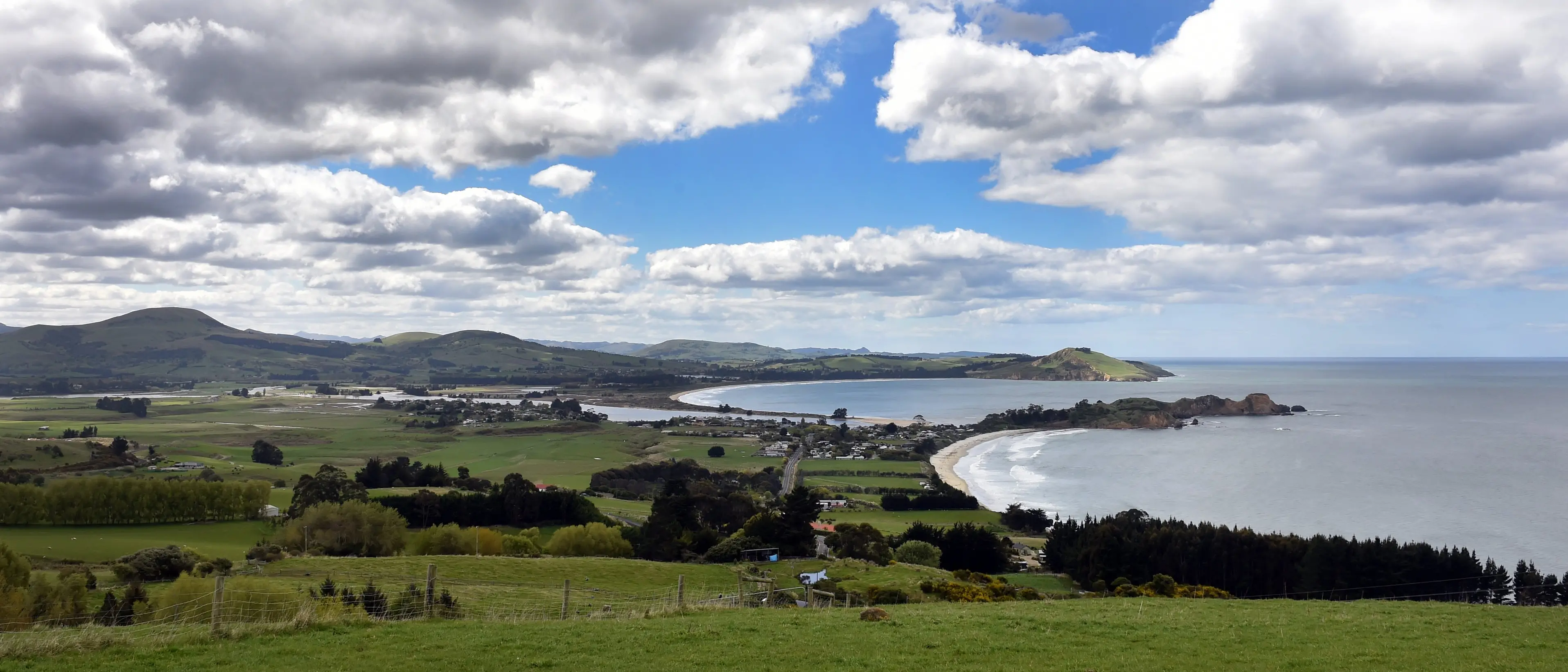
‘‘Te tai’’ is the coast and the area we’re talking about stretches south from the Waitaki River, down about as far as Long Point in the Catlins, Ellison, chair of Kati Huirapa Rūnaka ki Puketeraki, says.
It was a designation or description popularised by Hōri Kerei Taiaroa, or H.K. Taiaroa, the Ōtākou-based member for Southern Māori from 1871, who gave it life in his time as a way to unify the three close marae, he says.
‘‘They formed the Ārai-te-uru council back in the 1870s.’’
So, Te Tai o Ārai-te-uru is first a reflection of kotahitanga, or unity, but it also recognises a deeper history, he says, which begins with the storied voyaging waka Ārai-te-uru.
The waka has bound its memory generously across the local topography.
The weather has closed in around Karitāne, where Ellison sits on this occasion, the rain outside whipping in a cold wind, low cloud cloaking the whenua, so only its closest features are apparent.
But Ellison doesn’t need to see the contours here to tell the stories that map the district.
They are ancient stories, passed down, repeated. The one he’ll tell on this occasion concerns those onboard Ārai-te-uru, which finished its journeying in dramatic fashion at Matakaea, Shag Point, in a wreck. What happened to the crew? The hills have some of the answers.
‘‘There are a large number of hills, mountains, promontories on which the names of those survivors of the Ārai-te-uru waka wreck are placed,’’ Ellison explains. ‘‘And the beauty of it is, it’s a reminder of that whole tradition, of course.’’
For Ellison, the familiarity of the names warms the landscape, constantly renewing connection with his tīpuna.
The ubiquity of these names is a testament to the skill of Ārai-te-uru’s sailing master, Hipo, he says. He managed to keep the waka afloat until everyone else had managed to get off.
The stories he is about to tell are pakiwaitara or kōrero, he says, created to communicate some core messaging - in a way that would remain interesting.
‘‘And so some of the narratives, some would say, were somewhat embellished, but also there was some uncanny likenesses in the actual physical geography which supported the kōrero. So people will make what they will of it, of course, but at the end of the day it was about conveying stories that they wanted to be retained by future generations.’’
Ellison starts with Pakihiwitahi, one of the survivors of the wreck.
The crew might have survived but they were wet and cold and in unfamiliar territory, so after making a shelter, some were sent off to find and gather the resources they would need - with a warning to be back before nightfall.
Pakihiwitahi set off in a northwest direction, back towards the Waitaki where it is said he found an ipu, a bowl.
‘‘He found an ipu, cold water, and he found a hōaka, a grinding stone ... it was really important to find these sort of resources.’’
As a result, his name is associated still with a hill in what has also come to be known as the Horse Range.
‘‘There were others who were said to have flown here and there. Again, that’s probably just creating a bit of drama about the story,’’ Ellison says.
One of them was Puketapu, whose name now adorns the distinctive mauka near Palmerston.
She actually travelled further south and found firewood, which she tied into two bundles.
‘‘One tied together with kākaho and the other with harakeke or flax. Now, she had taken her time and on the way back she was overtaken by the darkness. And there she was, turned to stone in the landscape forever and a day.
‘‘And the truth of that kōrero is bolstered by the fact that the bundles of sticks which she had, one tied together with kākaho and the other with flax, could be seen on the east side of Puketapu. One valley had harakeke all the way down it, and the other had toetoe (kākaho). So there you go.
‘‘It bears a truth to the kernel of that story.’’
Another of the crew, Aonui, was sent south and went as far as Tokomairaro beach, east of Milton.
‘‘He must have hung around there a bit, blow me down, he was turned to stone as well. And there’s a large basalt boulder on the beach, at Tokomairaro, which is named Aonui.’’
Yet another of the voyagers dropped part of the resource he’d managed to collect as he made his way through what would become Ōtepoti Dunedin, and that became the city’s Town Belt, he dropped some more as he approached Karitāne and that became the Puketeraki bush, and in his haste to return to the encampment before he lost the light, dropped a third part at Goodwood, seeding the forest there.
The twin sisters of Heikura are said to have been turned to stone on the western horizon, as seen from Karitāne - Kā Tamariki-a-Heikura, sometimes called the Sister Peaks.
‘‘And of course Hikaroroa, or Mount Watkin, is to the south of Kā Tamariki-a-Heikura.’’
Hikaroroa, is interesting also, Ellison says, for the two names it now carries. In the late 19th century one of Kāi Tahu’s great chiefs, Rāwiri Te Maire, suggested that the Wesleyan missionary, the Rev James Watkin, who established the first mission station in the South Island, at Karitāne in 1840, be remembered on the land.
‘‘It was Rāwiri Te Maire who suggested that his name should be on that large promontory there, which was previously called Hikaroroa.’’
The old volcanic peak then became known as Mt Watkin but custom has shifted again more recently to accommodate both histories, a decision formalised through the Ngāi Tahu settlement process.
‘‘Prior to our settlement, we were looking to re-establish some of our older place names,’’ Ellison explains. ‘‘And during the settlement process, one of our suggestions was - not to the detriment of Reverend Watkin - but to uplift Hikaroroa as a co-name. That’s how it stands today, Hikaroroa Mt Watkin.’’
For Ellison, the importance of all this is that it warms the landscape for him.
‘‘You know, many people, three people in a room might have a different relationship with that mountain, that peak, Hikaroroa. And they could all have that relationship and be warmed by the lens which they apply.
‘‘But for me personally, I was very pleased to see Hikaroroa, an ancient name associated with the Ārai-te-uru waka, brought to new prominence - another way of bringing his memory back to life again. And that’s what I think that whole process was for, to rekindle the fires of knowledge and those associations on the landscape.’’
It layers history on the land, he says.
‘‘We’re still building our history, aren’t we? And in our time, we will leave a layer, and those who are coming after us will leave their lens or their layer of associations in work and deeds for others of their ancestors to follow, to know about and to warm.’’
There was a further purpose in these traditions, Ellison says, one illustrated in the life of a more recent ancestor, Te Matehaere, whose is understood to have maintained a kāika at the north end of Waikouaiti Beach, around Matainaka.
‘‘He was alive at the turn of the 18th century, and his name pops up through to about the 1840s.’’
He made an annual expedition up through what is now called the Pigroot, into the Māniatoto, into the Manuherekia, to maintain his ahikā. There they would gather mahika kai during the summer before returning to the coast to winter over, or perhaps heading south to gather tītī.
‘‘But, yes, there are names up on what we call the Pigroot now, which are associated with Te Matehaere. One creek heading towards Dunback, is called Te Wai o Rimurapa, named after his son, for example. And so they put their names all the way on the creeks and on the promontories, and they would codify it in waiata.’’
Then they’d recite those waiata as they travelled, the familiar features reassurance they were on the right trail.
‘‘It was their mind map - in the absence of a written map they could pull out of their pocket and refer to - but absolutely crucial to getting to where they needed to go.’’
A practice that again would have warmed the hearts of those travellers.
