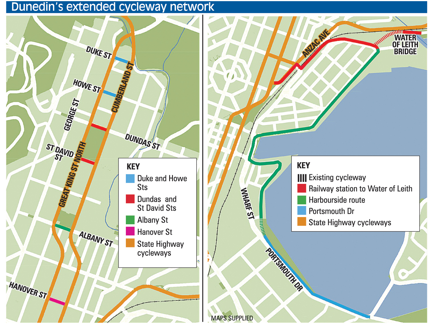
The plans will improve connections between the NZ Transport Agency’s one-way-system cycle lanes and connect the city and harbour’s cycleway networks.
The council will absorb about one-third of the cost, with the bulk coming via the Government’s Urban Cycleways Programme.
A net six car parks will be lost, 10 culled from Albany St and Anzac Ave and four added to Hanover St.The designs are open for public consultation.
Council transport group manager Richard Saunders said the aim was to create more ways for cyclists to get around the city by using fairly simple treatments to make selected roads safer and more cycle-friendly.
"On some streets, the work will be as simple as narrowing intersections and marking out areas to guide cyclists at the traffic lights.
"Albany St will have the most extensive work — we’re proposing new cycle lanes marked with reflective lane dividers."
The council was aware of the pressure caused by removing car parks and had worked in its designs to minimise losses.
"We are well aware of the parking pressures within the central city and around the hospital and university area."
One aspect of the project was to improve the safety of the roads connecting the cycleways network on the State Highway 1 one-way system.
Changes were planned for Duke, Howe, Dundas, Albany and Hanover Sts.
It was also planned to connect the harbour and central city.
The council proposed building a new cycleway on Anzac Ave from the Dunedin Railway Station to St Andrew St. From St Andrew St, a new path would create a link alongside the railway line to a new bridge over Water of Leith near its mouth.
New road markings would improve cycleways in Fryatt, Birch and Kitchener Sts, including a shared path planned between Fryatt and Birch St. The Portsmouth Dr shared path would be built up and resurfaced.
"Features like the Water of Leith bridge and the path along the railway line will join the dots with existing and planned infrastructure, making it easier for people to travel through the city and around the harbour," Mr Saunders said.
Consultation closes on June 30 and final plans will be announced in October.
Mr Saunders said it was planned for work to begin in October and be completed by mid to late next year.
Comments
Throwing good money after bad.
No!
John Birch Street Society
Yeah, because people will take a massive detour around the harbour you double-back over the bridge and back to the railway station.
Last time taught us this council will make a mess of this one as well


