

The MetService is predicting snow to 200m in large parts of the South Island from tonight, but the worst of the front is expected to miss Dunedin.
After earlier saying there was a "strong possibility'' that snow would hit Dunedin's hill suburbs, MetService revised its forecast to say snow was expected to 400m around the city this evening and tomorrow.
Elsewhere in the South Island, including parts of Central Otago and large parts of Canterbury and Marlborough, a severe weather watch has been upgraded to a warning and snow is expected to fall as low as 200m.
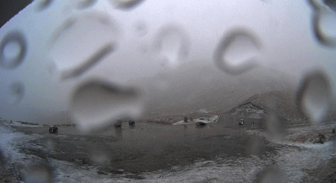
The front began making an impact on the Crown Range Rd with snow settling quickly at the summit between 4pm and 4.30pm.
"The driver of the snow is a front that is moving up Aotearoa today which will see cold southwesterlies affecting the South Island today and the lower North Island tomorrow."
A warning was in place for Central Otago north of Omakau and the Canterbury High Country and Plains from the Waimakariri River southwards from 6pm today to 8am tomorrow.
Snow was expected to 200m and 15cm to 20cm could accumulate above 400m.
For parts of the Canterbury High Country north of the Waimakariri River and Marlborough south of Ward the warning was in place from 3am to 3pm tomorrow.
A watch was in place for Southern Lakes, inland parts of Southland and Clutha and Central Otago south of Omakau.
Between 2pm and 10pm today snow was expected above 300m and warning accumulations possible above 500m.
A watch was also in place for Fiordland from 9am to 2pm today.
Meteorologist Peter Little said the trough was forecast to affect the west of the South Island through to early this morning, bringing northerly rain to the west coast with some heavy falls.
Mr Little said there was a strong possibility that snow could fall in the Dunedin hill suburbs tomorrow.
"Regardless of snow, it's certainly going to be very cold. With the strong southwesterly winds, the wind chill is going to be pretty bitter. Compared to what you've had recently, that's going to feel miserable.'
"People are advised to keep up-to-date with the latest forecasts in case parts of this watch are upgraded to a full warning or further areas are added.''
Mr Little said a second front was forecast to go through on Friday, but at this stage, the snow was not expected to drop below 500m.
SNOW FOR ALPINE PASSES, CROWN RANGE RD
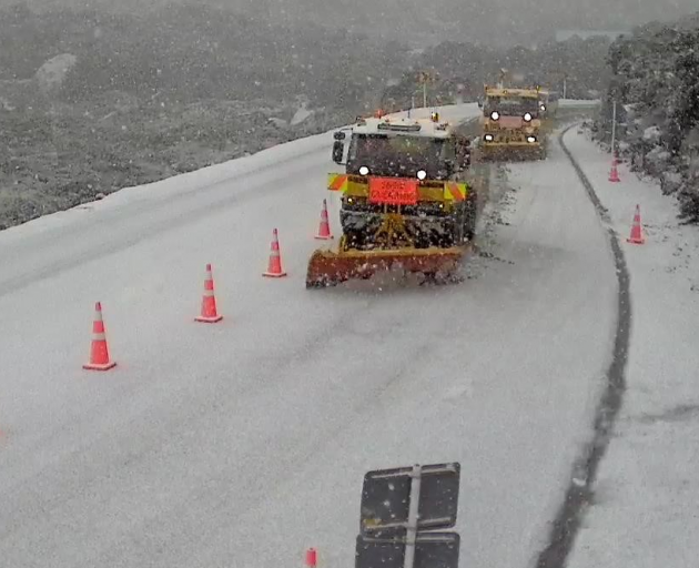
Snow is forecast to affect all alpine passes in the South Island from Tuesday afternoon, as well as the Crown Range Road, MetService says. Up to 20cm is predicted for Porters Pass and up to 10cm for the Lindis Pass.
CROWN RANGE ROAD
Snow was forecast to affect the road from Tuesday afternoon. Between 2pm and 10pm, expect 5cm to 10cm of snow above 500 metres, with lesser amounts down to 300 metres.
HAAST PASS (SH6)
Snow predicted on Tuesday afternoon. Between 2pm and 8pm, expect 1cm to 3cm of snow near the summit of the road, with lesser amounts down to 300 metres.
LINDIS PASS (SH8)
Snow is expected to affect the road from Tuesday afternoon. Between 2pm and 10pm today, 5cm to 10cm of snow was likely above 500 metres, with lesser amounts down to 300 metres.
PORTERS PASS (SH73)
Snow forecast from 8pm on Tuesday night until 8am on Wednesday morning. Expect 15cm to 20cm of snow above 400 metres, with deeper amounts expected at higher levels, and lesser amounts down to 200 metres.
ARTHURS PASS (SH73)
Snow predicted for highway from 8pm on Tuesday until 8am on Wednesday. Expect 3cm to 6cm of snow to affect the road above 500 metres, with lesser amounts down to 200 metres.
LEWIS PASS (SH7)
Snow could affect this road on Wednesday morning. Between 3am and midday, 1cm to 3cm of snow may settle on the road above 500 metres, with lesser amounts down to 300 metres.
MILFORD ROAD (SH94)
Snow showers should ease this afternoon. Until 2pm on Tuesday, a further 1cm or 2cm of snow may settle on the road above 600 metres on top of what has already fallen, with lesser amounts down to 400 metres.
NORTH ISLAND
The Desert Road in the central North Island is set to get 2cm-5cm of snow from 6pm on Wednesday until midnight. Snow may briefly affect the Rimutaka Hill Road, linking Wellington and Wairarapa, between 4pm and 8pm on Wednesday.
Related Stories


Comments
ODT, can you please find out why snow always seems to miss Dunedin these days, and gets everyone around us instead? Kinda serious.
Then go up in the sky and change the road (sky?) markings for clouds, so that we trick them into floating over Dunedin and dumping snow here instead. Kinda serious.