Four of the six routes, considered to be at serious risk from rockfalls and landslips, traverse Otago and Southland, and two are at the top of the South Island.
Costs could surpass $112 million to make the six highways more resilient in the face of increasingly frequent and severe storms brought about by climate change, tender documents obtained by the Otago Daily Times say.
A national review three years ago identified 20 stretches of highway across New Zealand that were very likely to suffer from natural hazards, which would have extreme consequences.
In this next stage of the project, a business case that set out solutions for each of the six priority southern routes was required, the Waka Kotahi NZ Transport Agency documents said.
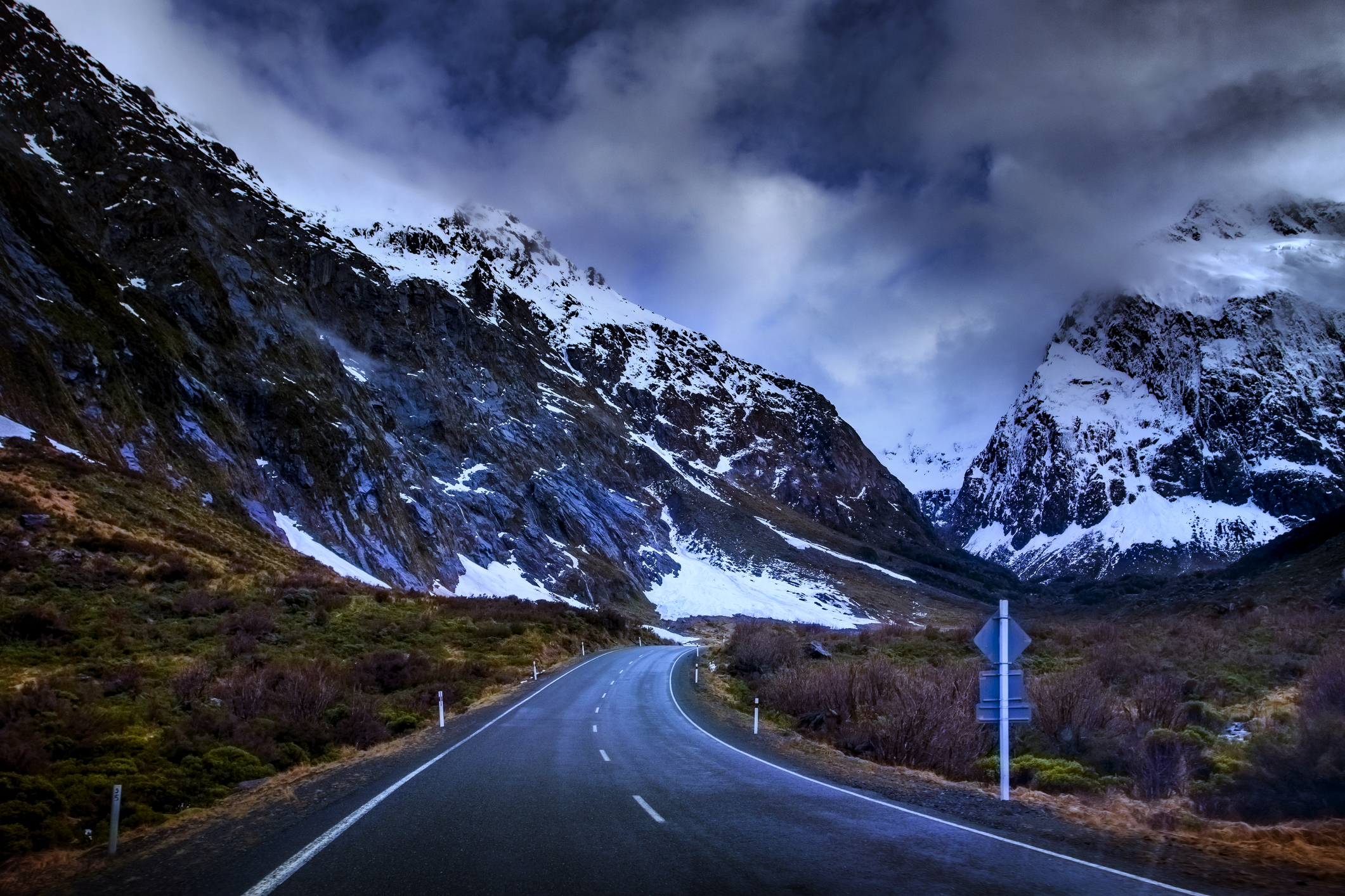
First, the 120km section of State Highway 94 north of Te Anau (Milford Rd) had a high number of closures because of alpine conditions and challenging terrain, Waka Kotahi said.
It provided the only access to Milford Sound and Fiordland National Park and closures could result in tourists and workers becoming stranded where there was limited capacity to accommodate them.
Issues on the road included rapidly changing weather conditions, black ice and poor cellphone coverage.
"Key risks along the route are numerous and include significant landslip and flooding, affecting both roads and bridges.
"Avalanche is also a key risk in winter and requires significant, ongoing proactive maintenance and likely to increase with the impacts of climate change.
"Treefall during extreme weather is also a risk that requires ongoing management even with the extensive programme which already occurs, this is also likely to increase with climate change," the documents said.
The total estimated cost for the work was unknown, but $22.5m had been submitted into the next national land transport programme, Waka Kotahi said.
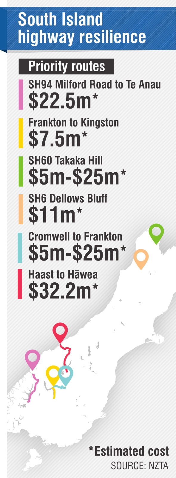
The total project was estimated to cost $7.5m, the agency said.
SH6 between Haast and Hawea linked the Queenstown Lakes district with the West Coast and if it closed it would represent a loss of $2m a day during peak tourism season, the agency said.
"Beyond ensuring resilience for tourists, this section is a critical lifeline route for people in the communities."
There was extreme landslip risk along the route and the "Epitaph Slip" in South Westland was said to be the most vulnerable piece of road to subside in New Zealand and at present only reactive work was under way there.
In Otago, landslips along the side of lakes Wanaka and Hawea presented an extreme risk.
There were many large-scale rockfall locations along the corridor, posing an extreme risk, the agency said.
The Epitaph Slip alone was expected to cost $15.2m. In total $32.2m had been submitted to the national land transport programme for the corridor.
Another section of SH6 between Cromwell and Frankton was identified as a crucial corridor that averaged 5287 vehicles a day, including 20% heavy vehicles.
Commuter traffic between Cromwell and Queenstown was significant and tourists and freight were increasingly using parts of the route.
However, the isolated nature of the highway meant there were limited alternatives for travel between the two regions.
If the route closed, the official detour route was through Wanaka over the Crown Range, adding 60km to the drive over an alpine pass with tight corners that could not be traversed by long vehicles, the agency said.
The national business case identified extreme risk of rockfalls and landslips throughout the Kawarau Gorge.
It also said the 1km-long and up to 160m-high Nevis Bluff was a "significant unstable feature" about halfway between Cromwell and Queenstown.
Total estimated cost was unknown because there was no "preferred solution" known at present but the national review estimated between $5m and $25m was required for the work.
Further north, SH6 between the West Coast boundary and the intersection with SH63, in the Tasman region, also carried an extreme rockfall risk.
At least three sites required netting, rock bolting or safety fencing. The project was expected to cost $11m.
And SH60 along Takaka Hill provided the only access to Golden Bay and Farewell Spit in the Tasman region and there landslips presented an extreme risk.
Resilience work along the stretch of highway was estimated to cost between $5m and $25m.
The work was being split into two tranches. Waka Kotahi said it was seeking three professional service providers and each would be asked to create a business case for one highway corridor in the first tranche.


