
Another bout of unsettled weather looks set to bring strong winds, heavy rain and possible thunderstorms to the South.
MetService said a front sitting over central New Zealand was bringing a band of rain with it, which the forecaster said could lead to thunderstorms in parts of the North Island.
"Meanwhile, a second front is moving up the South Island and is expected to reach central New Zealand by the end of the day."
MetService says this front also carries a risk of thunderstorms, in Fiordland and coastal areas of Southland and Clutha this morning, and around Dunedin, North Otago, and the Canterbury Plains this afternoon.
"Any thunderstorms that occur here may bring brief heavy rain with intensities of 5 to 15mmh, and hail 5 to 15mm in diameter."
Today's rain looks set to be followed by strong winds tomorrow, and MetService has strong wind watches in place for the whole of Otago and Southland. There is also a heavy rain watch in place for the headwaters of the Otago lakes and rivers.
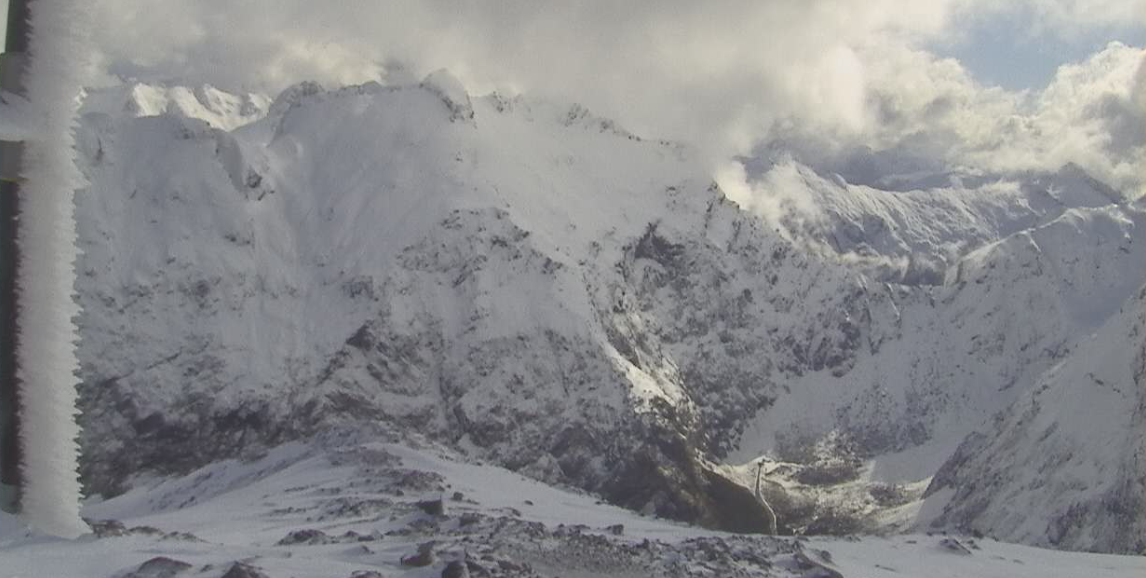
More snow closes Milford Road
More heavy snow is expected to affect the Milford Road tomorrow. MetService said snow was likely overnight and in the morning where between 6cm and 12cm may settle on the road until 11am.
State Highway 94 opened for an hour from 5pm today from Hollyford Intersection to Donne River Bridge before closing again overnight.
The avalanche risk in the area was low.
Milford Road Alliance said State Highway 94 would be open for essential traffic only from 10am until 1pm on Tuesday, after which the road would close. Snow showers, heavy rain and possible thunderstorms were expected.
Snow was also expected on Wednesday, falling to as low as 400 metres.
Road snow warnings previously issued for the Crown Range Road and the Lindis Pass (SH8) have expired.
Severe weather alerts
Heavy rain watch
Area: The headwaters of the Otago lakes and rivers, for 11 hours from 2pm to 1am on Wednesday.
Forecast: Periods of heavy rain. Rainfall amounts may approach warning criteria within 15 km east of the main divide.
Strong wind watches
Area: Otago, for 10 hours from 11am to 9pm on Tuesday.
Forecast: Northwest winds may approach severe gale in exposed places. Moderate chance of upgrading to a warning.
Area: Fiordland, Stewart Island and Southland, for 10 hours from 9am to 7pm on Tuesday.
Forecast: Northwest winds may approach severe gale in exposed places. Moderate chance of upgrading to a warning.
- Allied Media


