PHOTO
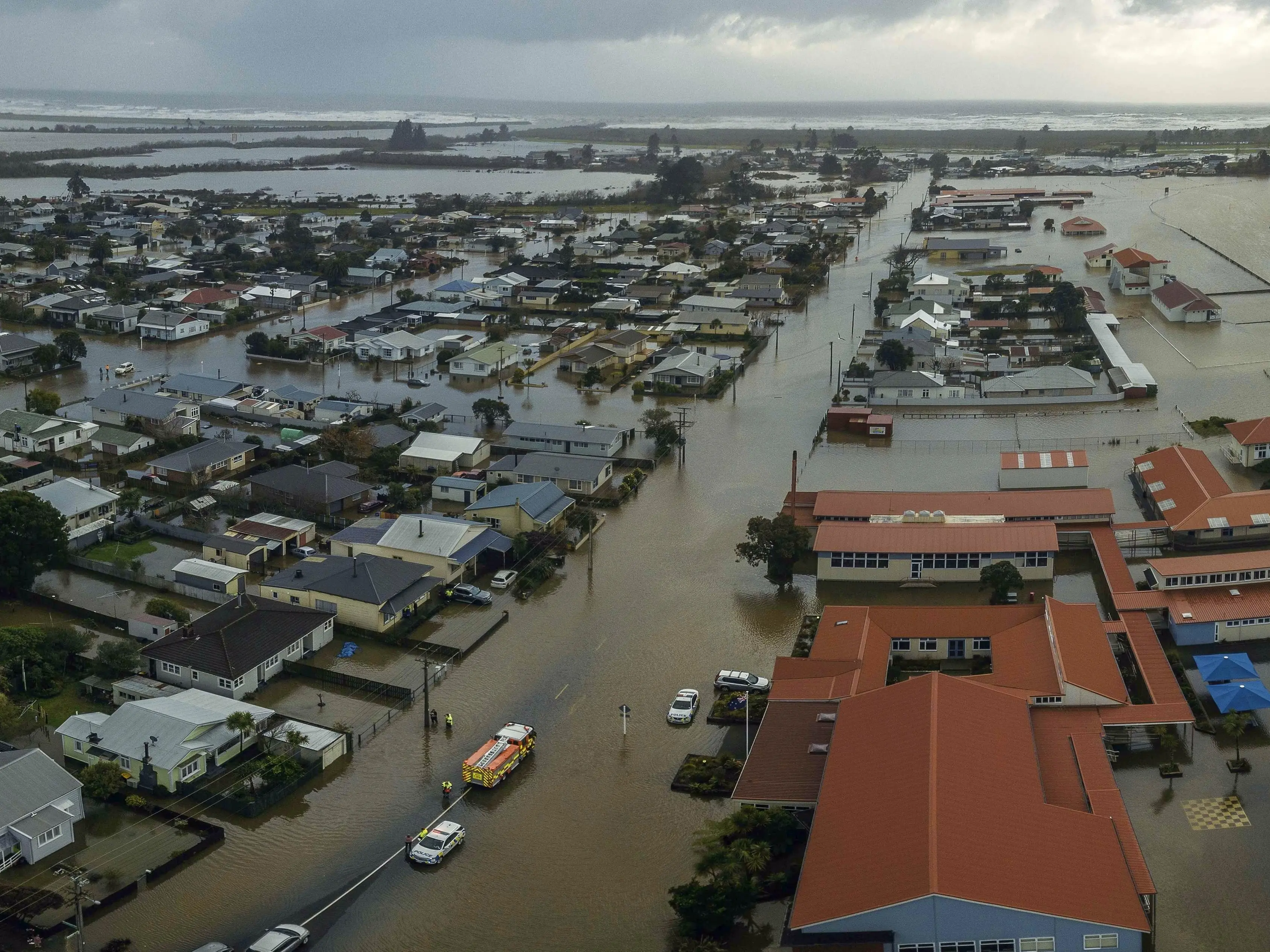
Plans to save Westport from one-in-100-year flooding could cost $54.4 million and involve 18km of floodwalls.
However, plans leave out the badly flooded Snodgrass Rd area, on the north side of the Orowaiti River and lagoon.
The Buller District Council and West Coast Regional Council have together unveiled the business case they will put to the Government, with a total bill of $54.4 million — $42.3 million of which would be sought from the Government.
The July 2021, floods damaged 563 houses, or 23% of the town’s housing stock.
The wide ranging solution includes 18km of walls and embankments, including floodwalls at Carters Beach to protect from the Buller River.
About half of the walls would be on public or reserve land, 44% on private property and 6% on KiwiRail land, traversing six farms, up to 12 lifestyle blocks and seven homes. A further 15-20 properties would have the embankment or floodwalls on reserve land adjacent to their properties.
Viewing platforms are also proposed.
The councils have ruled out dredging the Buller River, a direct cut to the sea from the Orowaiti River estuary, and floodwalls on the Snodgrass Peninsula, which has about 35 homes.
They say the proposed plan was designed to avoid $400 million of damage to Westport buildings alone.
"It lays out the plight we’re facing," Buller Mayor Jamie Cleine said.
The councils said building floodwalls at Snodgrass would significantly increase water levels for upstream properties over 6km. That would require higher structures for the Westport ring-bank on the other side of the Orowaiti estuary, as well as increasing flood depths on land within the (unprotected) Orowaiti overflow area upstream.
Resource consents may be difficult to obtain because the toe of many parts of the stopbank would extend into the estuary.
The councils also flagged other issues, including talking with the New Zealand Transport Agency about the effects of the embankment on peak flood flows on State Highway bridges.
Another proposal involves relocating the airport to higher ground, at some stage, and the report also addresses relocation and retreat from Westport township.
"We have a town that needs to grow. We have land that could be available outside the hazard zone, and we have councils that are willing to collaborate with central Government, and to transition from forced retreat to strategic relocation based on future growth," the report said.
Alma Road — a terrace on the south bank of the Buller River — was the best option for large scale managed retreat, due to its proximity to the existing town, the ease of servicing by infrastructure, the elevated location away from coastal hazards and its proximity to the main transport links.
However, Mr Cleine yesterday said they would not be paying to relocate people.
There could be funds, though, for people to build their own bund, or raise the height of their homes.
"It’s a hand up, not a handout."
The business case will go to the Government this week.
Mr Cleine said they would ask the Government to speed up rules around hazards in the new Te Tai o Poutini Plan. Parts of the proposal, such as floodwalls, will be consulted on if funding is secured.
At a glance
Westport flood remedy work: Westport floodwalls and Carters Beach $18m; Organs Island reafforestation $1.5m; immediate works on Buller riverbank and longer term operational expenditure $6.6m; operational expenditure on Westport and Carters Beach walls $3.3m; consents $1m; contingency $1m.
Retreat/relocated: Adaptation fund to help people in areas such as Snodgrass Road $10m; $0.5m for Alma Road
Accommodate: $12m for stormwater; $740,000 for Civil Defence and sea level monitors and tide gauges.