PHOTO
This walk’s more of a tramp, with a river crossing, steep hill climb and a poled route along tussock tops. My apologies to people who aren’t able to access such a place; I hope you can enjoy the outing through these words and pictures.
Nearly all of us will have seen the Maungatuas, though — the big flat range dominating the skyline as you exit Dunedin airport. How many of us have wondered what’s up there?
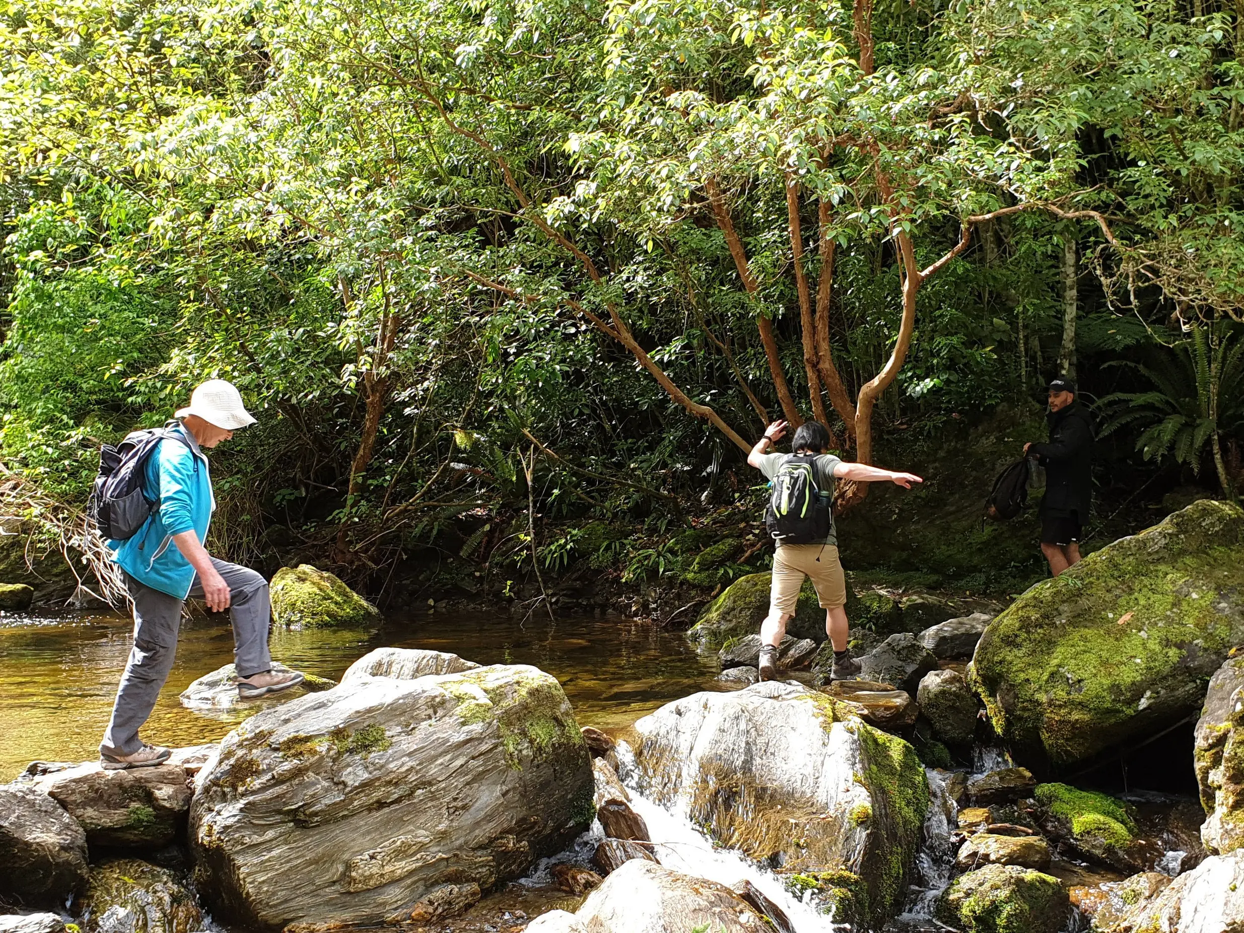
Finding out involves a start at Woodside Glen, near Outram. A 750m high-quality walkway leads up to Lee Stream with its waterholes, a choice destination in its own right.
Now the track climbs steeply through some really quite healthy native bush, good enough to host at least one New Zealand falcon. It’s nearly 2km to the bushline where gaps in the trees give glimpses back over the bush to the start of today’s epic effort.
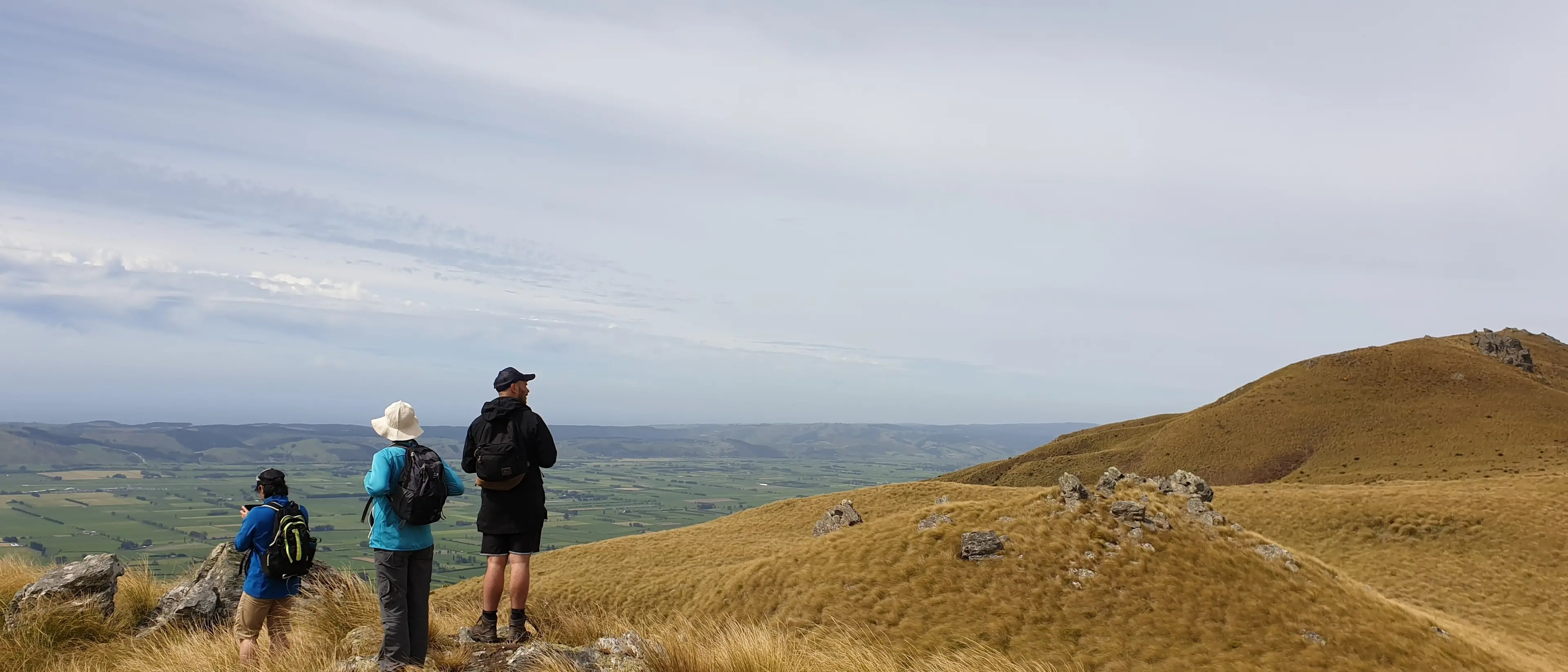
Hold out through the tussock climb for a proper stop at the first rocky tor. The Taieri Plain is a green sea below and poking up in the distance are Hereweka (Harbour Cone) and Kapukataumahaka ( Mt Cargill). Way down like a wee dot is the airport.
Around this point the track peters out but it’s also around this point the walk becomes a much more gradual undulation. Marker poles go up a ridgeline but a topomap’s a good idea. Views take you inland or over secretive valleys below.
With increasing height the temperature drops and the vegetation changes. Everything starts to feel pretty special. Open tussocky tops and subalpine scenery aren’t something we normally associate with Dunedin city.
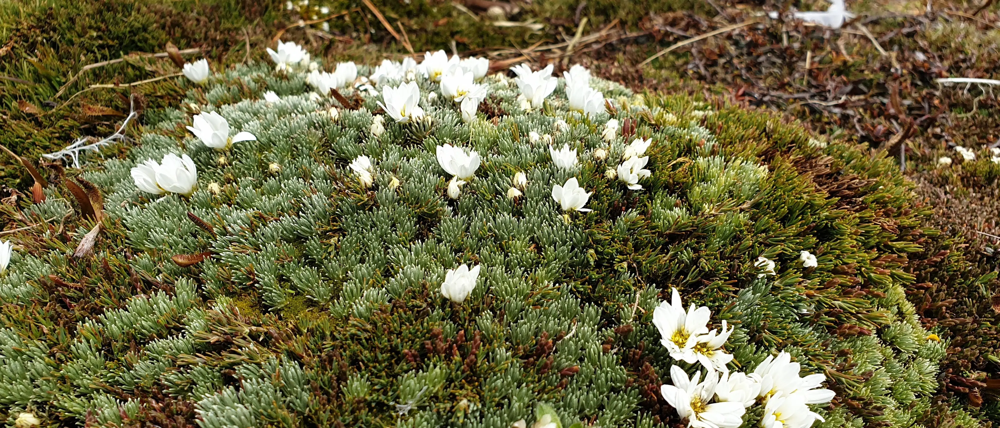
The view from the airport gives a perfect appreciation of how flat the top of this hill is. It’s so flat there are wet basins around the summit area. Water gathers in small, dense tarns.
Some pretty special native plants grow up there and the area is rated as being of national significance. About 10 different species of cushion plants grow, creating mini meadows. Sphagnum moss collects in big, dense bogs. Carpet heaths and mountain daisies appear.
Walking to the summit involves skirting round the boggy bits and finding the toughest looking plants that might cope. My lotto dream on this day, when half the world seemed to be in isolation or quarantine, was donating a high-quality track and boardwalk to protect this area and allow more of us to marvel at its specialness.
In 1997 its specialness was recognised with the awarding of topuni status.
Under the Ngai Tahu Deed of Settlement a topuni confirms an overlay, like a cloak, of Ngai Tahu values on specific areas of public conservation land. A topuni doesn’t alter existing land status, in this case, scenic reserve, but officially recognises traditional values in a site’s management.
Mauka Atua (using the proper local pronunciation) is a wahi taonga, a treasured place. It has an urupa, burial site, on its north shoulder and stands guard over the interior of Otago.
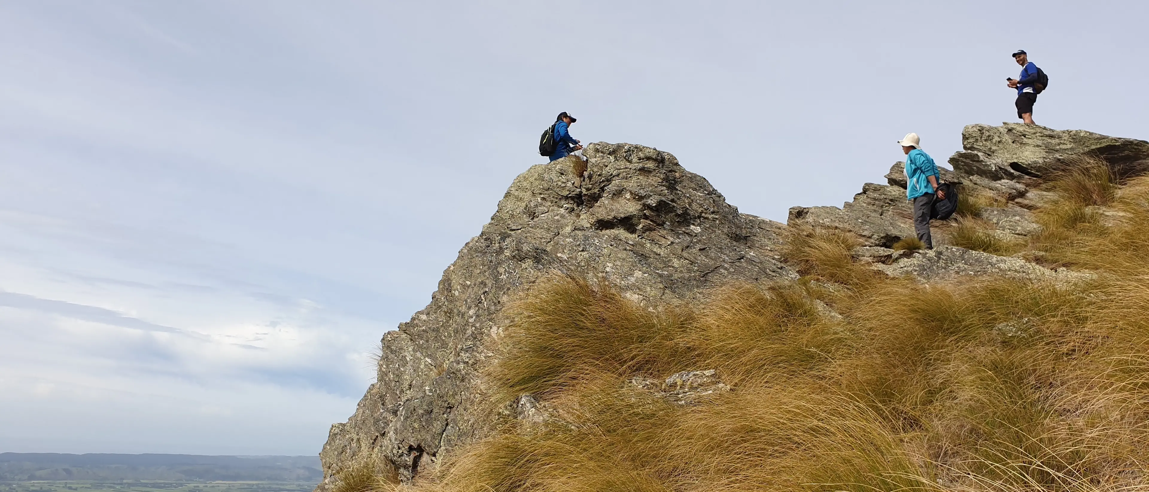
As you exit the airport what a statement of strength it is. It’s a stepping stone linking the coast’s lowlands with the interior’s highlands. And when you’re up there, rocky tors and wild tussocklands make it feel as if it’s where Central starts.
- Clare Fraser