The Central Otago and Southern Lakes areas are bracing for more stormy weather today as Roxburgh remains cut off and cleaning up from Sunday’s deluge.
Virtually all inland South Island regions were being told to expect thunderstorms on Wednesday, for the fourth day in a row.
Localised ones were expected to strike from the Nelson Ranges to Central Otago and the Southern Lakes after lunch until tonight.
MetService said unstable conditions over inland central and lower North Island and inland areas of the South Island meant heavy showers and isolated thunderstorms were likely.
Some were expected to be so intense, up to 40mm of rain could fall in an hour sparking flash floods and slips and driving could be hazardous.
In the North Island, MetService said the risk of thunderstorms this afternoon and evening was high for inland parts from Waikato south.
Auckland, Coromandel Peninsula, inland Gisborne and parts of Northland had also been put on notice, but the risk of storms was lower.
Yesterday, more than 10,000 lightning strikes were recorded over the country and severe thunderstorm cells sparked warnings for the Mackenzie Basin and Marlborough.
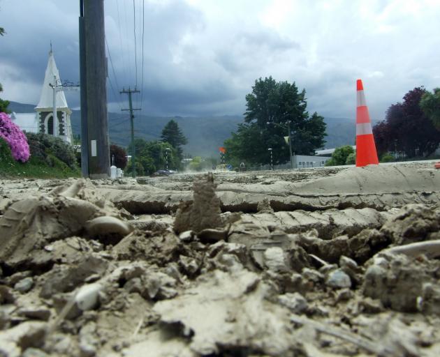
Meanwhile, the mop-up is continuing in Roxburgh where State Highway 8 remained closed as road crews cleared slips and repaired washouts on the main highway between Roxburgh dam and Millers Flat.
SH8 between Millers Flat and Roxburgh remained closed with more rain forecast overnight.
Lake Roxburgh Village was put under a boil water notice yesterday and residents asked to conserve water.