
Heavy rain is drenching the Grey and Buller districts on the West Coast, causing flooding and slips that have closed key roads.
Emergency operations centres have been activated in both districts, with the Grey District Council advising people in flood-prone areas that they might need to evacuate if they feel uncertain.
Grey district mayor Tania Gibson says people should avoid non-essential travel as water in the backcountry moves towards the coast.
"It came through very fast up at Waipuna and up at Ahaura this morning. The farmers alerted me. It happened very quickly for them so it took us a little bit by surprise even though we knew we were getting quite a lot of rain," she said.
"At the moment there doesn't seem to be too much risk to houses or homes, which is great. We just watching that all very closely."
West Coast Emergency Management said the Grey River was still rising, as floodwaters moved downstream.
A heavy rain warning for the Buller District is not set to expire until 9am Sunday.
MetService said the heavy rain may ease for a period on Saturday afternoon and evening before resuming overnight.
Heavy rain watches are in place for neighbouring areas Tasman (west of Takaka) and Nelson Lakes.
Staff were keeping a close watch on Kaiata and Golf Links Roads, near Greymouth, while the Greymouth Aerodrome runway was closed, because of flooding.
A slip about 40 metres from Sawyers Creek, off Marlborough Street, was being monitored.Controller Andy Thompson said there were also reports of toilets backing up, and wood and debris in rivers.
Civil Defence staff would remain on deck until midnight.
Earlier Ahaura's Awahono School sent children home.
West Coast Emergency Management group manager Claire Brown said schools were being contacted as a precaution, as water levels rose at Coal Creek and Kaiata ahead of school bus runs.
The council said the Ahaura River had started to plateau and the Waipuna was falling by 11.30am.
Atarau Road was being watched closely but rivers were starting to fall, while the Iveagh Bay underpass flooded so the bypass route over the railway was opened.
There was surface flooding from Stillwater to Moana, the council said.
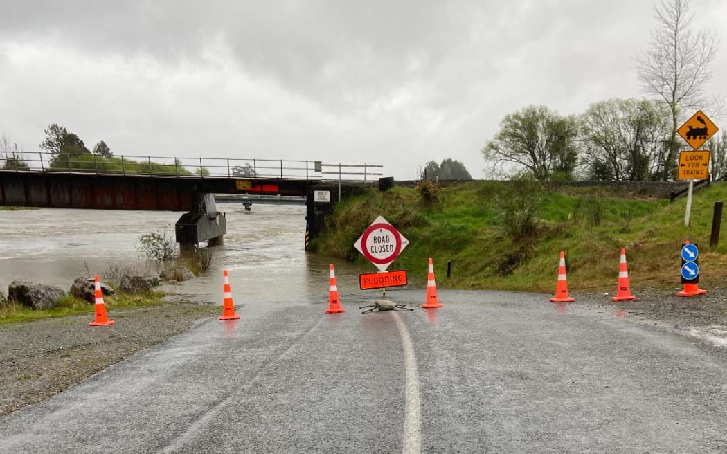
Meanwhile, parts of a major alpine pass has closed, as wild weather batters the upper South Island.
Two sections of State Highway 7 are closed, due to flooding and the risk of slips.
The road is closed between Stillwater and Ngahere, and motorists are asked to detour via Atarau, Taylorville-Blackball and Taylorville Roads.
The highway between Springs Junction and Reefton is also shut.
State Highway 67 from Mokihinui to Karamea Bluff was closed because of a slip, while the bad weather had also caused flooding on the road between the Lower Buller Gorge and Mokihinui, State Highway 6 through the Lower Buller Gorge and from Greymouth to Punakaki and State Highway 67A from Westport to Cape Foulwind.
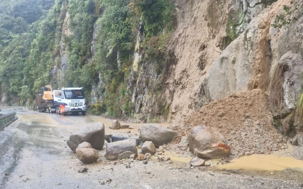
Rocks had fallen on State Highway 6 near Meybille Bay, north of Punakaiki.
The New Zealand Transport Agency (NZTA) was also urging people to take extra care State Highway 73 between Arthur's Pass Village and Kumara Junction because of flooding and slips.
Buller mayor Jamie Cleine said the rain had mainly fallen in the ranges, affecting inland rivers around Reefton.
Buller Emergency Management said staff were keeping a close watch on river levels across northern Buller and Inangahua.
Teams were clearing drains and checking key areas, while pumps would be deployed in known trouble spots.


