Snow blanketed parts of the South, with Queenstown skifields receiving their first big dump of snow ahead of the season’s start.
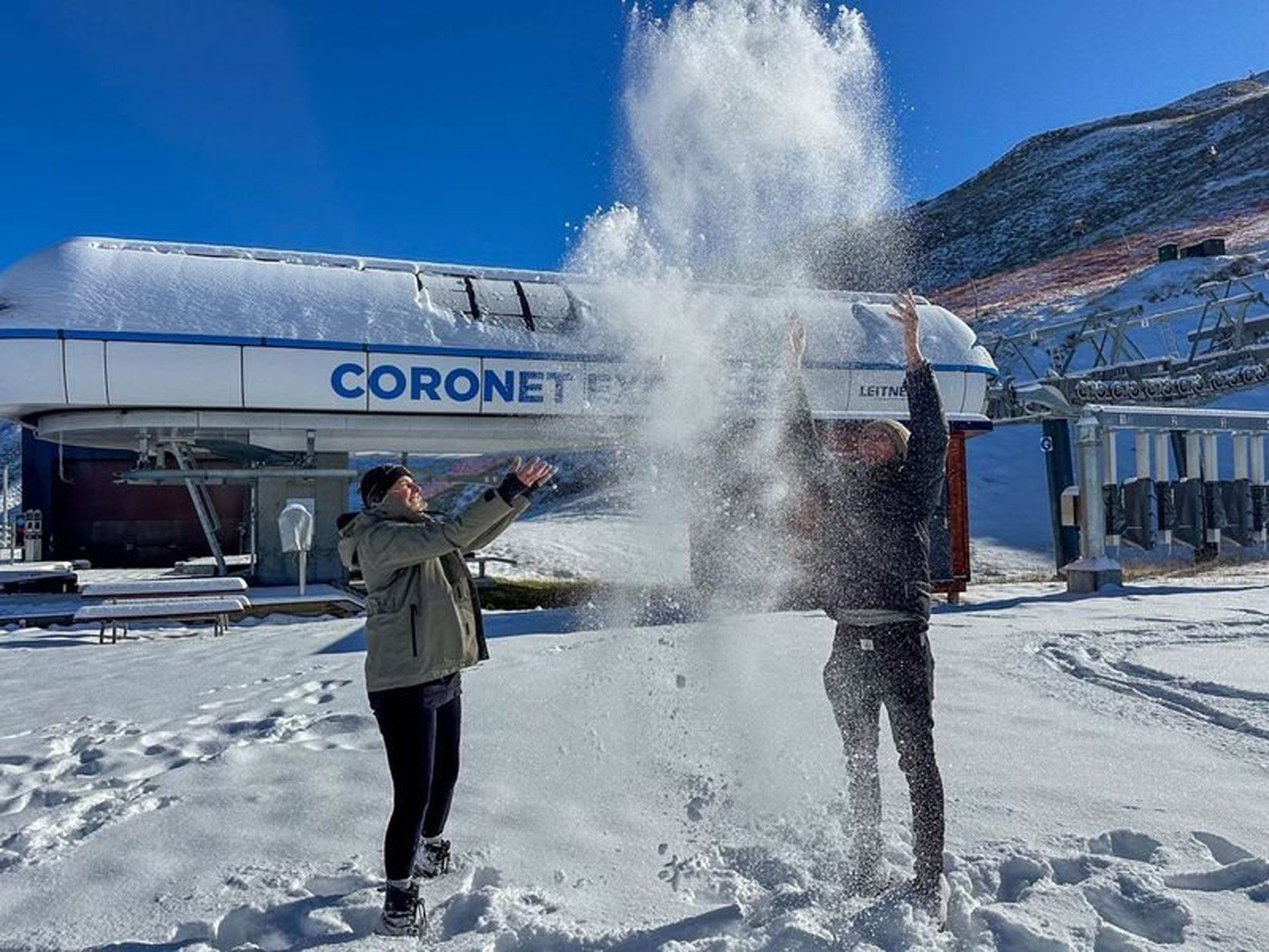
Both Coronet Peak and The Remarkables received 20cm of fresh snow.
Coronet Peak area manager Nigel Kerr said 20cm was a lot of snow for this time of year, and that the recent dump has been great, as it got everyone excited for the upcoming season.
The Remarkables area manager Steve Hall said "snow like this is what we live for, especially this early in the year".
Both Coronet Peak and The Remarkables expected to have their snowguns producing the snow, getting the skifields ready ahead of their opening.
Both skifields were planning to open on June 15.
A MetService spokesman said Mt Cook village received the thickest blanketing of snow, at 40cm.
The coldest spot in the South this weekend was Mid Dome, near Lumsden, Southland, where temperatures plunged to an icy -6°C at 1am on Sunday.
NZ Transport Agency/Waka Kotahi issued ice warnings for several highways across the roading network, which included SH1 Dunedin to Waitati (Leith Saddle), SH6 Frankton to Kingston, SH6 Cromwell to Gibbston (Kawarau Gorge), SH8 Omarama to Tarras (Lindis Pass), SH85 Alexandra to Ranfurly. By 9.30am yesterday all warnings had been lifted.
The Queenstown Lakes District Council said the Crown Range and Coronet Peak roads were open during the cold snap, but were "very icy with packed snow around the summits".
Despite the frosty conditions, a police spokesman said there was no spike in any weather related crashes or slips on the roads.
'Bitterly cold nights ahead'
A MetService spokesman said in the week ahead parts of Central Otago and Southland would reach daytime temperature peaks in the double digits.
However, he did warn people to be prepared for bitterly cold night temperatures.
"We’re expecting [Sunday] to be the coldest day, after that things should start to heat up - marginally. Overnight though, we’re expecting temperatures like 0°C and 1°C in places like Gore and Wanaka."
People should also expect some frosty mornings on the way, with much of Central Otago and Southland forecasted for some slippery conditions.
Dunedin however will manage to "skate by just out of the frost zone".
Chains needed on Coronet Peak Rd
A spokesman for the Queenstown Lakes District Council said this morning the Crown Range Road and Coronet Peak Road were open with icy patches from the overnight rain.
Grit has been applied to both roads. The combination of snow melt and overnight rain freezing means chains must be fitted on Coronet Peak Road from the Skippers Road turn-off.
"Ice is forming in shaded spots in and around Arthurs Point, so be sure to slow down and increase your following distance when commuting through there. Elsewhere conditions are mostly back to normal after what was an eventful weekend with the weather."
By Laine Priestley, Olivia Judd and ODT Online


