PHOTO
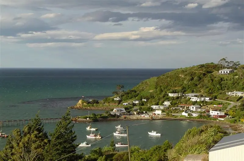
Landslips in the North Otago fishing village of Moeraki are nothing new, but modern lifestyles and an unwillingness by town planners to restrict development in the township have resulted in land values falling dramatically.
Residents are frustrated, but it seems, at last, some consensus has been reached on how to tackle the problem. Moves have been made to investigate and prioritise land stability issues by the Waitaki District Council and the new Moeraki Land Stabilisation Group working party - a group made up of residents, council representatives and the Waihemo Community Board.
The group met twice during May, and working party chairman Rod Philip said it would now start to map underground spring systems that were thought to be the cause of stability issues.
Two members of the group were assessing what stormwater system might be needed, he said.
''There is no stormwater system in Moeraki and they will investigate how best we could get that water to the sea.''
The Waitaki District Council recently made available $15,000 from its disaster fund to pay for a combination of investigative and physical work to help the situation.
It has also allocated another $50,000 in its draft annual plan for next year. A further $27,000 from the Moeraki community amenity rate was available to fund work.
A hazard map included in a report from geological consultants Tonkin and Taylor , which was published in May 2012, has been used by the Waitaki District Council to guide planning policy.
That report said houses in Haven St, (between Davids and Glamorgan Sts), were located on a large landslip complex and it designated 268 sections of land as being in a ''high-risk natural hazard zone'', and a further 24 sections as being in a ''very high risk'' zone.
About 70 of the township's 207 existing properties were designated as being in one of the two zones.
The report said, while landslips in the township dated back to 1836, the existing landslip in Moeraki was ''highly sensitive'' to any increase in groundwater and recommended that building in ''very high risk'' areas be made a prohibited activity - something that many in the township said should have been done before houses were built there.
Council assets manager Neil Jorgensen said landslips had occurred in Moeraki ''since the beginning'', and council policy had allowed people choice, while managing risk.
''Our job as council is to try and enable people to make choices on what they do on their private land. Of course, us Kiwis love doing things that might be proved difficult just to show it can be done, if you like. We don't like being told `No you can't build something there'.''
He pointed out that a hazard map for the township had always existed and the Tonkin and Taylor report merely updated it.
The investigations would help reduce landslip rates by removing stormwater, but longer-term solutions would not be looked at until current investigations were completed, a job that could only be done once, and therefore had to be done correctly, he said.
''Since 2010, we have been trying to work cost-effectively with the local community to find a solution that is affordable, because one of the issues with Moeraki is that they have very high rates, particularly due to the sewerage scheme that was put in [in 1999].
''The last thing we want to do is spend millions of dollars in Moeraki without proof that it is going to make a meaningful difference to the community and leave them with a financial burden they couldn't actually afford.''
Resident Bill Pile said land movements had been noted in the village as early as the 1850s. Although houses in the village that dated back to 1937 had ''never had a problem'', some newer houses had been built in areas where ''they should not have been'', he said.
Restaurateur Fleur Sullivan said properties built during the coastal housing boom of about 2003, primarily by cashed-up Queenstown home owners moving to the coast, had worsened land movements, effectively ''altering'' the water table underneath the township.
''Moeraki has been like it is forever, and that part of Moeraki was always dodgy, but people have come along and built, and chopped down trees and bulldozed to suit their own design, including the council, who have chopped down trees, without a big picture of Moeraki.''
However, since the Christchurch earthquakes, insurance companies had demonstrated ''nervousness'' in offering insurance even to people who wanted to buy property on land that had ''never shifted'', she said.
''People coming in naturally think we received that damage with the Christchurch earthquakes, but we haven't.''
Ms Sullivan suggested an aqueduct could be installed to solve the problem, to take the water off, but questioned why concrete could not be used to solve the issue, as it was in the Cromwell Gorge in the 1980s.
The Tonkin and Taylor report had recommended all stormwater be drained from the landslip catchment ''as soon as practicable'', and Moeraki Holiday Park owner Robbie Mitchell said, although the council had ''taken their time'' about resolving the issue, it was ''pretty clear'' there was no money available to spend on fixing the problem.
''They are touching on things like the stormwater, which will help. It will only take another big rainfall and who knows what it will be like then.''
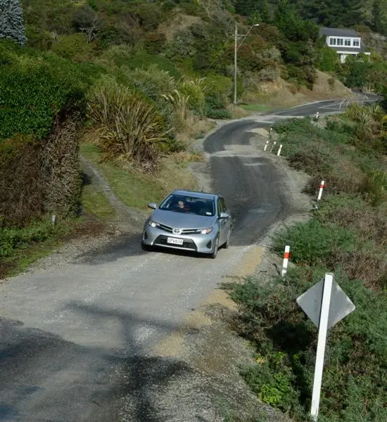
His biggest concern was the state of Haven St, the township's main thoroughfare, Mr Mitchell said.
''I am concerned about it; especially a lot of overseas people are very concerned about the roads - they get narrower and narrower.''
Tourist numbers had not been affected by the issue, he said.
However, some homeowners have said they have struggled to sell their property since the publication of the Tonkin and Taylor report.
Resident Jacinta Thomas had been unable to sell her property since the report was released because, although her home was in a ''moderate risk'' zone, that zone had been coloured ''red''.
''We have had a lot of interest in the house, but people go away and Google the area and they see it is in a red zone and relate that to the situation in Christchurch, even though red is not a danger zone.''
The property had been on the market for nine months, and Mrs Thomas estimated the price had fallen by about $85,000 since the publication of the report, Last year, Quotable Value NZ revealed the average land value in Moeraki dropped 45% between 2009 and 2012 and, while prices for waterfront homes and sections across the country had ''cooled'', the drop in Moeraki was ''certainly'' down to land stability issues, QVNZ said.
Moeraki resident Dave Brown moved to the area six years ago, and was well aware of the village's issues with land stability before he bought property.
Although his property was designated as being in a ''very high risk'' zone in the Tonkin and Taylor report, he was not concerned about the recent fall in values.
''Our QV here has since dropped from $515,000 to $300,000. We are not that worried as we are committed to living here.''
Moeraki
• Moeraki is a fishing village and popular holiday spot located 76km north of Dunedin and 40km south of Oamaru.
• Settled by Europeans in 1836, when a whaling station was established.
• 1850s: Land movement noted in Moeraki.
• 1879: Rail link in Moeraki abandoned after rails moved 1.2m towards the sea in just one year.
• Moeraki is built on an existing landslip complex, known as the Tenby St Landslip, which is about 900m wide and extends 600m back from the coast.
• There are 207 rateable properties in the village.
• May 2010: The Earthquake Commission receives 28 insurance claims after 300mm of rain falls in one week, resulting in land movement in Haven St.
• August 2010: The Earthquake Commission installs a quarter of a kilometre of drainage pipe to relieve underground water build-up.
• May 2012: Tonkin and Taylor report designates more than 70 properties as being in a ''natural hazard zone''.
• October 2012: Quotable Value NZ says Moeraki land prices have dropped by an average 45% since 2009.