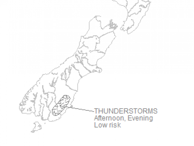
MetService is forecasting possible thunderstorms about east Otago this afternoon.
Isolated showers are expected to develop across the region, and there is a low risk of a thunderstorm about inland areas of eastern Otago.
A MetService spokesman said a front was forecast to move on to the lower South Island from the south Tasman Sea tomorrow, preceded by a strong moist northerly flow, bringing a period of heavy rain to Fiordland and Westland.
"There is high confidence of rainfall amounts reaching warning criteria about Fiordland on Wednesday, moderate confidence for southern Westland from Wednesday afternoon to early Thursday and low confidence for the remainder of Westland during Thursday morning, mainly about the ranges."
"The front then weakens away over northern New Zealand later on Thursday and Friday, while a ridge of high pressure spreads over the South Island."
Meanwhile, after a stunning Labour Weekend the South was again expected to bask in balmy temperatures.
Central Otago and the Southern Lakes was expected to be the hottest. Alexandra was expected to reach 26C and Wanaka 25C.
But the rest of the South was also in for a warm day with Invercargill expected to reach 22C , Gore 24C and Dunedin 20C.