PHOTO
Inch Clutha is, to many, a mystery.
You can’t really see it when you drive nearby, so well does it blend in with its surroundings.
It has what can only be described as an extremely odd name, yet it has been called Inch Clutha for so long nobody questions its nomenclature.
Perhaps most remarkable of all, many people don’t know what it is: is it a district, a constituency, a community board area, a parish or perhaps even a rural block?
Is it a principality, a domain or a dominion?
Is it a kingdom?
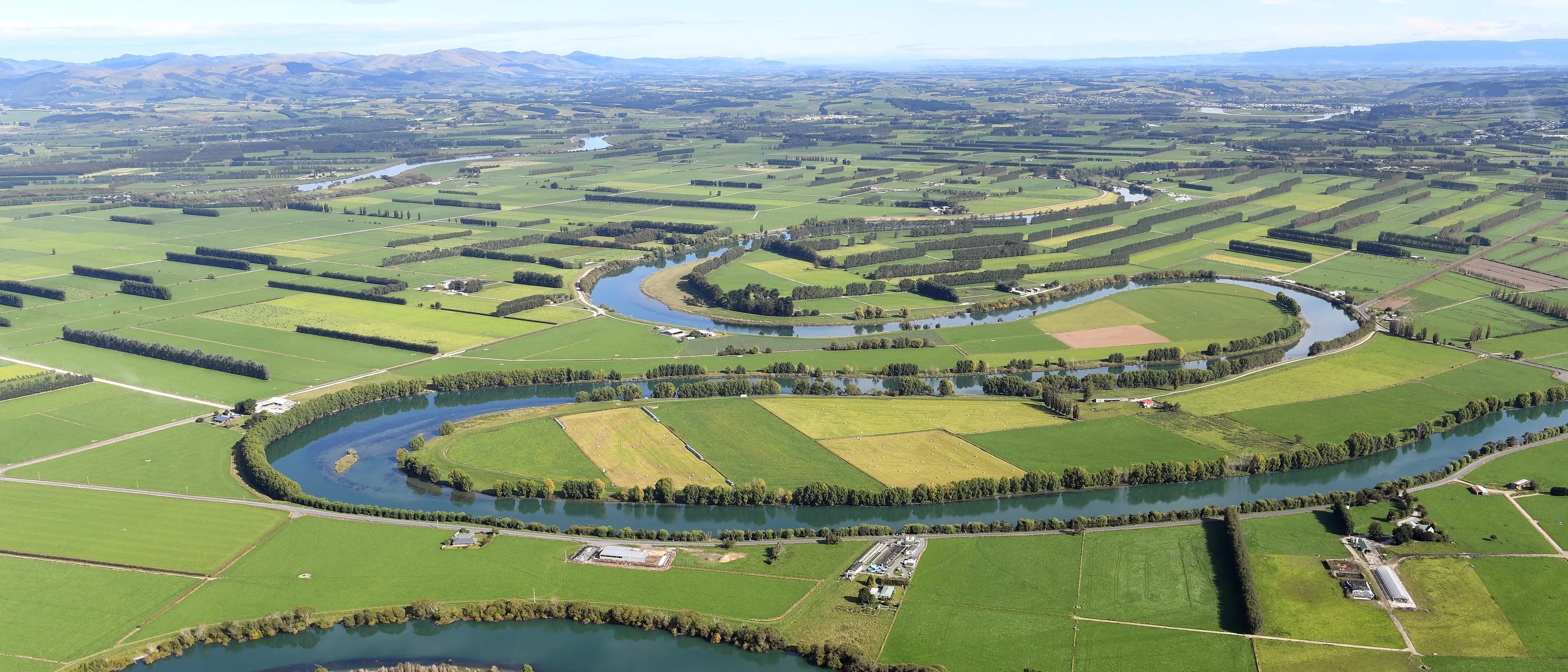
There is one clue for the traveller to the bucolic community nestled in the unyielding embrace of the mighty Mata-au.
That clue is in the access points for the traveller as they approach Inch Clutha.
Both are bridges.
Yes, Inch Clutha is an island.
Here’s a fact.
If river delta islands were included in the list of New Zealand’s largest islands (I think they should be), it would be the 16th largest island in the country.
The island takes its name from Scots Gaelic, "innis" meaning "island" and Cluaidh being the Gaelic form of the name of Scotland’s River Clyde.
That is what Wikipedia says, though Alma M Rutherford reckons "inch" is a Celtic word for either "island" or "pasture land near water".
Both work.
Alma M Rutherford’s book The Inch: The Reproduction and Update of the Story of Stirling and the Inch Clutha is an essential research tool for those newly fascinated by the island.
Rutherford says Maori from the area called the island Tauhinu, camped at its neck and grew potatoes in its clearings. Their chief, Tuhawaika, was known as Bloody Jack, despite being "almost invariably accorded respect in existing records as a fine and gentlemanly type".
Surveyor Frederick Tuckett, who visited the island in 1844, arrived at the Matau (east) branch of the river, and liked what he saw.
"I was well satisfied with the country throughout, but especially on arriving at the Matau — a river which an American would not despise ... the great plain of Matau when drained [will be] suitable for tillage, rich and warm enough for maize ... the Matau District alone would afford all the land required for settlement ...".
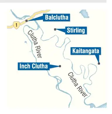
Nowadays, coming from Balclutha, one approaches and crosses the Matau via the 1962 bridge that stretches across from the charming town of Stirling.
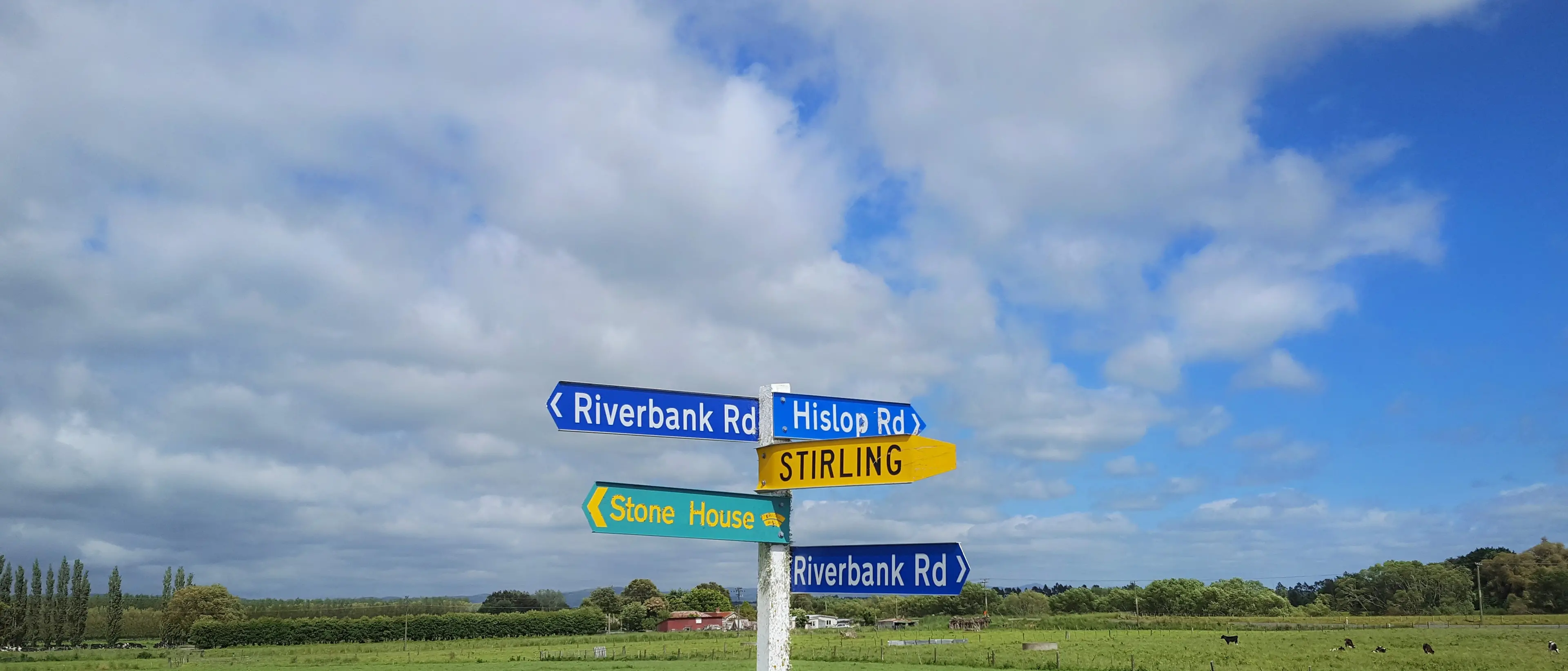
On the other side you end up on a 10km by 3km island, at the intersection of the aptly named Riverbank Rd and Hislop Rd.
Cattle beast low mournfully in the late morning sun, the grass is lush and the local sheep attentive. There is a pleasing level of birdsong. There are no traffic jams on Inch Clutha. If you hang a left down Riverbank and then slam a hard right on to Lawson Rd, you’ll soon hit Centre Rd.
Centre Rd is also aptly named, as it neatly bisects the island.It is an excellent road, straight as an arrow and unsealed, so a large and satisfying plume of dust follows you as you tear along its emptiness.
On each side, roads strike out at right angles and head off to either of the arms of the river. Inch Clutha has striking shelter belts. They are so numerous and made of a grand variety of trees, and they carve out grid patterns and form neat squares across the landscape. There are very few road cones on Inch Clutha.
The island is of an acceptable size. It takes only a few minutes to rip from one end to the other, from the whitebaiters’ huts near the coast to where Centre Rd, which changes its name to Chicory Rd at the last minute, peters out into a paddock from where you can see the outskirts of Balclutha.
On all sides is a gentle island where dairy farmers quietly and methodically go about their work.
Alma M Rutherford tells us a history of schools and churches, of hotels and shopping areas, all book-ended by floods, the serious flood of 1851, the "enraged, swollen torrent" of 1878, the second largest flood 100 years later, then the soakings of 1980 and 1983. And that leads us to another feature of Inch Clutha that is a thing of wonder and joy.
Alma M Rutherford notes that while the Kaitangata Bridge served the island for 86 years after being built in 1901, the 1983 flood formed a raft of debris that distorted the structure.Investigations discovered a new bridge was needed.

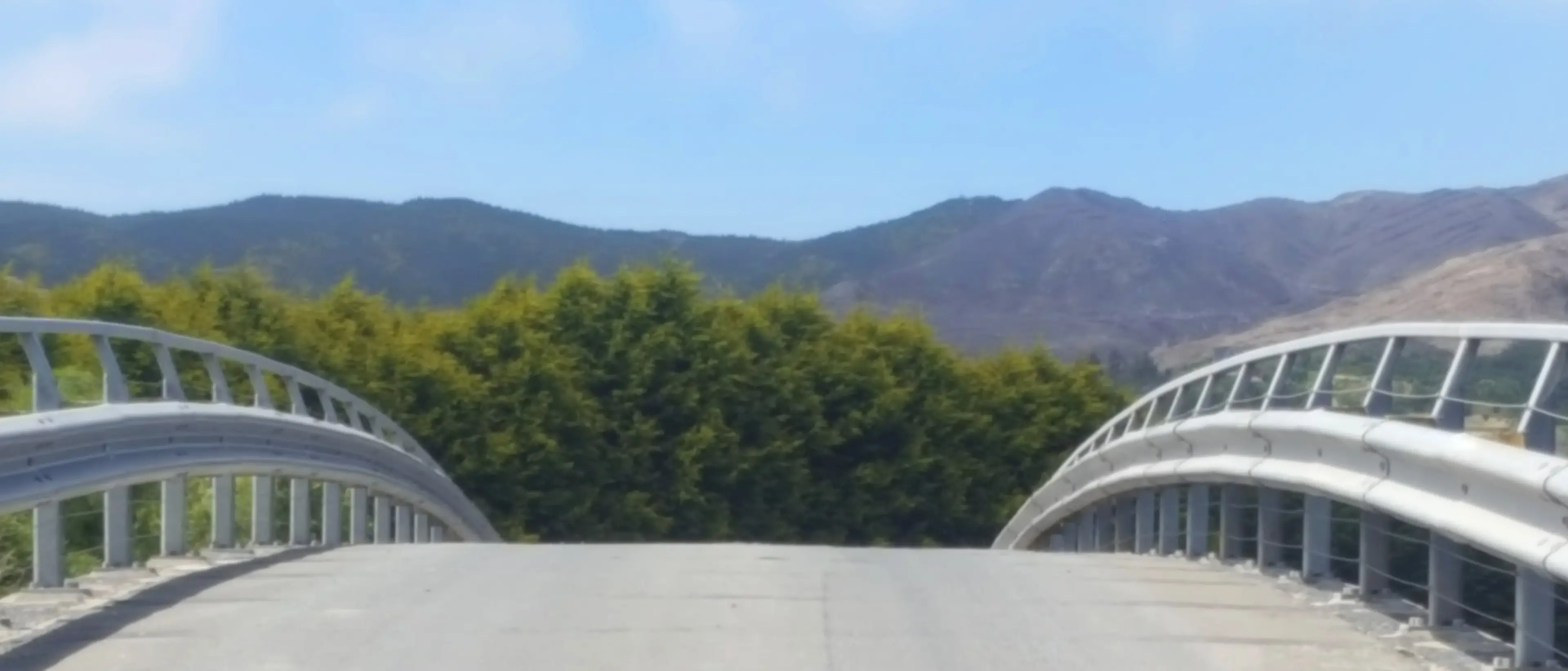
The facts of the bridge are perhaps a little dry.It has a 68m central span made of Corten steel, to reduce corrosion, and was built in Christchurch in three sections and transported south by road.
The three sections were welded together and floated across the river on a pontoon.Its steep arch created better flood clearance, but necessitated traffic lights for safety, as it was impossible to see over the top.
It cost $1.1million, and was opened by associate Minister of Works, Mr Neilson, in 1988.The facts are dry but the bridge is divine.
The deck rises smooth and slender, it curves gently and alluringly towards the sky, you want to run your finger gently along its voluptuous concrete edge; it draws you to it.
Beneath its skirts sit the most artfully designed concrete struts, lissom and inviting, strong yet light of being and graceful of purpose.
The bridge’s concrete piles emerge thick and powerful from the luxuriant soil of the river’s edge, spreading their mighty arms to embrace the deck and hold it gently but firmly in place.
And when the traffic light turns green, you mount the structure, driving onward and upward to its peak, where, high above the boiling turmoil of the mighty Clutha you reach the zenith, the apogee, and take your foot off the accelerator and glide, sated, to the mainland.
And you leave, perhaps via Kaitangata, or perhaps via Stirling, and you know you have been on a little journey.
For just a while, you have tasted the joy of island life.