Coastal Dunedin bore the brunt of the rain overnight - approximately 25-50mm, with other parts of Otago getting 20-50mm, the Otago Regional Council said in a statement early on Saturday afternoon.
"Flood infrastructure is doing its job and performing as expected. There were no significant issues overnight."
Rainfall has eased in North Otago but Dunedin could see a further 20-30mm and 30-40mm for Clutha until about 9pm on Saturday.
A MetService orange rain warning remains in place for Dunedin and Clutha. The forecaster said streams and rivers could rise rapidly, and surface flooding, slips and difficult driving conditions were possible.
Scott MacLean, the Dunedin City Council's general manager of climate and city growth, said this morning the network had "coped well" with heavy rain.
“Contractors responded to isolated incidents of ponding overnight. Our teams are inspecting the network for damage and flooding, and there are some temporary road closures in place. Up-to-date advice on road closures can be found on our website.
“With the exception of the Logan Park artificial turfs, all council grounds are closed to the public today. Staff and contractors will continue to monitor the network over the weekend.”

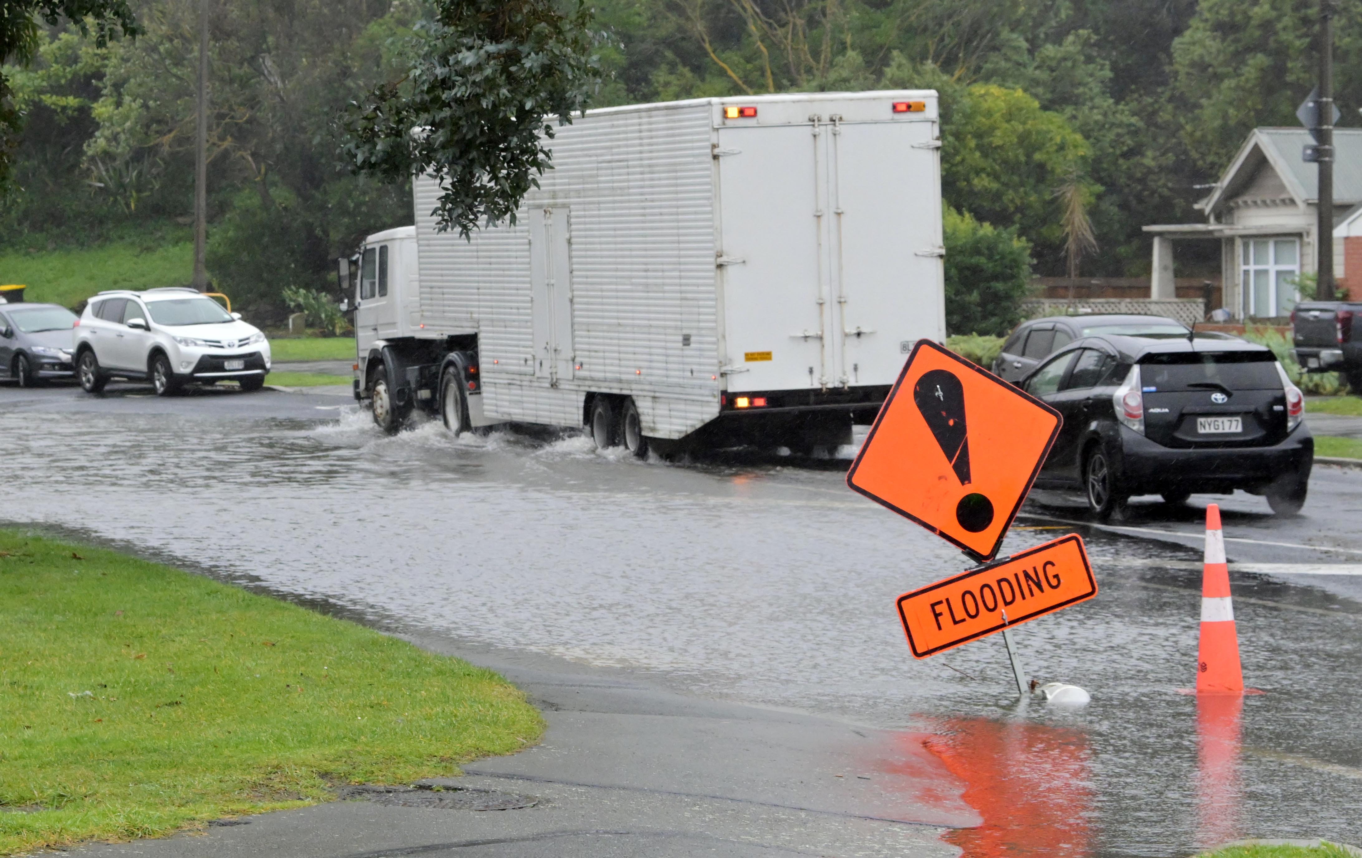
The city-bound lane of Shore St and a section of Portobello Rd, between Andersons Bay Rd and Portsmouth Dr, have been closed due to flooding.
Old Brighton Rd and Aramoana Rd, near Deborah Bay, are also closed, the DCC's website showed.
A low off the South Island east coast was expected to bring heavy rain to the lower South Island and snow to inland parts of Otago and Southland today, MetService advised this morning.
A heavy snow watch was in place for Central Otago, Southland north of Lumsden, also inland Dunedin and Clutha from 9am until 7pm on Saturday. Periods of heavy snow were expected above 400 metres, where snowfall amounts may approach warning criteria.
A heavy rain watch was in place for Southland about and east of Mossburn from 9am until 3pm on Saturday. Periods of heavy rain were expected and amounts may approach warning criteria.

Once the low-pressure system had passed over to the east side of the country, easterly winds would then push it back towards the Otago coastline.
"That rain coming across the country swirls around and makes landfall again near Dunedin and North Otago. It’s kind of like a spinning top."
DCC chief executive Sandy Graham said yesterday while the city's network was expected to cope with the downpour, staff and contractors were in a state of readiness.
"At this stage the Dunedin Civil Defence bunker is not activating, and we expect our network will cope with the forecast rain, but we’ll continue to monitor the situation and make further announcements as needed."
ORC keeping close eye
The Otago Regional Council is closely monitoring the weather, streams and rivers 24/7 over the weekend.
Flood duty officer Ann Conroy said on Saturday afternoon river levels were rising but had not yet peaked in North Otago, and the Dunedin and Clutha area.
"Flood infrastructure is doing its job and performing as expected. There were no significant issues overnight and surface flooding and ponding are likely in lower-lying areas.
"We are ready to respond to any issues that arise will continue to closely monitor river levels.
"Rivers are rising and we’ll be keeping a close eye on the low-lying areas which could potentially be affected, including parts of the Tokomairaro floodplain such as Milton, the Lower Taieri floodplain including Henley, the Lower Clutha floodplain and Middlemarch."
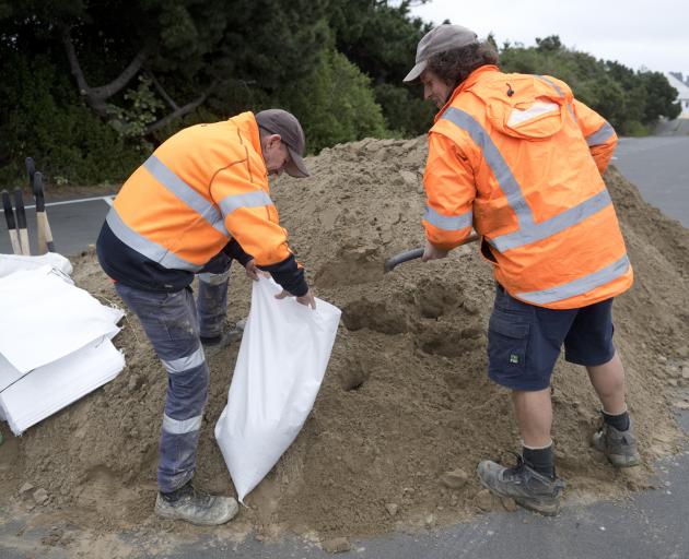
Staff and contractors would be in the field checking floodbank and drainage assets and pumping stations.
The Water of Leith and Lindsay Creek in Dunedin were not expected to overtop their banks, the ORC said.
The Silver Stream near Mosgiel was expected to peak at about 90-100 cumecs on Saturday afternoon.
The Taieri River at Outram was expected to peak on Saturday evening at about 400-600 cumecs. Flooding of the unprotected areas downstream of Outram was likely.
The Clutha River at Balclutha was expected to peak at around 1900 cumecs on Sunday morning. Flooding was likely in low-lying areas adjacent to the river upstream of Balclutha, and unprotected areas downstream of the township on the Clutha delta.
“At this stage, we do not expect widespread issues from the rain, but conditions can change and we will monitor closely. Communities in affected areas should stay up to date with conditions. Should the situation worsen, we are ready to act.”
In South Otago, contractors for the district council have been monitoring river levels in Clutha since the early hours of Saturday morning.
There were numerous areas of surface flooding affecting roads in the district. Karoro Creek Rd, Young Rd/Lake Rd (Berwick) and Allison Rd were closed, a council spokeswoman said.
"The creeks and streams are full around West Otago which we will continue to monitor."
Contractors were assessing the network on Saturday afternoon, visiting Milton, Kaka Point, Tuapeka Mouth and Lawrence.
"At this stage we are placing signs on the worst areas of flooding but as conditions can change quite quickly over such a large network there will be locations that worsen before we get to them," she said.
"As always, road users need to drive to the conditions and avoid driving through areas of flooding due to the risk of hidden hazards."
- APL