PHOTO
The deadly 7.8 Kaikoura quake was so powerful that parts of the South Island are now more than 5m closer to the North Island, new research has revealed.
A study led by GNS Science is today being published in the prestigious journal Science.
It analyses the November quake in unprecedented detail, thanks to it being one of the best recorded large earthquakes anywhere in the world.
Researchers analysed a wide range of quake data, including satellite radar imagery, field observations, GPS data, and coastal uplift data.
Scientists said the results might force a rethink of the way they look at earthquake hazards along plate boundary zones across the world, because of the complex and unusual patterns in the November quake.
Their study shows the shaking was so violent, parts of the South Island were permanently shifted higher, and northwards.
From Kaikoura to Cape Campbell, the Earth was pushed 5m closer to the North Island, as well as several metres higher in various places.
Near the Papatea Fault, the ground was raised as much as 8m.
Despite the major movement, scientists believe it would have happened almost simultaneously with the earthquake.
The earthquake ruptured along a record 21 faultlines. At least 12 major crustal faults were involved, as well as nine lesser faults.
The NZTA are using 3D technology to help us assess the key areas of damage along the Kaikoura Coast from Oaro, south of the town, to the Clarence on the north side. The seabed changes can also be seen. Video
Some of the faults involved were previously unknown to scientists.
The total rupture travelled 180km, but only took two minutes to travel its entire length.
There's also evidence of a slip along the southern end of the Hikurangi subduction zone plate boundary, which lies 20km below the North Canterbury and Marlborough coastlines.
The Kekerengu Fault had some of the biggest movements, with deep pieces of the Earth's crust shifting up to 25m at a depth of around 15km.
At the surface, the biggest movement was a 12m horizontal shift.
The authors of the study said the earthquake was so complex, it defied many of their conventional assumptions, including the degree to which an earthquake is controlled by an individual fault.
They said a rethink was now needed for how these issues would affect seismic hazard models around the world.
Lead author and GNS Science geodesy specialist Ian Hamling said the quake was so long and complex, it made it difficult to accurately pin down the magnitude.
This raised problems for earthquake early warning systems, and showed standard hazard models were too simple and restrictive.
"Scientists have known for a long time that this region is capable of producing complex earthquakes.
"Even so, the high level of complexity of the Kaikoura earthquake took many by surprise.
"It serves to underline why some scientists regard this region as the most complex plate boundary zone in the world."
Hamling said the research would now continue, with a particular focus on any deformation as the ground continued to slip and adjust.
Even though the research was focused on a complex area, the insights are expected to help with understanding similar plate boundary zones around the world.
This could have knock-on effects for building codes and the insurance sector.
The ground-breaking research is winning praise from other scientists around the world.
Pennsylvania State University professor of GeoSciences Kevin Furlong said the results were exciting because of how new and unexpected they were.
"The area of the subduction interface that ruptured is on land - more typically the rupture areas are offshore.
"As a result, the surface faulting that is able to be so well documented in the Kaikoura region is usually invisible in other large megathrust earthquakes."
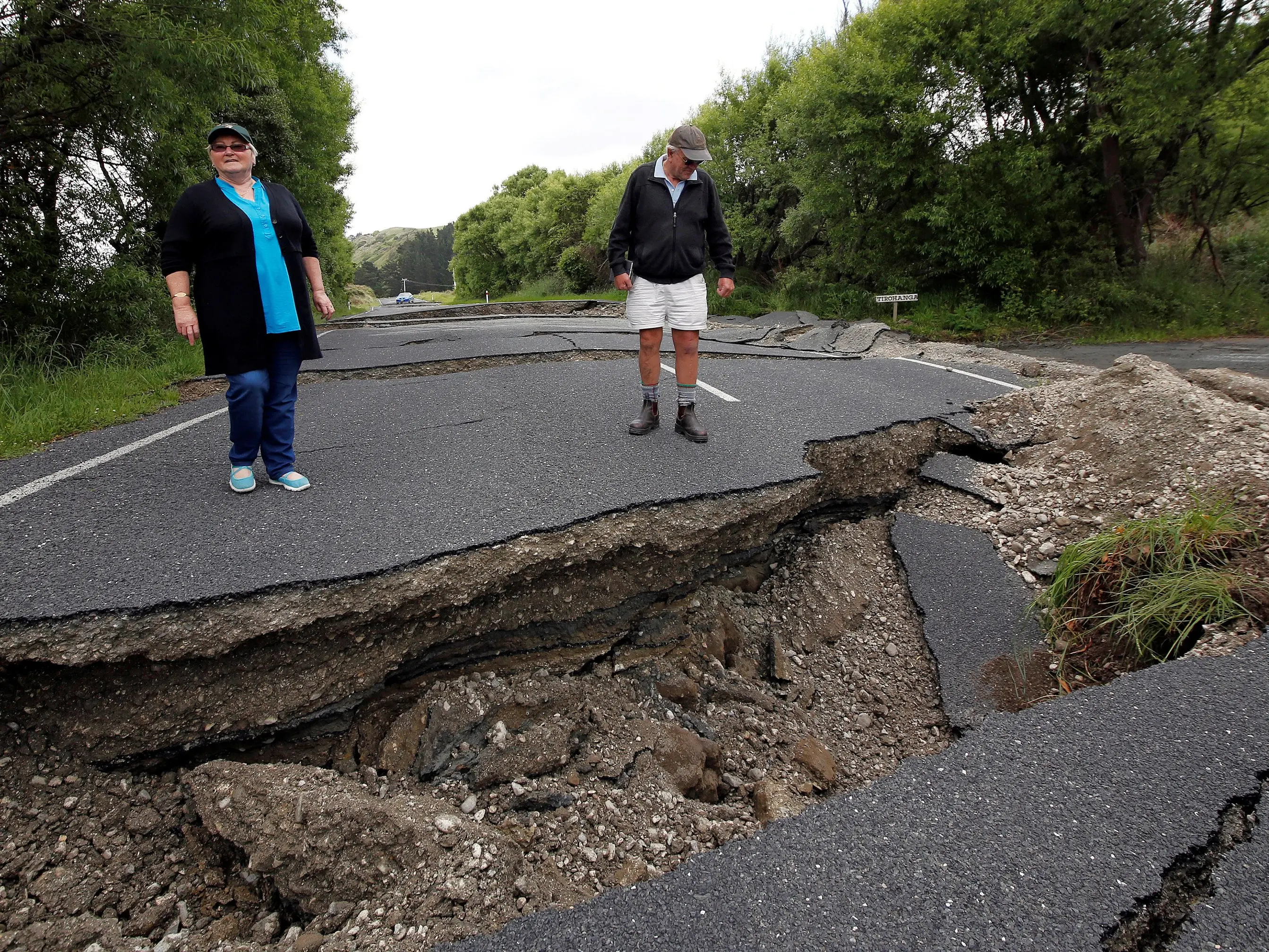
The Kaikoura earthquake struck just after midnight on November 14, devastating Kaikoura and causing major problems in Wellington.
Buildings were damaged, major slips set off, and key rail and roading links closed for months.
Mt Lyford resident Jo-Anne MacKinnon and Louis Edgar, of Kaikoura, died in the quake.
Dozens of others were injured.