
PHOTO
The government has announced the site has been chosen for a new radar for the top of the South Island, to address a black spot in the country's weather forecasting coverage.
The project has been fast-tracked by the Government with funding of up to $5 million, following the severe storms and flooding last July.
South Island Minister James Meager said Nelson Tasman had limited radar coverage, relying largely on the Wellington radar, which could not adequately monitor parts of northwest Tasman.
"The region has experienced several high-impact flooding events in recent years, including five states of emergency since 2011. The new radar will make a huge difference in better preparing communities for future disasters."
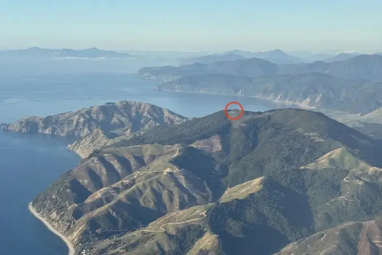
The radar will be located near Horoirangi Peak, about 15km northeast of Nelson City at 630m above sea level. It is expected to be operational by mid-2027.
MetService will install and operate the radar, with ongoing annual operating costs expected to be around $260,000.
The radar will feature modern Doppler dual-polarisation technology, which provides more accurate rainfall estimates and enhanced weather monitoring capability.
Emergency Management and Recovery Minister Mark Mitchell said the investment was part of the government's commitment to strengthening New Zealand's resilience to severe weather.
"This is a big step towards improving short-term weather forecasting and rainfall mapping, helping emergency management agencies, councils, first responders and communities better prepare and respond to major events."
Mitchell said the radar would provide better information and a significant improvement in the quality and timeliness of weather information available to emergency managers, councils and residents.
