
PHOTO
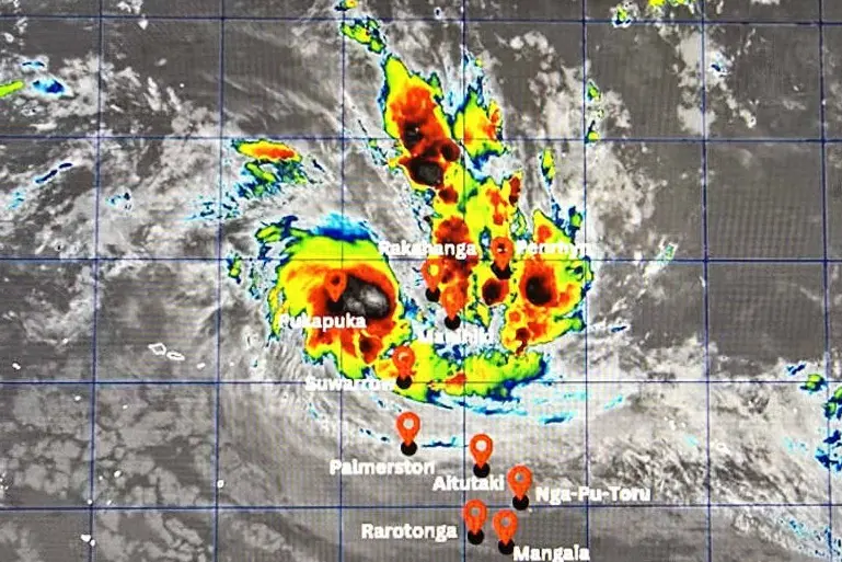
A tropical depression that's been brewing in Cook Islands waters has developed into a tropical cyclone.
New Zealand MetService said the category one system, named Tropical Cyclone Wati, was moving in a south-easterly direction.
This is the first cyclone in the region, arriving two weeks before the official start of the South Pacific cyclone season.
The Cook Islands Meteorological Service Director Maara Vaiimene had earlier told RNZ Pacific that the el nino weather phase over the region was contributing to the unusually early development of a possible tropical cyclone.
The Cook Islands is currently in an el nino climate situation.
The Cook Islands Meteorological Service is advising the public that the weather situation is developing and people across the Cook Islands should stay informed and prepared.
It said the Emergency Cook Islands team had a response guideline for what people need to do in the event that the tropical depression becomes a tropical cyclone.
What should you do now
- Secure loose items around your home and property.
- Check your emergency supplies and household plans.
- Fishermen, boat operators and inter-island vessels should closely monitor marine forecasts and warnings and avoid going to sea if conditions are unsafe.
- Keep checking official CIMS updates and follow advice from the relevant authorities.
Earth Sciences New Zealand is predicting elevated cyclone activity for parts of the Pacific in the coming cyclone season.
Weather conditions
For Suwarrow, people there can expect damaging gale-force winds of 64kmh with gusts up to 92kmh.
Periods of heavy rain, with squally thunderstorms.
High seas and damaging heavy swells.
For the rest of Pa Enua Tokerau, fresh to strong winds of to 55kmh with gusts to 74kmh.
Periods of rain, heavy at times, with squally thunderstorms.
Rough to very rough seas with moderate to heavy swells.
Palmerston, Aitutaki and nearby islands, strong east to southeast winds of 37 to 46kmh with gusts to of 64km/h.
Winds may strengthen to damaging gale-force of 64kmh and gusting to 92kmh.
Rain and thunderstorms developing and becoming frequent and heavy.
Seas will become rough to very rough, becoming very rough to high seas from later tomorrow and damaging heavy swells.
And for the rest of Pa Enua Tonga
Moderate to fresh east to southeast winds, becoming strong and gusty during the weekend.
Cloudy periods with occasional showers, becoming frequent and heavy at times.
Seas becoming rough, with moderate to heavy swells.
