
PHOTO
Severe weather warnings have been issued for parts of the South, including heavy snow for Central Otago mid-week.
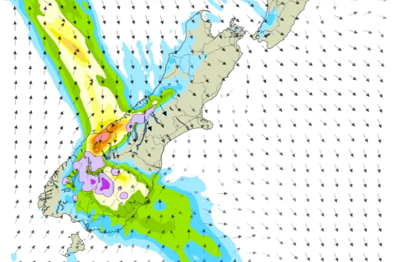
MetService said a front moving northwards over southern and central South Island from this evening and during Wednesday was expected to bring a period of heavy rain to Fiordland and the Westland ranges, and heavy snow to low levels for Central Otago, the Southern Lakes and the MacKenzie Basin.
Met Service on Tuesday morning issued road snowfall warnings for Central Otago’s Lindis Pass (State Highway 8), the Crown Range Road, linking Queenstown and Wānaka, and the Milford Road (SH94) in Southland.
At this stage SH94 was expected to remain open, Milford Road Alliance advised. The avalanche threat was low.
ROAD SNOWFALL WARNINGS
Area: Milford Road (SH94) from 6am until 7pm on Wednesday.
Forecast: Snow may affect the road from the morning until early evening. Up to 1cm may accumulate at the Home Tunnel entrance, with lesser amounts lower down.
Area: Crown Range Road from 1pm on Wednesday until 3am on Thursday.
Snow expected to lower to 500 metres in the afternoon and evening. Up to 5cm may accumulate above 700 metres, with lesser amounts lower down.
Area: Lindis Pass (SH8) from 3pm on Wednesday until 6am on Thursday.
Snow lowering to 400m. Accumulations of 5cm to 10cm possible above 600m and lesser amounts down to 400m.
HEAVY SNOW WATCH
Areas: Central Otago, Southern Lakes and the MacKenzie Basin from 4pm on Wednesday until 2am on Thursday.
Periods of heavy snow above 600 metres, where snowfall amounts may approach warning criteria, and lesser amount down to 400 metres.
HEAVY RAIN WATCHES
Area: Fiordland
From 8pm on Tuesday until 10am on Wednesday.
Heavy rain is expected to spread northwards from Tuesday evening. Rainfall accumulations may approach warning criteria.
Area: The ranges of The Westland District
From 6am on Wednesday until 12am on Thursday.
Heavy rain is expected to spread north during Wednesday morning and afternoon, and amounts may approach warning criteria.
- Allied Media