
PHOTO
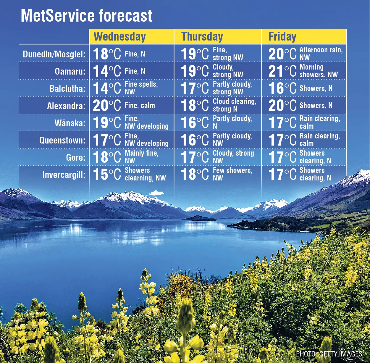
If you are tired of all this cold, squally weather, Mother Nature has a reprieve in store for the South — albeit, a short one.
From Wednesday through to Friday, temperatures are expected to be considerably warmer, reaching up to 20˚C.
But the bad news is, there will still be some wind and rain in parts of Otago and Southland.
MetService meteorologist Ethan Walton-Jones said throughout this week, the winds would take on a more northwesterly flow over the country as a high pressure system approached the country from the Tasman Sea.
“So that's really what's driving those warmer temperatures — that high pressure causing the winds to change direction from the southwesterly that we've had over the weekend, into more of a northwesterly flow.
“And it looks like it's going to last until Friday. Then on the weekend, the spring weather will resume.
“There's another front that begins to pass up the country from late on Thursday, early Friday morning, that causes the temperatures to turn more southwesterly again, taking you back into the usual for spring.”
While the temperatures would be cooler again, there would be much less wind and rain over the weekend.
He said spring weather was generally very changeable, but temperatures would become warmer as we moved towards summer.
There would be much less chance of snow, like that experienced in higher areas of Dunedin and wider Otago on Sunday.
“In theory, the temperatures should generally increase throughout spring heading into summer, but I can't put a guarantee on there being an increasing amount of fine spells or warmer spells like this one.”
The present warm spell would be welcomed, he said.
john.lewis@odt.co.nz