
PHOTO
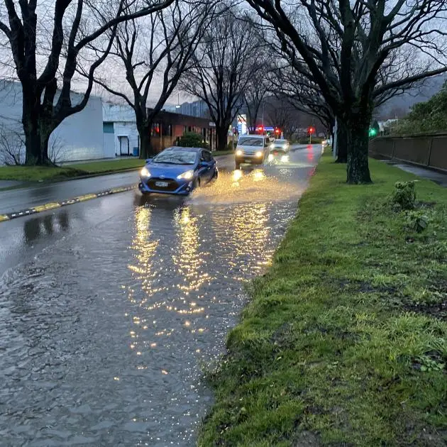
As Dunedinites continue the clean-up from the deluge that hit the city, MetService is warning that more heavy rain is on the way.
Coastal Otago residents are being urged to be prepared for more possible flooding as another heavy rain-laden front is expected to pass over already-saturated ground on the Taieri, South Dunedin and Oamaru tonight.
In a statement released at about 4.20pm, a DCC spokesman said the council would be keeping a close watch on the forecast for tomorrow.
"At this stage the expected rain is manageable within normal operations.
"We have asked our contractors to stop collecting used sandbags from streets for now, meaning those people who have sandbags can continue to use them if reassurance is needed."
Contractors would continue to clear flooding debris from the roads and pipes and extra pumps will remain available in Mosgiel, should they be needed.
Dunedin, particularly Mosgiel, was hit by torrential rain on Sunday going into Monday, leaving properties flooded, roads closed temporarily, a handful of buildings damaged and many cars flooded.
MetService meteorologist Lewis Ferris said between 12.01am Sunday and 3pm yesterday, 113mm of rain was recorded in Dunedin (Octagon), 118.3mm at Dunedin Airport and 105.4mm in Oamaru. This was ‘‘a lot of rain given their July average rainfall is around 40mm’’.
Another meteorologist Paris Marshall told the Otago Daily Times today the rain was not expected to be as heavy as it was on Sunday and yesterday, but because the ground along coastal Otago, between Balclutha and Oamaru was already sodden, it may cause more flooding.
“There's another feature that's moving its way up the east coast of the South Island, and that's a cold front and that's bringing along this band of rain.
“The ground is already quite wet and we've got quite a lot of impacts there already.
“So we've gone and called the councils in those areas and let them know that there's another event coming.
“It's not going to bring as high totals of rainfall, but with the amounts that are already there and the impacts that have already happened, this could lead to more damage on quite vulnerable areas due to that previous event.”
She urged residents to clear gutters and drains again, and sandbagging may be necessary.
“I would definitely recommend that people just prepare as if it was the previous warning, as it's very hard to know how unstable the ground is with the previous events.
“Stay away from vulnerable places to slips, and areas that are low-lying that are still recovering. And watch out for streams and river levels because they might rise up again.
“Reach out if you feel unsafe. It is quite unstable when the ground is wet and exposed to quite a lot of rain.”
A heavy rain watch had been issued for Coastal Otago, north of the Clutha River, for the 12 hours between 3am and 3pm tomorrow, she said.
However, that watch may get upgraded to an orange severe weather warning at 10pm today because the period of heavy rain may reach warning criteria.
Up to another 50mm could fall within 6 hours, or up to 100mm within 24 hours, she said.
Dunedin City Council’s emergency operations centre was active for about 24 hours to 3.30pm yesterday.
Council incident controller Chris Henderson yesterday said efforts to clear drains and debris, assess any damage or safety issues and carry out repairs and maintenance would continue.
Meanwhile, there are also road snow warnings for the Crown Range Road, the Lindis Pass (State Highway 8) and the Milford Road (SH94), while further north severe weather advisories, including a red rain warning for parts of Marlborough and Canterbury, cover most of the upper South Island.
Snow was also forecast for Arthur's and Porters passes (SH73) in Canterbury.
- additional reporting by Allied Media