
PHOTO
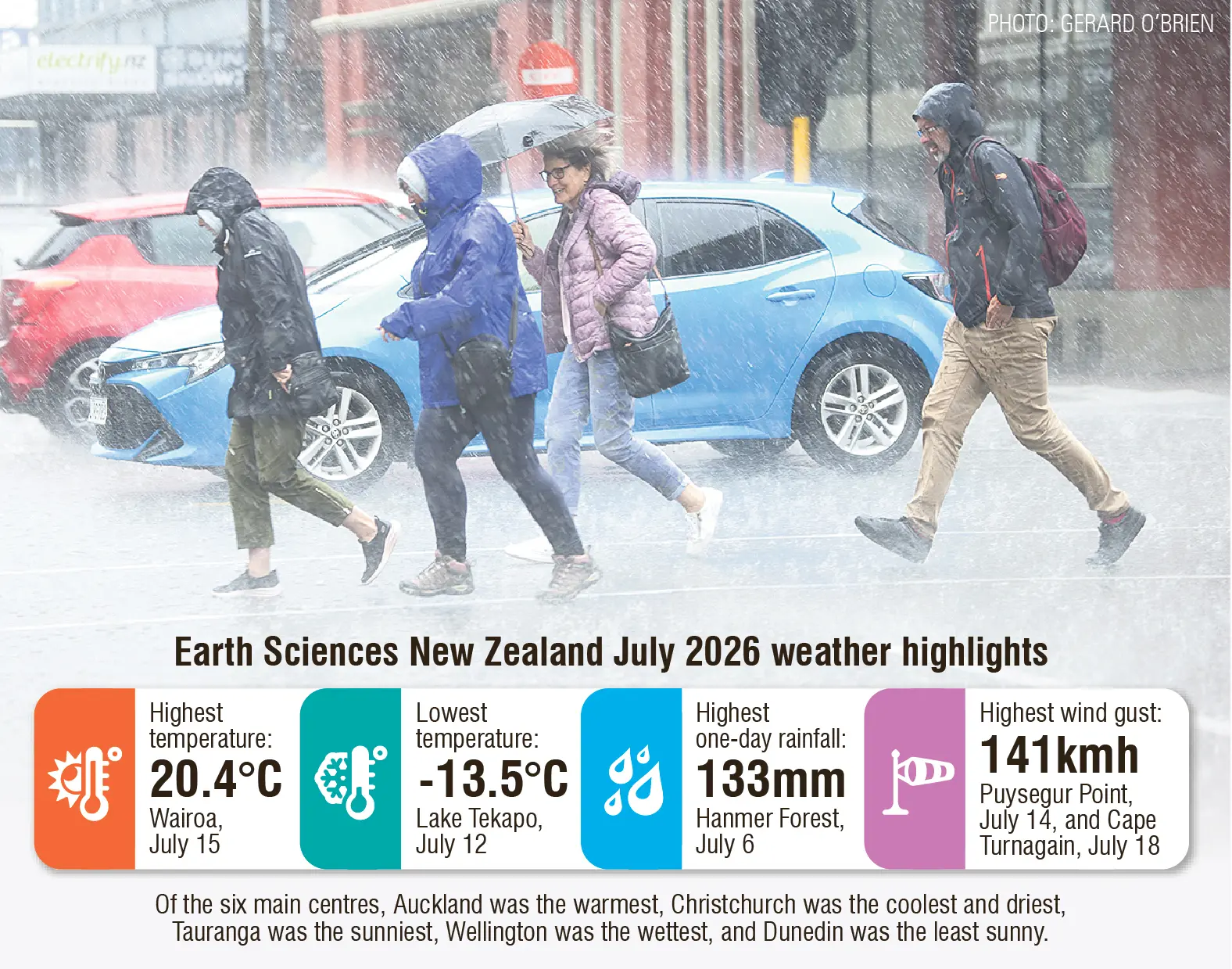
Longstanding weather records tumbled across Otago and Southland during July, as incoming El Nino conditions brought some of the strongest July atmospheric measurements on record.
Dunedin, in particular, broke two rainfall records and was New Zealand’s wettest location relative to normal, when 445% of its normal rainfall fell during July.
It was also the city’s second-warmest July on record.


Earth Sciences New Zealand climate scientist Gregor Macara said the month began on “a settled note”, with high pressure bringing widespread clear weather and frosty conditions, particularly for the southern regions.
He said brief warm northerly airflow delivered record and near-record high daily maximum and minimum temperatures for southern and inland parts of the South Island.
Then from July 5-9, a broad area of low pressure prevailed over and east of New Zealand, delivering consecutive days of considerable rainfall to eastern parts of the country.
“The middle and latter portion of July was often settled across the country, with a cool southerly airflow prevailing over the final week of the month.”
Despite snow falls in the later part of July, temperatures across the south were above average or well above average for the month.
It was especially warm for Fiordland, Arthur’s Pass, and Greymouth where mean temperatures were at least 2°C above the July average.
Mean maximum air temperature records for July were broken at Milford Sound (11.4˚C), Waipounamu (10.7˚C) and Invercargill (11.7˚C).
Dunedin (Musselburgh), South West Cape and Campbell Island recorded their second highest, and Secretary Island, Puysegur Point, Middlemarch, Manapouri, Gore, Oban (Stewart Island) and Tautuku recorded their third-highest.
Middlemarch and Manapouri also broke their daily maximum air temperature records for July when the mercury reached 19.6˚C and 17˚C, respectively.
Puysegur Point (17.3˚C) and Lumsden (17.3˚C) recorded their second-highest daily maximums for July.
Mr Macara said the nationwide average temperature in July 2026 was 8.9°C (0.8°C above the 1991-2020 July average), making it New Zealand’s 12th-warmest July on record.
Rainfall was above normal or well above normal (more than 149% of normal) for
most of Southland, Otago, South Canterbury and the West Coast.
Mr Macara said New Zealand’s wettest location relative to normal, was Dunedin Airport, where 176mm fell during July (445% of normal).
This made it the location’s wettest July since records began in 1962.
Rainfall was also exceptionally high in Oamaru, with the town receiving 191mm (400% of normal), making it its third-highest July rainfall.
Dunedin Airport also broke its July extreme one-day rainfall total when 116mm fell on July 5, and Oamaru recorded its second-highest when 110mm fell on the same day.
He said the records were broken as part of the broad area of low pressure that sat over New Zealand from July 5-9, delivering consecutive days of rainfall which caused surface flooding for eastern parts of Otago, including Dunedin, Mosgiel and Oamaru.
“Waitaki District Council declared a [local] state of emergency, with flooding affecting homes and businesses along Thames St, in central Oamaru, and at least 20 people self-evacuated their homes in Oamaru, with reports of emergency crews responding to people trapped in cars and homes.”
Then on July 8, another burst of heavy rain hit eastern parts of Otago, closing SH1 between Oamaru and Glenavy due to flooding, he said.
At least eight homes were evacuated in Dunedin due to possible landslips, while three homes were evacuated in Oamaru due to a landslip.
July wind gust records were also broken in Middlemarch when wind speeds reached 117kmh on July 4, and Oamaru when they reached 93kmh on July 5.
Southern residents have been warned to be prepared for “significant” weather impacts over the next three months, as El Nino conditions continue to strengthen across New Zealand.
Conditions are expected to peak during the 2026-27 summer, and is likely to develop into one of the strongest in recent history.
john.lewis@odt.co.nz