
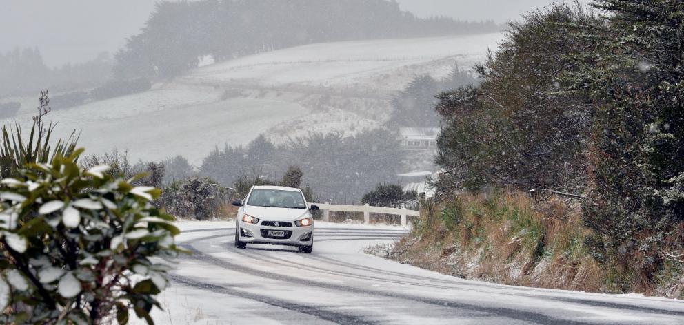
A snow warning has been issued for Dunedin with the northern motorway expected to be affected on Friday as a wintry blast bears down.
MetService is forecasting snow on State Highway 1 between Dunedin and Waitati from Friday morning until the evening.
Heavy snow warnings have been issued for all alpine roads in the South Island.
The forecaster has issued an orange heavy snow warning for Central Otago for 15 hours from 9am on Friday.
There is also a heavy snow watch for Queenstown Lakes for 12 hours from 9am on Friday.
As well, road snowfall warnings have been issued for all state highway alpine passes in the South Island and the Crown Range Road.
They would begin for some roads late on Thursday morning and continue until late on Saturday morning.
NZTA issued its own warning this evening and was urging motorists to not get caught out by the snow fall.
It said snow down to 300m could potentially cause travel disruption, as well as damage to trees and powerlines in Central Otago and Canterbury, from the Rangitata River south.
"We got off relatively lightly with the snow so far this week," NZTA system manager Mark Pinner said.
"The highway closures we had in the MacKenzie Country were only short-lived and the impact was not widespread. If you are heading away for the weekend, and especially if you are travelling on highways at higher elevations, make sure you are prepared and plan ahead using our Journey Planner."
In addition to accumulating snow, he said cold temperatures created risks of frost and ice on the roads.
"Make sure that if you are driving in these conditions, that you adjust your speeds and following distances accordingly," he said.
"You can find out more about good winter driving habits here.
"If you can avoid or delay travel on roads while there is elevated risk, that’s sensible."
Heavy snow has been forecast for Canterbury's Lewis Pass (SH7) of between 10cm to 20cm, Porters Pass (SH73) between 20cm to 30cm and Arthur's Pass (SH73) of up to 12cm, while the Lindis Pass (SH8) in Central Otago was forecast to get up to 8cm, and the Crown Range and Southland's Milford Road could get between 5cm and 10cm of snow.
MetService said travel disruptions and damage to trees and powerlines were possible, and the cold could cause stress for livestock.
The forecaster urged people to prepare for snow, cold temperatures, and possible power outages.
"If you must travel, drive cautiously, and ensure you have snow chains, sleeping bags, warm clothing, and emergency items."
MetService meteorologist Mmathapelo Makgabutlane said most people would be feeling the chill.
"Starting on Friday and also over the weekend actually, most of Aotearoa New Zealand is looking to be plunged deep into winter. We've got very cold temperatures expected across the country and also some further snow expected.
“Firewood, warm drinks, and plenty of extra layers will go a long way, I would imagine.”
Road snowfall warnings
Lewis Pass (SH7)
Valid: 20 hours from 3pm on Friday until 11am on Saturday
Snow expected to fall about the road from Friday afternoon until late Saturday morning. Some 10cm to 20 cm may accumulate about the summit with less lower down.
Arthur's Pass (SH73)
Valid: 16 hours from 3pm Friday June 6 to 7am Saturday June 7
A few further snow showers are possible Thursday evening but it is unlikely the snow will accumulate on the road. Further snow is expected from Friday afternoon until Saturday morning and 5 to 10 cm of snow may accumulate at the summit with lesser amounts at lower elevations.
Porters Pass (SH73)
Valid: 17 hours from 3pm on Friday until 8am on Saturday
Forecast: Snow expected to fall about the road from Friday afternoon until Saturday morning. Some 20cm to 30 cm may accumulate near the summit with less lower down.
Haast Pass (SH6)
Valid: 10 hours from 12pm to 10pm on Thursday, 18 hours from 6am on Friday until midnight on Saturday.
Snow is expected along the road until tonight. 1cm to 2cm may accumulate above 400 metres.
Lindis Pass (SH8)
Valid: 10 hours from 2pm on Friday until 12am on Saturday
Snow expected about the road from Friday afternoon until night. 3cm to 8cm may accumulate about the summit with less lower down on the road.
Crown Range Road
Valid: 10 hours from 12pm to 10pm on Friday.
Snow expected about the road until late at night. Some 5cm to 10cm may accumulate about the summit with less lower down on the road.
Milford Road (SH94)
Valid: 11 hours from 11am until 10pm on Thursday, also eight hours from 1pm until 9pm on Friday.
Snow showers likely to develop late in the morning and continue until late at night. Some 5cm to 10 cm of snow may accumulate above 600 metres on the road with less down to 400 metres.
Chains must be carried from East Gate (Hollyford) to The Chasm from 6pm.
Dunedin to Waitati Highway (SH1)
Valid: 12 hours from 10am until 10pm on Friday
Snow set to fall about the road from Friday morning until Friday night. 1 to 2 cm may accumulate about the summit, with less down to about 300 metres.
Meanwhile, in Central Otago, the Danseys Pass Road is closed owing to ice and snow.
Temperatures to tumble
MetService said temperatures were set to tumble going into the end of the week.
“The second half of the week will be feeling very different to the first, as cold southwesterly winds sweep across New Zealand,” meteorologist John Law said.
“The coldest spots will be found in Central Otago, where daytime temperatures for Wānaka and Alexandra are only likely to reach 3°C or 4°C this weekend.”
MetService's seven-day forecast shows a bitter week ahead for Alexandra, with overnight temperatures dropping into the minuses ever night and the highest point touched by the mercury being 6C.
Dunedin will also be cool, and wet at times, but isn't expected to have any sub-zero temperatures.

“Cold air and wintry showers will feature in the forecast for parts of the South Island on Friday, but the heaviest snow is expected over the highest parts of Canterbury overnight on Wednesday. Snow is likely to near sea level on Friday for Canterbury, Otago, Southland and Fiordland."
The forecast of more snow comes after heavy falls forced two highways in inland Canterbury to be shut for a time into Thursday morning.
State Highway 8, between Lake Pukaki and Fairlie, and SH80, between Lake Pukaki and Aoraki-Mount Cook, were both closed overnight. NZ Transport Agency/Waka Kotahi advised about 8am both roads had reopened but said motorists still needed to take care.

Civil Defence said this morning they were monitoring the river, in the central North Island, as homes north of the town of Turangi were potentially in danger of being flooded.
Officials were door-knocking at 70 properties at risk along the river, in the Oruatua/Te Rangiita area.
In an update shortly before 9.30am Taupo Civil Defence said the river had peaked and evacuations were now unlikely.
In a statement, they said the river had not breached its banks and it was expected to start falling soon.
The ongoing heavy rain began yesterday afternoon and led to a raft of weather-related callouts by emergency services across the North Island.
Emergency workers removed trees from powerlines and homes, and rescued vehicles from floodwaters. Power was out to hundreds of consumers across the island.
In the Wellington suburb of Newlands, strong winds lifted the roof of a house and dropped it on another house in a different street.
- APL/RNZ


