
MetService said the front, preceded by a moist northwesterly flow, was expected to move over the south of the South Island from early on Sunday, with a low then forming a front to the west of Westland.
The front and low would then move northeast over central and northern parts of New Zealand from Sunday afternoon to early on Monday, bringing rain to most places, with brief heavy falls likely in the west of the South Island.
Much colder southerly winds follow the front, which should bring the snow level down to around 400 to 500 metres in Canterbury, Otago, Southland and Fiordland.
It was likely that several of the higher South Island roads would be affected by snow, and high country farmers in Otago and Canterbury were advised to prepare for the potential of significant snowfall.
MetService updated warnings for most alpine roads late on Sunday morning to advise of less snow than previously forecast, particularly for Canterbury alpine roads.
However, by mid-afternoon the Lindis Pass (State Highway 8) had closed due to snow between Omarama and Tarras, Waka Kotahi/NZ Transport Agency advised. It reopened by 4pm.
More snow than previously forecast was expected on the Crown Range from about 10am today. MetService said 5 to 10cm of snow (or more) may settle on the road near the summit, with lesser amounts to 500 metres. By 4.30pm the weather agency had lifted the warning for this area.
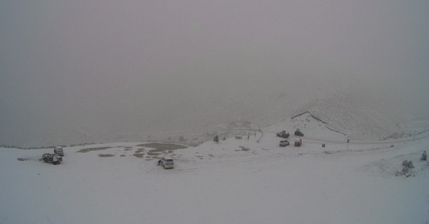
The road linking Queenstown and Wanaka was temporarily closed after a vehicle got stuck on Sunday afternoon, but was reopen by 2pm.
In a Facebook post, the Queenstown Lakes District Council said the closure was from Cardrona Village to Eastburn Rd and crews worked to clear the road.
"We're asking that chains still be fitted at this stage due to current conditions."
Conditions were fine on the alternative route via Cromwell for those without chains.
Grit had been applied near the summit of the Crown Range and extra caution was advised.
"Temperatures are dropping, with ice is expected to form in other areas of the road. Crews will continue to monitor the situation. Remember, if you regularly travel over the Crown Range chains should be carried all winter."

Central Otago
In Central Otago, snow was settling in Maniototo, the Ida Valley and St Bathans areas and caution was advised, a spokesman for the Central Otago District Council said mid-afternoon.
Crews were out ploughing and gritting, and road users should drive to winter conditions.
A snow watch was in place for the Canterbury High Country, about and north of Rangitata River, from 4pm on Sunday until 1am on Monday. Snow may lower to 400 metres, with heavy snow expected above 700 metres.
People are advised to keep up-to-date with the latest forecasts, snow warnings and to take care on the roads during the long weekend.
Snow for alpine roads
MetService late on Sunday morning revised down warnings for most alpine roads. By 4pm, warnings for the Crown Range, Milford Road (SH94) in Southland and the Lindis Pass (SH8) had been lifted.
Further north, snow was set to affect Canterbury alpine passes including Porters Pass (SH73), which may get up to 8cm and Arthur's Pass (SH73), which was forecast to get up to 5cm on Sunday evening until Monday morning.
Porters Pass (SH73)
From 5pm on Sunday until 6am on Monday: Snow is forecast to lower to 700 metres in the evening, and 4 to 8cm of snow may settle on the road near the summit, with lesser amounts lower down.
Arthur's Pass (SH73)
From 6pm on Sunday until 6am on Monday: Snow is forecast to lower to 700 metres in the evening, and 3 to 5cm of snow may settle on the road near the summit, with lesser amounts lower down.
Lewis Pass (SH7)
From 8pm on Sunday until 8am on Monday: Snow is forecast to lower to 700 metres this evening, and 3 to 5cm of snow may settle on the road near the summit, with lesser amounts lower down.


