PHOTO
Lake Wānaka might be one of the most photographed locations in the country, but for geologists mapping its depths, the lake still has secrets to spill.
Over the last week, technicians working for the National Institute of Water and Atmospheric Research (Niwa) have been on a mission to map the entirety of Lake Wānaka’s lakebed in order to better understand its structure and the potential hazards that may lie there.
Niwa marine geology technician Sam Davidson said the team were primarily interested in observing evidence of past activity below the lake’s surface, such as landslides, and the "tsunamigenic risk" that future activity could pose to lakefront communities.
Mr Davidson said with two weeks left in the three-week project it was too early for him to draw any solid conclusions from the data they had gathered, but noted that the areas of the lake they had mapped demonstrated a wider topographical pattern.
"Based on the features that we’re seeing so far, a lot of the topography that you see going down into the lake is very comparative to what we see above the lake.
"So those very steep slopes above water level continue straight down into water depths of more than 200m in some places."
He said Lake Wānaka’s history as a glacial valley had produced a distinct, U-shaped basin that held greater quantities of water which could, during a landslide or similar event, cause a tsunami.
"Lake Wānaka is of high interest to us with respect to those potential tsunami events because of those really steep sides and how quickly that water level drops deeply."
"Being able to see where those limits are really helps to inform our hazard modellers and also providing on to councils and hazard planners what sort of information they need to be better prepared for any of those sorts of events, especially given our proximity to the Alpine Fault and how seismically active this region is, or New Zealand as a whole."
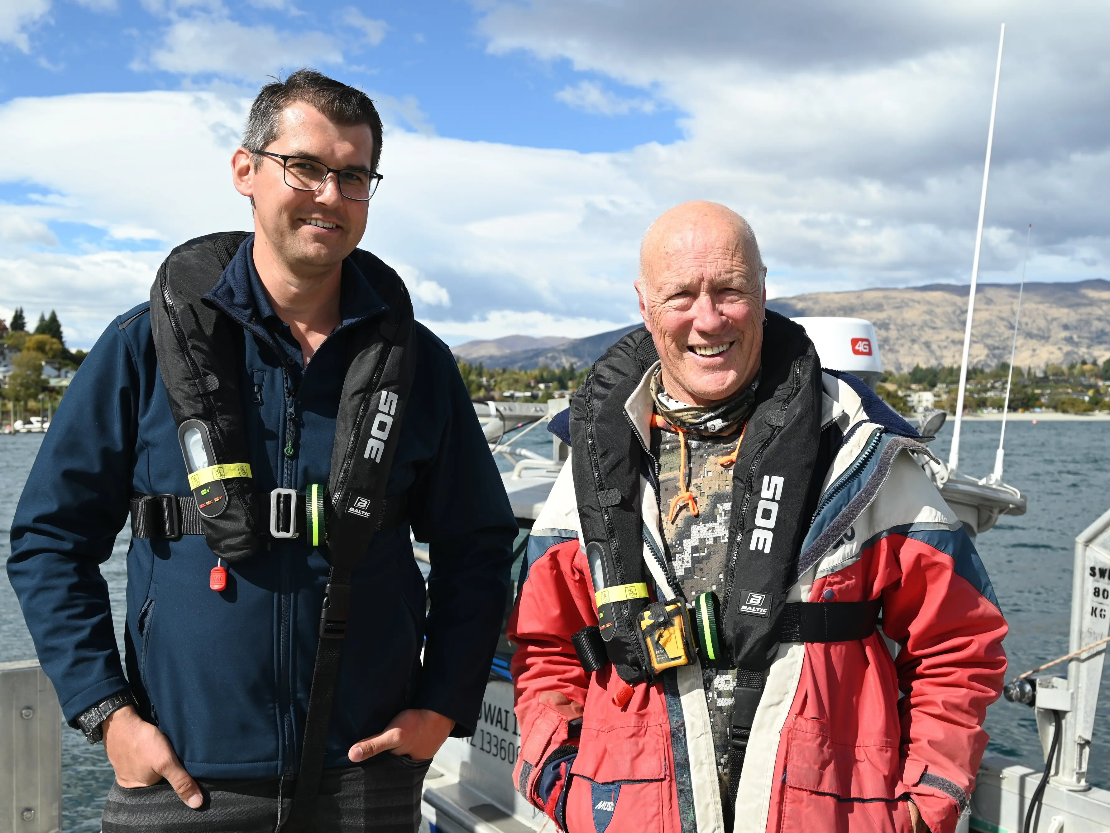
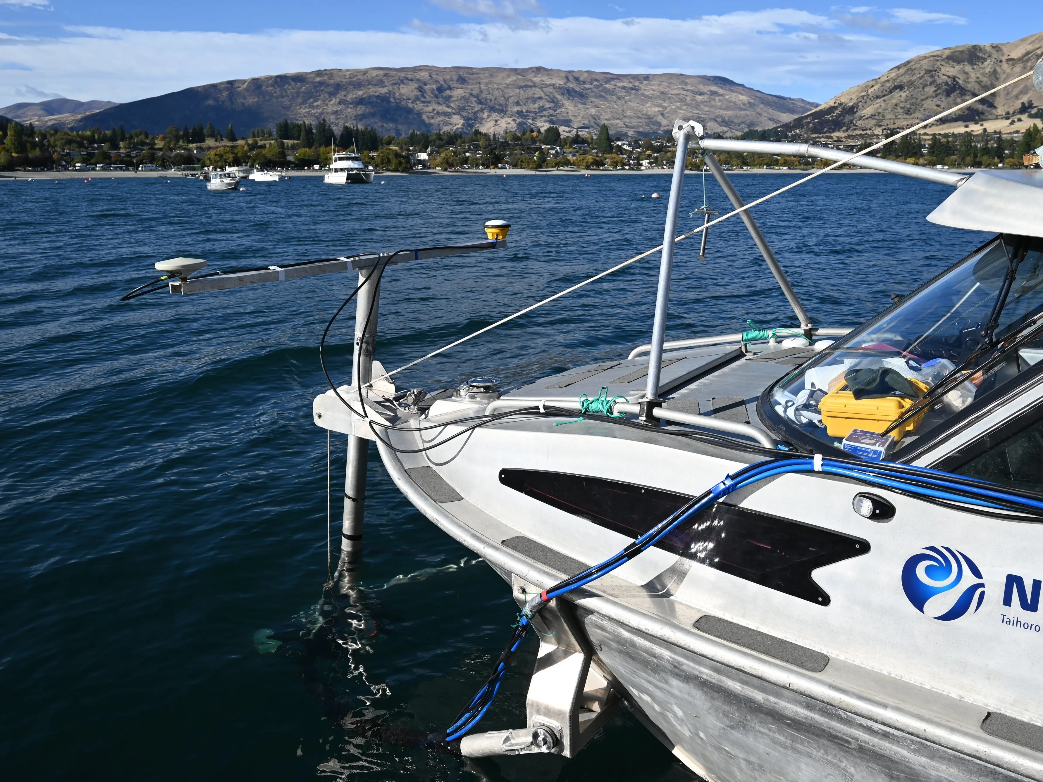
Each morning, seven days a week, Mr Davidson and fellow technicians Pete Notman and Kevin MacKay take to the water in Rukuwai II, a 7m dive vessel retrofitted with a multibeam echosounder system on its bow.
As Mr Notman steers the ship in a back-and-forth pattern the multibeam bounces high-frequency acoustic pings off the lakebed every tenth of a second.
As the information is picked up by the system’s receiver, onboard computers then render the details on a map in real-time, the imagery containing 5m of lakebed per pixel.
Mr Davidson said while the level of detail they were getting would not be enough to detect smaller objects like a rock or a misplaced cellphone, it was sufficient for them to identify larger hazards such as boulders or protruding rock formations.
He said the last survey of its kind in Lake Wānaka took place in the 1970s, using technology that was a far cry from the system attached to Rukuwai II.
Despite the technological advancements, piloting a boat with sensitive survey equipment submerged from its bow still came with its own challenges.
"One of the risks of having our system mounted on the front like that is even though it’s getting the least-disturbed water flow, it’s the bumper," Mr Davidson said.
Mr Notman, a marine technician with over 30 years’ experience as a diver with Niwa, said while many of the shallow, rockier sections of Lake Wānaka would not pose a problem to most watercraft gliding along the surface, it was not so for Rukuwai II.
As the vessel neared a sandbar at a steady 5 knots, Mr Notman was ready to bring it to a complete stop at a moment’s notice from Mr Davidson, who scrutinised the mapping software for any sudden changes in elevation that could pose a hazard for the multibeam equipment.
"Even the satellite imagery doesn’t really show anything like that," Mr Notman said.
"I thought ah, we’re sweet. Look at the satellite imagery, we’re in deep water. Apparently not."
Mr Notman, who will retire next month after the project is completed, said once the mapping work was done a team of geologists in Wellington would spend a considerable amount of time interpreting the data.
"This is just the tip of the iceberg, this is the fun part.
"A huge amount of work goes in to turning that data into something useful."