
PHOTO
Christchurch has hit a record June high of nearly 25°C as northwesterly winds buffet the South Island, with MetService warning of heavy rain and strong winds for many areas.
A heavy rain warning has been issued for the headwaters of Canterbury lakes and rivers, while strong wind warnings are in effect for the east coast of the top of the South Island down to the Canterbury High Country, bringing severe gales today.
Gusts of more than 120km/h have been recorded in Canterbury today, MetService said.
A flood-hit major highway straddling Otago and the West Coast has reopened. A spokesman for the New Zealand Transport Agency advised about 9.30am today that State Highway 6/Haast Pass Highway, between Haast and Makarora, was closed due to flooding.
The road had reopened fully by 1pm, though surface flooding remained on the route and people should travel with care.
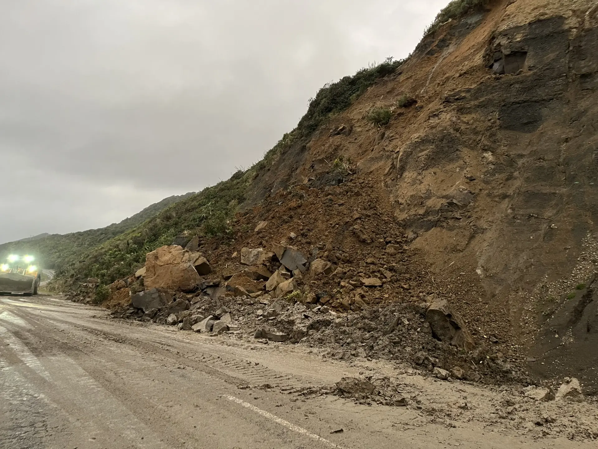
Meanwhile, SH6/Coast Rd, between Rapahoe and Nine Mile in the Grey District, was still open to only a single lane following a slip, and road users were required to stop on demand.
Heavy rain warnings remained in place for much of the West Coast region, with rain bringing an increased risk of slips, surface flooding and difficult driving conditions, MetService said.
Heavy rain for large part of South Is
A heavy rain warning is in place for the ranges of Westland from 9am until 7pm today. MetService says on top of what has already fallen, expect 200 to 250mm of rain. Peak rates of 20 to 30mm/h. Thunderstorms possible.
Further north, a heavy rain warning has also been issued for coastal ranges of the districts of Buller and Grey from 11am on Saturday until 1am on Sunday. Expect 80 to 130mm of rain. Peak rates of 15 to 25mm/h from this afternoon.
A heavy rain watch is in place for the inland ranges of the Buller District and the Nelson Lakes from 11am on Saturday until 1am on Sunday.
For the headwaters of the Canterbury lakes and rivers south of the Hurunui River from 9am until 7pm: On top of what has already fallen, expect 200 to 250mm of rain about the main divide, and 100 to 140mm within 15 km farther east, with thunderstorms possible.
Streams and rivers may rise rapidly. Surface flooding, slips and difficult driving conditions possible.
Severe gales
Strong winds are set to buffet east coast parts of the South Island and inland today.
Warnings are in place for Canterbury High Country from 9am until 5pm, with severe gale northwest winds gusting 130km/h in exposed places. These will gradually ease from the south from mid-afternoon.
For the Canterbury Plains about and north of Rakaia, including Christchurch and Banks Peninsula: Severe gale northwest winds gusting 120km/h in exposed places between 1pm and 5pm.
For Marlborough about south of Clarence: Severe gale northwest winds gusting 130km/h in exposed places from 11am until 10pm.
From Marlborough north of Clarence: Severe gale northwest winds gusting 120km/h in exposed places from 1pm until midnight.
MetService warns damage to trees, powerlines and unsecured structures were possible. Driving may be difficult, especially for high-sided vehicles and motorcycles.
- Allied Media and RNZ