
PHOTO
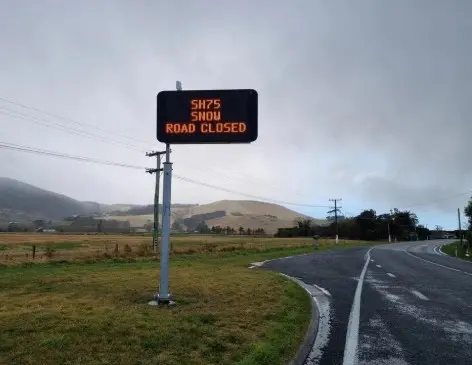
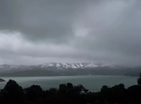
Sleet and snow flurries have caused road closures and warnings in Canterbury on Tuesday morning.
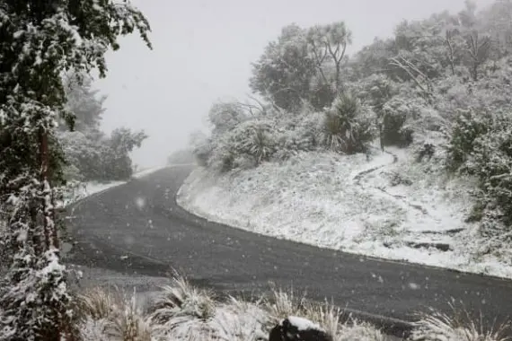
Christchurch City Council contractors laid grit and ploughed Dyers Pass Rd and Summit Rd as snow flurries, hail and a bitterly cold wind hit the city.
Snow settled at the Sign of the Kiwi on Summit Rd and in suburbs across the city.
Earlier on Tuesday, about 20 people were on Dyers Pass Rd when the road was closed.
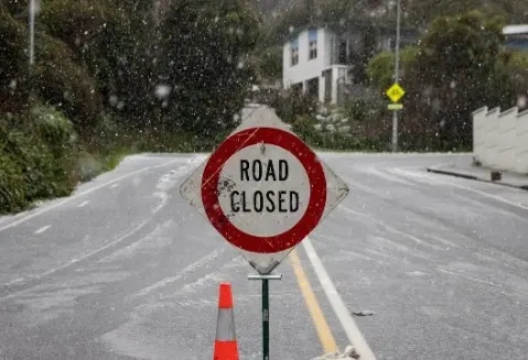
Dyers Pass Rd was closed from the Hackthorne Rd intersection to Governors Bay, including Summit Rd, while contractors cleared the roads, the city council said.
It reopened towards Christchurch about 10.50am but remained closed towards Governors Bay.
The road from Little River to Duvauchelle also reopened after closing on Tuesday morning from Tai Tapu. Other Banks Peninsula road closures included Summit Rd from Little Akaloa to Le Bons Bay Rd, Goughs Bay Rd, Hickory Bay, Long Bay Road, Western Valley from Port Levy to Little River, Purau Port Levy Rd.
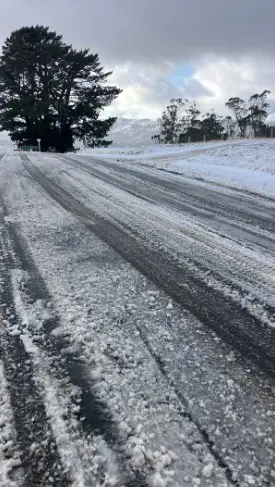
“While we expect most roads to be driveable, we ask residents to refrain from driving up the hills to see the snow as this can create traffic backlogs and safety issues while contractors are working in the area,” a council spokesperson said.
There will be no changes to the kerbside collection services in the city while trucks had safe road access.
“If access is disrupted due to weather conditions, the contractor will monitor the situation and return to collect bins as soon as it is safe and practical to do so on the following day.”
Updates will be provided through the Christchurch Bins app and on the council website.
There is also a snow warning for SH73 Springfield to Arthur’s Pass.
“Vehicle restrictions are in place on SH73 Springfield to Arthur’s Pass, with the road closed to towing vehicles, with chains essential,” an NZTA spokesperson said.
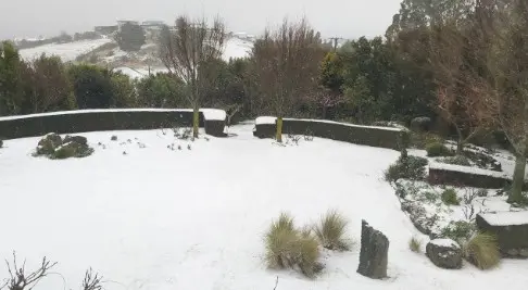
Snow has also been falling in Lyttelton and Taylor’s Mistake.
“Please take extra care on all roads and plan ahead if you intend to travel on the network today,” NZTA said.
MetService meteorologist Alwyn Bakker told RNZ parts of the South Island got to -1°C or -2°C overnight but it wasn’t “too cold”.
The “real excitement” would be on Tuesday night and into Wednesday when it was going to get even colder.
Parts of the South Island would reach -3°C or -4°C, with Christchurch expected to get down to -5°C.
“That’s pretty darn cold,” Bakker said.
Snow was also expected as far north as the ranges of Gisborne, as well as around Wellington, Canterbury and Marlborough.
MetService meteorologist Ethan Walton-Jones told RNZ snow would be falling across the country.
“In Otago and Canterbury, we’re expecting flakes falling right down into the town levels, and then further north, all the way up as far as Gisborne, we’ll have a fresh frosting of snow up on the hills.”
Most Cook Strait ferry sailings are cancelled this morning, due to forecast high winds and large swells.
Interislander has cancelled all of its sailings, and Bluebridge has done the same except for two services earlier this morning.
Wellington’s Harbourmaster Grant Nalder said the swell is forecast to reach between 5 and 9 metres at its peak around midday, while Walton-Jones said waves of up to six metres are expected this morning.
Nalder said swells would not be as bad as some recent storms Wellington has had, but rough enough to cause disruption.
Snow warnings for parts of the North Island began from 4am Tuesday morning — including for the Desert Rd and Remutaka Hill Rd between Wellington and Wairarapa.
“For all the Crown Range Road, the Dunedin — Waitati Highway, Porters Pass, Lewis Pass and the Remutaka Hill Road. But we’re also expecting more of the road snowfall,” Walton-Jones said.
State Highway 87 between Outram and Middlemarch in Otago was closed by snow on Monday night.
Meanwhile, SH1 is closed in Dunedin from Pine Hill Road to Leith Valley Road due to heavy snow.
Tony Trewinnard from Blue Skies Weather said you can expect the cold weather to continue.
He told The Star the next couple of weeks “are going to be on the cold side” while “things will start to warm up” in the latter half of August.
“You might find that you get a day where it’s showery and there’s a bit of sleet or hail and a bit of snow on the hills — just a few light flakes,” he said.
However, those days “are not going to be the pattern”.
Cold airflows from the Southern Ocean were expected to move across Canterbury in the first half of the month.
“So it tends to be rather on the cold side — but not unpleasant. It doesn’t necessarily mean that it’s going to be continually cloudy, wet, or that type of cold; we may well find that many days in the next two weeks are frosty in the morning, sunny and cool in the afternoon.”
Temperatures could start to rise in the second half of August as northerly and westerly airflows come to dominate, Trewinnard said.
“We might have some nor’west days starting to wind up. It will probably stay quite dry and relatively settled, and the temperatures will start to climb noticeably.”
Looking further ahead, Trewinnard said the El Niño climate system will start influencing our weather.
“I don’t think you can blame or label El Niño as the cause of this pattern for August just yet. I think we need to get into September or probably more October before we can really say that the impact of the El Niño event is actually being felt here.
“Those months will probably be very typical spring months. So quite a lot of nor’west days, brief southwest changes coming through with them, the odd cold night following those southwest changes, but plenty of days where the temperatures are on the mild side.”
Earth Sciences New Zealand’s seasonal outlook for July to September, meanwhile, said temperatures are more likely to be at or above average, and the chance of big shifts in temperatures was likely to increase.
-Raphael Franks and RNZ