
PHOTO
Snow's on the way for much of the South Island, as another chilly blast sweeps up the country.
MetService late this morning updated road snowfall warnings for alpine passes and other high roads in the South Island, saying less snow was forecast to fall and it would come later than predicted yesterday, including for Canterbury areas. However, it now extends to alpine passes in the North Island.
A warning for Dunedin's Northern Motorway (SH1 to Waitati) remains, though snow was now expected later at 6pm on Wednesday, instead of 11am, and may affect the summit where up to 2cm could settle until 5am on Thursday.
A heavy snow watch stays in place for Otago, south of a line Queenstown to Mosgiel, and also inland Fiordland and Southland from 1pm on Wednesday until 3am on Thursday. Snow was expected to about 200 metres, with heavy falls above 400 metres where accumulations may approach warning criteria, MetService said.
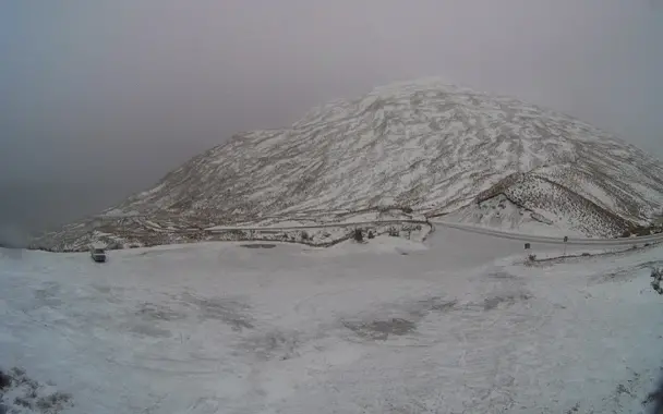
Conditions were easing for the Crown Range, linking Queenstown and Wanaka, which was looking pretty snowy this morning at the summit. MetService said a few snow showers may now affect the road from 10am today and overnight, with just 1cm expected to settle at times.
Roads were generally dry in the region this morning, with low temperatures either at or below zero. Grit had been applied by teams specifically around Arrow Junction, Wānaka/Hawea, and SH85 to Ranfurly.
Snow showers were also likely for the Lindis Pass (SH8) from 10am today until 2am on Thursday.
In Southland, light snow showers may affect the Milford Road (SH94) throughout today and into Thursday morning, but no road closures were expected. However, motorists were advised to watch out for snow clearing equipment during daylight hours.
The snow warning has been extended to the North Island to include the Desert Road (State Highway 1), the Remutaka Hill Road (SH2), linking Wellington and the Wairarapa, and SH5's Napier-Taupo Road from Thursday morning.
MetService meteorologist Mmathapelo Magabutlane said a ridge of high pressure was expected to move over the country later on Thursday and Friday, before fronts spread on to New Zealand from the Tasman Sea on Saturday. At this stage, Saturday looks mainly fine, but later on Sunday, another snow-bearing front was looking likely.
Less snow for Canterbury
MetService now says less snow was set to affect alpine passes in Canterbury (up to 25cm had been forecast), with with Porters (SH73) and Lewis (SH7) passes now expected to get between 5cm to 10cm and Arthur's Pass (SH73) between 4cm to 6cm today and overnight.
A heavy snow warning for inland Canterbury about and north of Arthur's Pass, inland Marlborough, the Richmond Range and Nelson Lakes National Park has been downgraded to a heavy snow watch. Snow was expected to about 200 metres, with heavy falls above 400 metres where accumulations may approach warning criteria.
A heavy snow watch is also in place for inland Canterbury, south of Arthur's Pass to Lake Tekapo. Snow was expected to 300 metres, with heavy falls above 500 metres where accumulations may approach warning criteria. More snow was likely on Thursday morning.
And there's a heavy snow watch also for inland Buller and parts of Tasman. Snow was forecast down to 300 metres, with heavy snow possible above 400 metres on Thursday morning.
Road snowfall warnings
SOUTH ISLAND
Dunedin to Waitati Highway (SH1)
Period: 6pm on Wednesday until 5m on Thursday
Snow may affect the summit of the road this evening and before dawn on Thursday, where 1 to 2cm of snow may settle.
Crown Range Road
Period: from 10am on Wednesday until 2am on Thursday
A few snow showers may affect the road today and overnight, where 1cm of snow may settle at times.
Milford Road (SH94)
Period: From 10am on Wednesday until 2am on Thursday
A few snow showers may affect the road today and overnight, mainly south of Lake Gunn, where 1cm to 2cm may settle at times.
Lindis Pass (SH8)
Period: From 10am on Wednesday until 2am on Thursday
A few snow showers may affect the road today and overnight tonight, where 1cm of snow may settle at times.
Haast Pass (SH6)
Snow is no longer expected to affect the road.
Porters Pass (SH73)
Period: From 4pm on Wednesday until 11am on Thursday
Snow forecast to affect the road from late Wednesday afternoon through to overnight tonight, with 5cm to 10cm of snow expected to settle. Snow showers may affect the road on Thursday morning, with a further 2cm to 4cm of snow possible.
Arthur's Pass (SH73)
Period: From 5pm on Wednesday until 2am on Thursday
Snow set to affect the road on Wednesday evening and overnight, with 4cm to 6cm expected to settle.
Lewis Pass (SH7)
Period: From 7pm on Wednesday until 5am on Thursday
Snow is forecast to affect the road on Wednesday evening and overnight, with 5cm to 10cm expected to settle.
NORTH ISLAND
Napier-Taupo Road (SH5)
Period: From 3pm until 11pm on Thursday
Snow expected to lower to about 500 metres in the afternoon and evening. Expect 2cm to 3cm to settle on the road.
Desert Road (SH1)
Period: From 1pm until 10pm on Thursday
Snow forecast to lower to about 400 metres in the afternoon and evening. Expect 4cm to 6cm to settle on the road.
Remutaka Hill Road (SH2)
Period: From 5am until 12pm on Thursday
Snow set to lower to about 400 metres in the morning, with 4cm to 6cm of snow expected to settle. Further snow showers possible about the summit in the afternoon and evening.