An image taken from space reveals a well-lit New Zealand by night, even in some of the smaller rural towns.
Nasa has released a map of the Earth at night, the first time since 2012, using newly improved, high-resolution graphics.
The Visible Infrared Imaging Radiometer Suite (VIIRS) used is able to capture night-time shots at an unprecedented resolution, according to ScienceAlert.It is able to detect photons of light in 22 wavelengths.
On the New Zealand image (below), the snow-capped Southern Alps can be seen, and lights shining bright in some rural areas.

Italy is particularly recognisable lit up at night, but it's the Nile in the image below that is fascinating as a vast amount of lights make the river visible snaking through Egypt.

Japan can be seen slightly to the right of this image below, and next to it are the bright lights of South Korea.
North Korea, however, is in darkness, the borderline very apparent.
North Korea has previously admitted that it has had problems getting enough electricity, with Kim Jong Un telling the nation's citizens to work hard to restore the country's electricity in a 2015 speech.

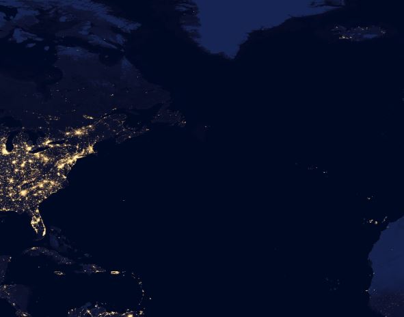
Resting beside a dark Atlantic Ocean is the East Coast of the United States (below). No surprises the lights of New York, the city that never sleeps, burn brightly.
The newly released images will help scientists plot population patterns, energy demand and study expansion of cities.