PHOTO
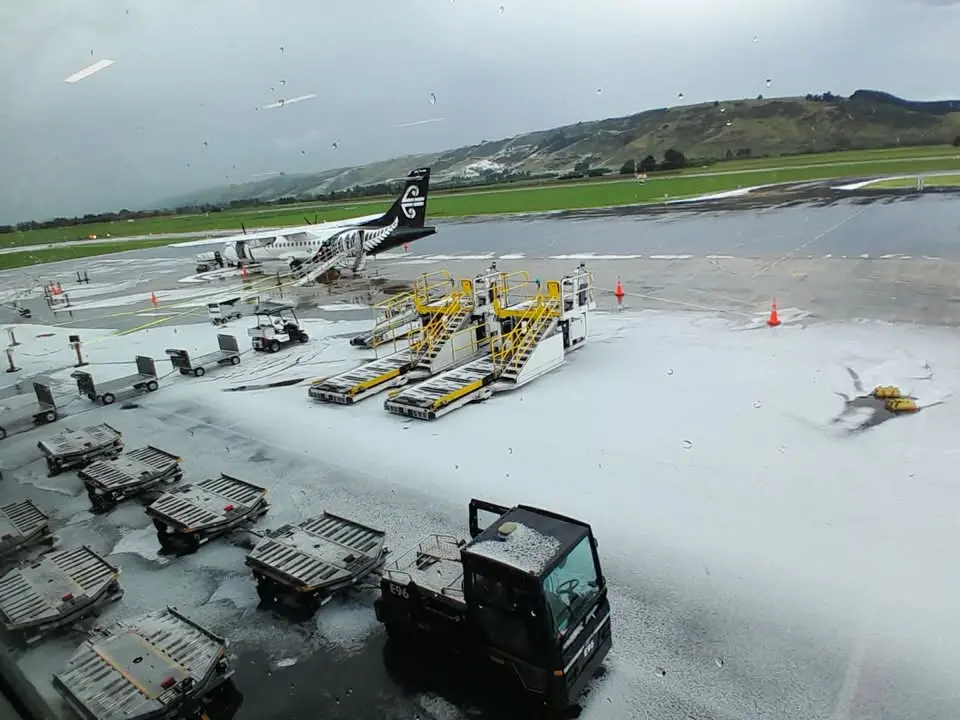
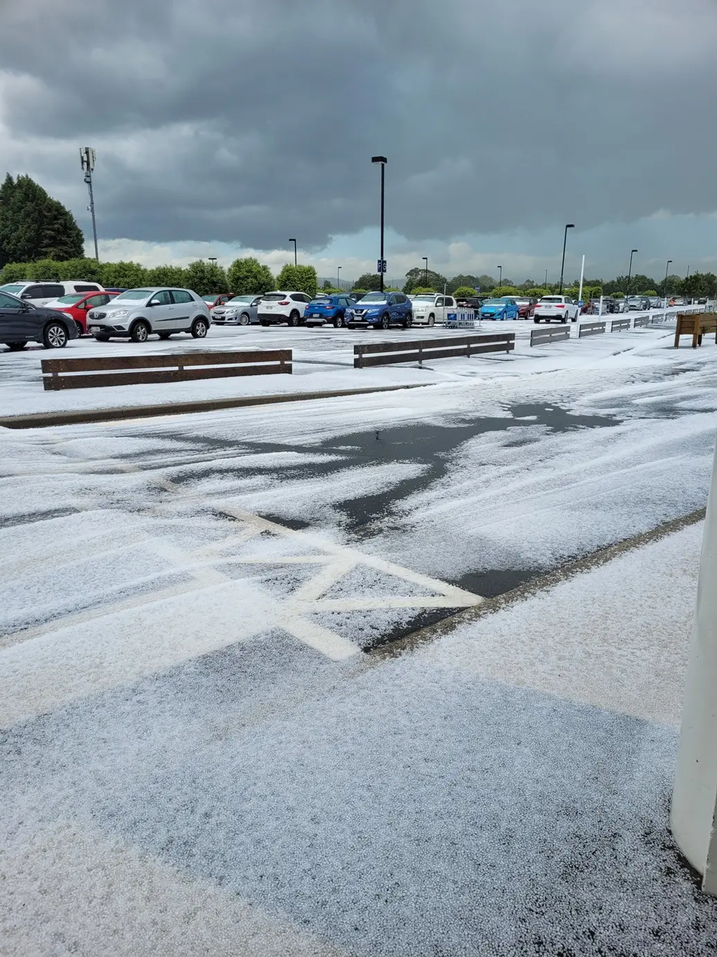
A severe thunderstorm warning has been lifted after hail coated the ground at Dunedin Airport and lightning forked in the sky above Dunedin this afternoon.
Waihola resident Anja Theron, who was caught in the storm on the way to the airport, said "it was like driving on marbles. Visibility was almost zero."
"We left home at 2:15, drove through the storm, it hadn't reached the airport yet, by the time we reached the airport we got hit a second time within minutes.
"The back road to the airport probably had about 5 to 10 centimeters of hail and water on it.
"We were driving about 30km per hour, driving an old ute, glad we left the good cars at home today."
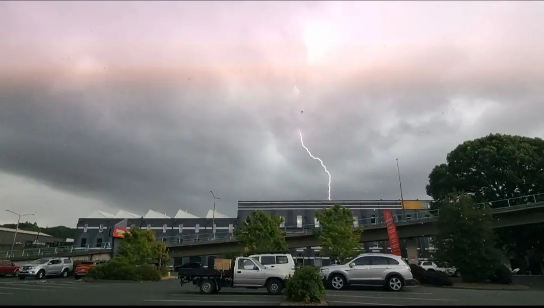
Alicia Southee captured a stunning photo of lightning in the sky above Vogel St in Dunedin.
"I took it with my phone inside my car. It was stunning and spectacular to watch."
MetService had been warning of thunderstorms and possible large hail for parts of the South this afternoon.
The forecaster lifted the severe thunderstorm warning for Otago at 7pm.
In an update at 3.30pm, MetService weather radar had detected severe thunderstorms near Middlemarch, Lake Mahinerangi, Clarks Junction, Sutton and the Lammerlaw Range.
These severe thunderstorms are moving towards the east, and were expected to lie near Dunedin, Waikouaiti, Outram, Warrington and Hindon later in the afternoon.
Earlier, MetService said its weather radar had detected severe thunderstorms near Dunedin Airport, Mosgiel, Outram, Brighton and Dunedin City.
The storms were moving towards the east/northeast, and were expected to move more towards the city, Port Chalmers and Otago Peninsula over the next hour.
"These thunderstorms are expected to be accompanied by torrential rain and large hail."
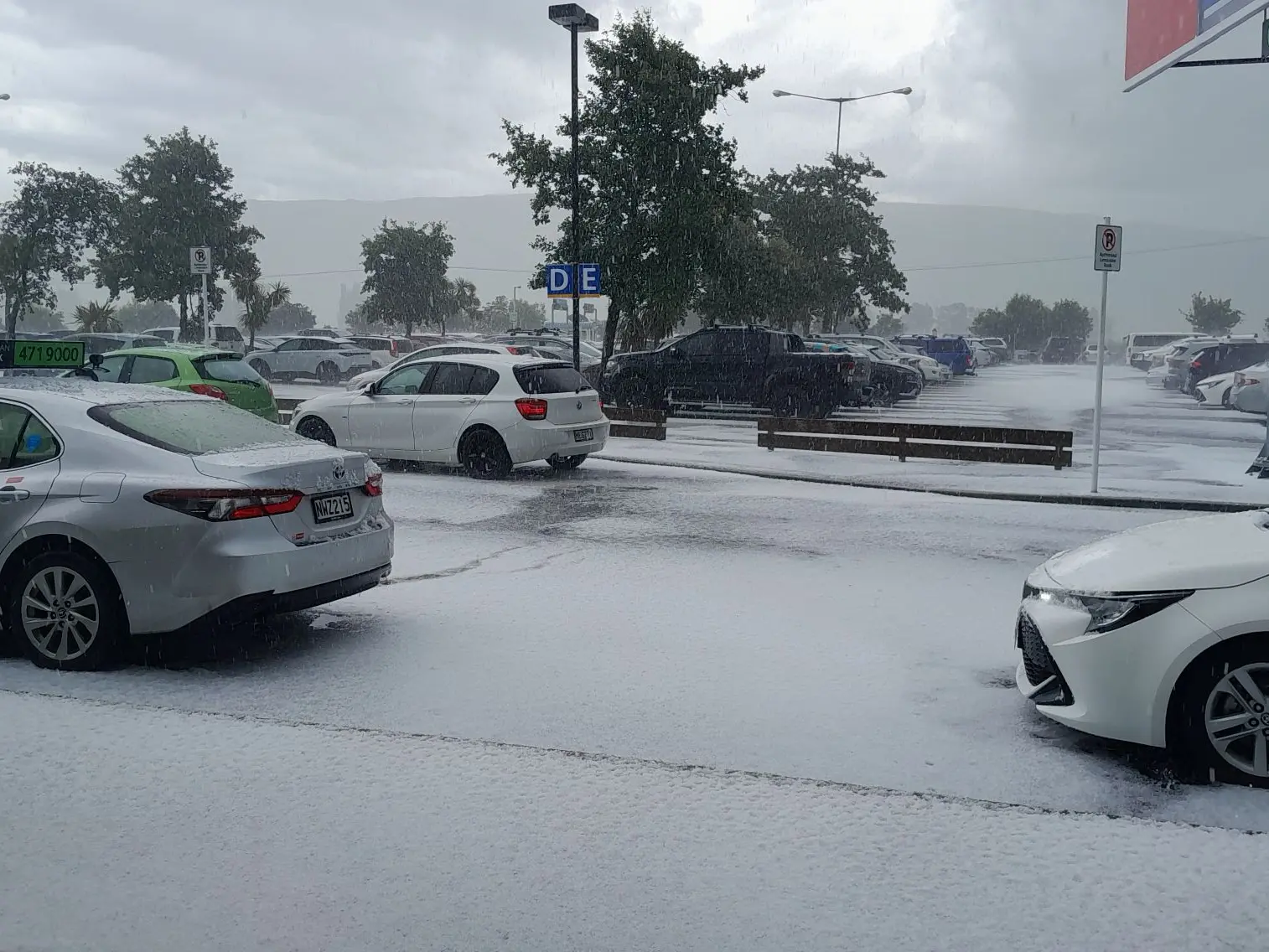
The forecaster said large hail could cause significant damage to crops, orchards, vines, glasshouses and vehicles, and make driving conditions hazardous.
MetService said a combination of an upper cold trough and northeasterly winds in the east turning southwest was likely to produce scattered heavy showers and thunderstorms in many southern and eastern areas.
There was a high risk of thunderstorms about South Canterbury and eastern parts of Otago this afternoon and evening, and a moderate risk about Central Otago, inland Southland and Clutha this afternoon and evening.
Further north, there was a moderate risk about parts of Mid and North Canterbury (including Christchurch) this evening and tonight.
MetService said the thunderstorms would produce localised heavy rain mainly in the 10-25mm/h range, and hail in the 5-20mm diameter range.
"About South Canterbury and eastern Otago, however, there is a low risk one or two of the thunderstorms may be severe with localised rainfall rates in excess of 25mm/h and larger hail, as well as a low risk of a small localised tornado."
- Allied Media