Hiking in the Grampians in Australia. PHOTO: GETTY IMAGESHiking is all about the freedom to encounter unfamiliar cultures, spy animals in their natural habitat and savour solitude or the company of other hikers.
Here are a few hikes from Lonely Planet’s latest collection of Where to Go When to help plan your next trip.
THE BOOK:
Where to go When: Hiking by Lonely Planet, RRP $55
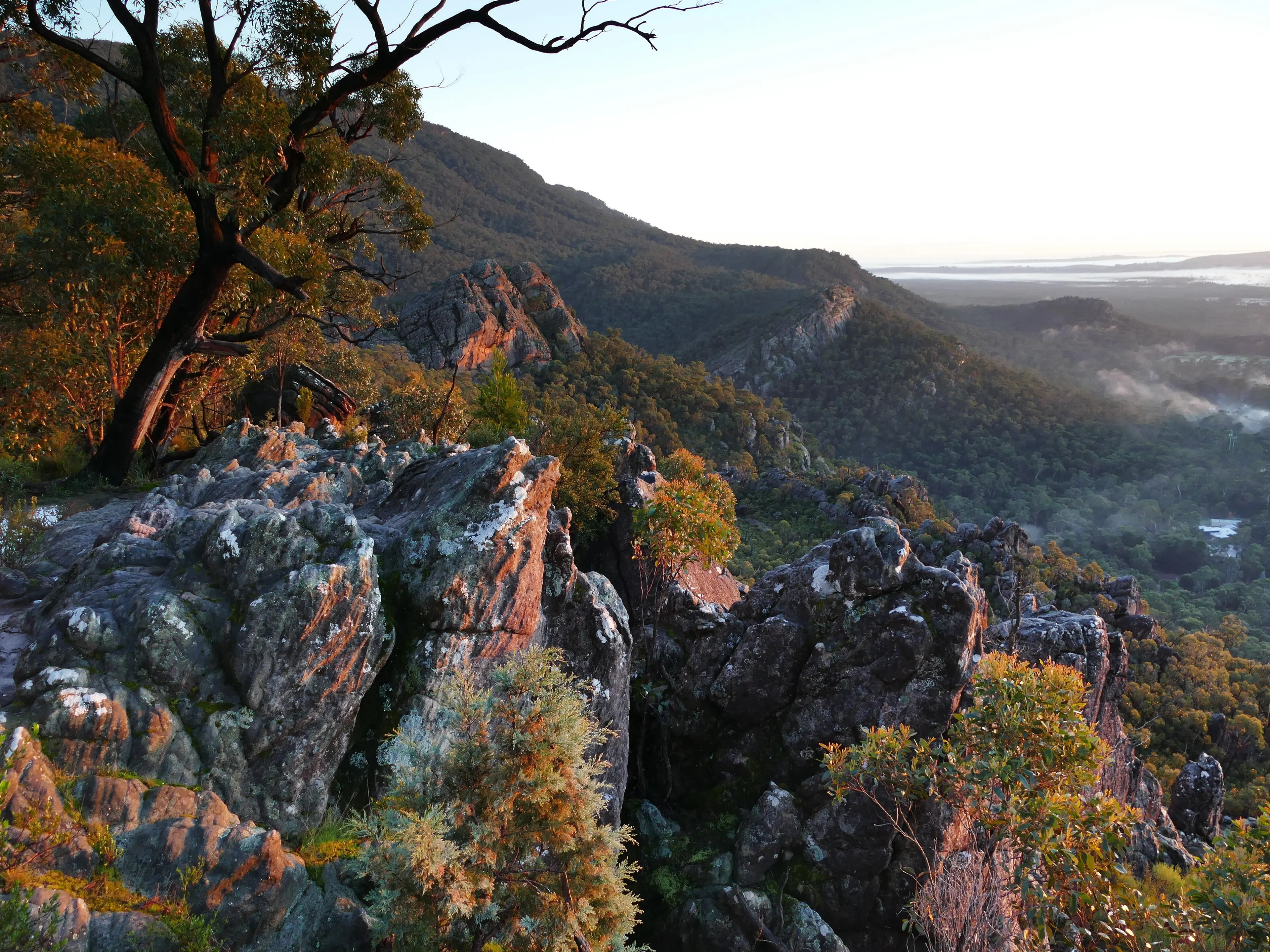
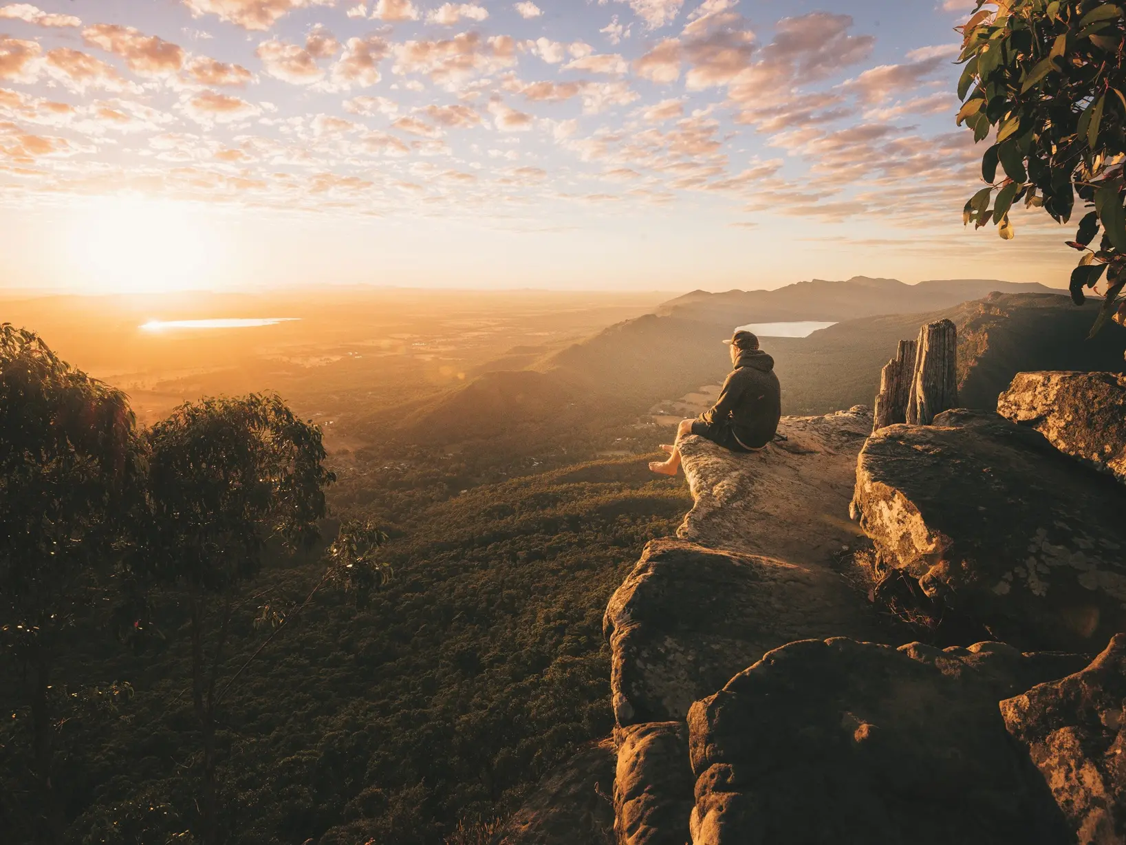
Grampians Halls Gap. PHOTO: GETTY IMAGESGrampians Peaks Trail
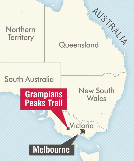
VICTORIA, AUSTRALIA
START: Mt Zero Picnic Area
FINISH: Dunkeld
DISTANCE: 162km
DURATION: 13 days
CHALLENGE LEVEL: 5 stars
WHEN TO WALK: March-May & September-November
Take on the “Big Mountains” in an adventure that immerses hikers in the wild beauty and ancient Aboriginal culture ofVictoria’s Grampians (Gariwerd) National Park.
Names reveal a lot about a place — and a hike. Take the Indigenous Jardwadjali word for central-west Victoria’s Grampians Range: Gariwerd — “Big Mountain”. Encompassing peaks with daunting monikers such as Mt Abrupt and Mt Difficult, this 1672sq km national park is a rugged, wild expanse of sandstone summits and crags.
Unsurprisingly, the Grampians Peaks Trail that snakes north-to-south through the park isn’t to be taken lightly — not least because it was designed to tackle many of the highest mountains in the range. Tellingly, it’s designated mostly grade 4 or 5, suitable for experienced bushwalkers with a good level of fitness. And such passionate outdoors folk won’t want to miss its hard-won delights.
This 13-stage trek finally opened in 2021 after years of work constructing many miles of trails and creating walk-in campsites with flat pitches, long-drop toilets and shelters. The result is a perambulating showreel of the park’s greatest hits — its dramatic sandstone ridges and cliffs, its ancient Aboriginal rock art, its varied wildlife and, of course, its inspiring views.
Hikers encounter the region’s main town, Halls Gap, at the end of stage 4 — offering a welcome chance to slumber in a comfy bed and feast on meals someone else has cooked — but for the rest of the trek you must be fully self-sufficient. That means carrying food, camping and cooking gear plus plenty of water.
In the hottest months, the region is prone to drought, with water tanks running low, and sometimes bushfires — check forecasts and track conditions before setting out. Winter brings the risk of ice at higher levels, too. So visit in autumn or, better still, in spring when the weather is mild and wildflowers bloom. You’ll likely encounter a cross-section of the park’s native species: grey kangaroos, red-necked and swamp wallabies, emus and perhaps echidnas snuffling for ants. The region is home to at least 230 bird species, too: you may be woken by the cackling laughs of kookaburras or squawking cockatoos at your camp-site. And you’ll tramp through forests of stringybark and manna gums, relish the shade of banksias and she-oaks and admire luxuriant tree ferns.
But the headline act here is geology: the quartz-gleaming sandstone sculpted and carved by wind, ice and rain over millions of years into sheer escarpments, soaring pinnacles and curious rock formations. The route tackles high peaks right from the off: the climb up Mt Stapylton comes at the start of stage 1, Mt Difficult tests trekkers on stage 3 and 1167m (3829ft) Mt William — the highest summit in the Grampians — awaits midway through the hike.
If completing the whole route in one go sounds too much, take on a shorter section. The 50km northern stretch, from Mt Zero Picnic Area to Halls Gap, yields marvellous views across its four days. The central five-day section between Halls Gap and Yarram is tougher, while the southern four-day leg to Dunkeld is the gentlest. However far you hike, you’ll gain a rich understanding of this land of Big Mountains.
Accommodation: Walk-in campsites; midway Halls Gap has camping, hostels, lodges and hotels.
Food: Carry all supplies, cooking kit and plenty of water, which may be scarce in dry periods (and should always be purified).
Getting there: Halls Gap is the main hub, a 40-minute bus ride from Ararat (2½ hours by train from Melbourne). Book a transfer to Mt Zero Picnic Area (via grampianspeaks.com.au); food drops are also possible. Buses link Dunkeld with Halls Gap in 45 minutes.
Planning: Book campsite spots well in advance (fees payable).
Safety: Bring printed maps; check for wildfire warnings; prepare for all weather conditions.
Info: parks.vic.gov.au
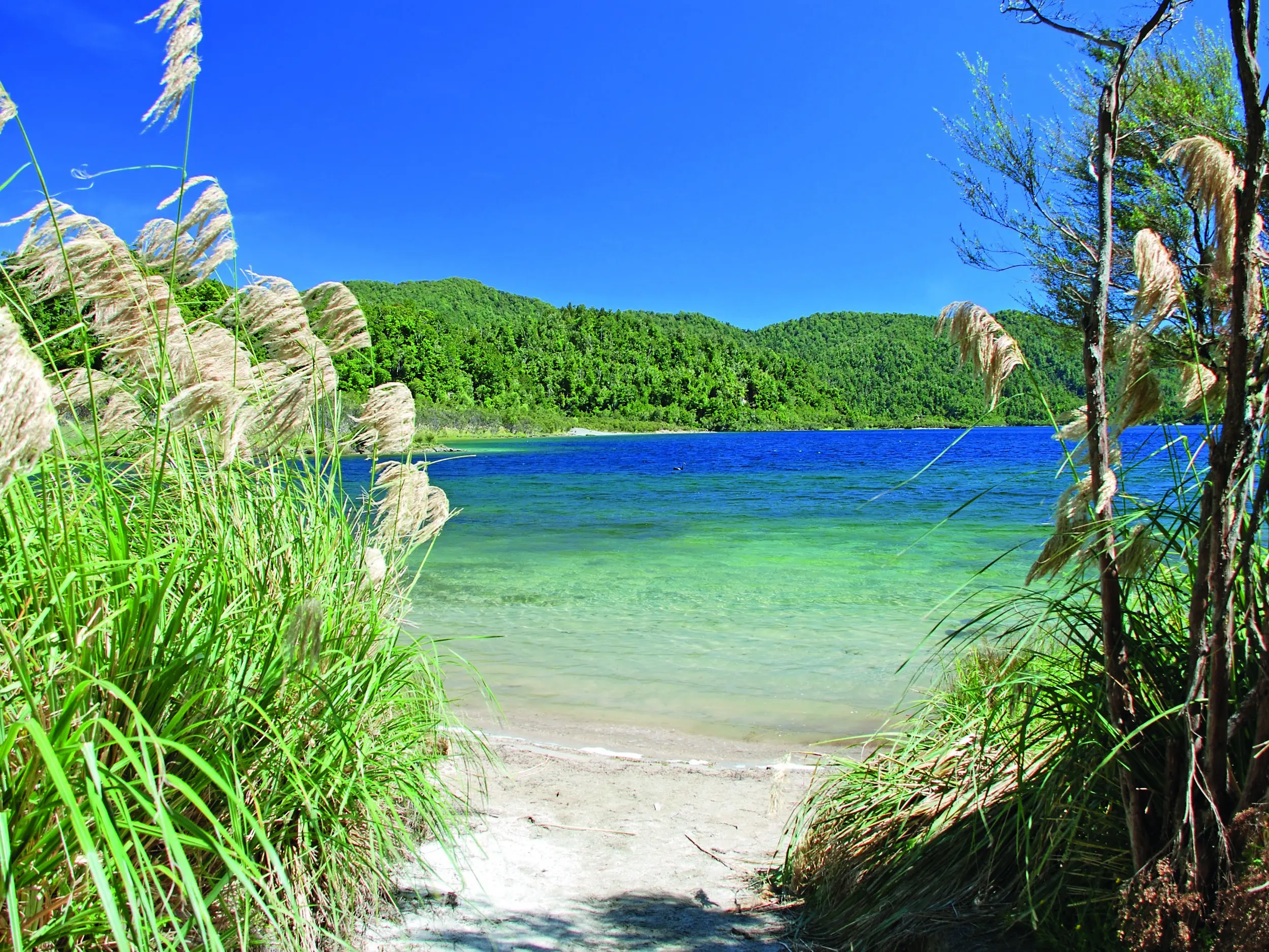
Lake Waikaremoana Great Walk is not as busy as many. PHOTO: CANTO-SHUTTERSTOCKLake Waikaremoana Great Walk
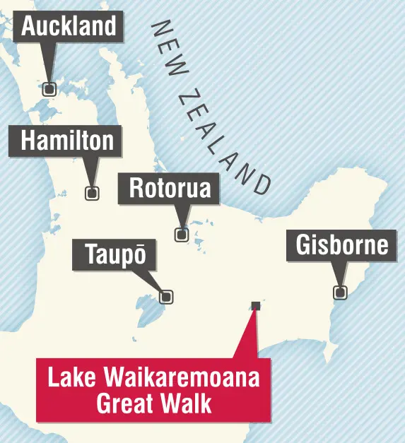
NORTH ISLAND, NEW ZEALAND START: Onepoto
FINISH: Hopuruahine (or vice-versa) DISTANCE: 46km DURATION: Three to four days CHALLENGE LEVEL: 5 stars WHEN TO WALK: October-May
Tackle a remote Great Walk in a lush North Island wilderness that’s rich in nature and Māori heritage.
Less a hike, more an extended forest-bathing experience, this lakeside route offers an immersive introduction to the human and natural history of Te Urewera – a region recognised in law as a living person.
This is the traditional homeland of the Ngāi Tūhoe, the iwi known as the “Children of the Mist’’, who care for the tracks as well as the environment. A swathe of undulating emerald greenery, it’s the epitome of New Zealand’s primal wilderness, encompassing the North Island’s largest expanse of native forest.
Midsummer, when sunshine is most likely to sparkle off Lake Waikaremoana, is the perfect time to hike. You can start at either end of the horseshoe-shaped route, though most set out from Onepoto. “Most’’ being relative: hikers are sparse compared with other Great Walks. Wildlife, though — well, that’s not so scarce.
Over three or four days, starting with the steady haul up to Panekire Bluffs and ridge for sweeping lake views, you’ll traverse rainforest and “goblin forest”, wetland and scrub, grassy flats and shoreline stretches, misty valleys and hillsides striped with cascades. Among the rimu, red beech, tōtara, rātā and many other tree species, you might spy — or hear — almost any of North Island’s native forest birds. You’ll be regaled by the piping, trilling, whistling call of the tūī and the soft cooing of the kererū.
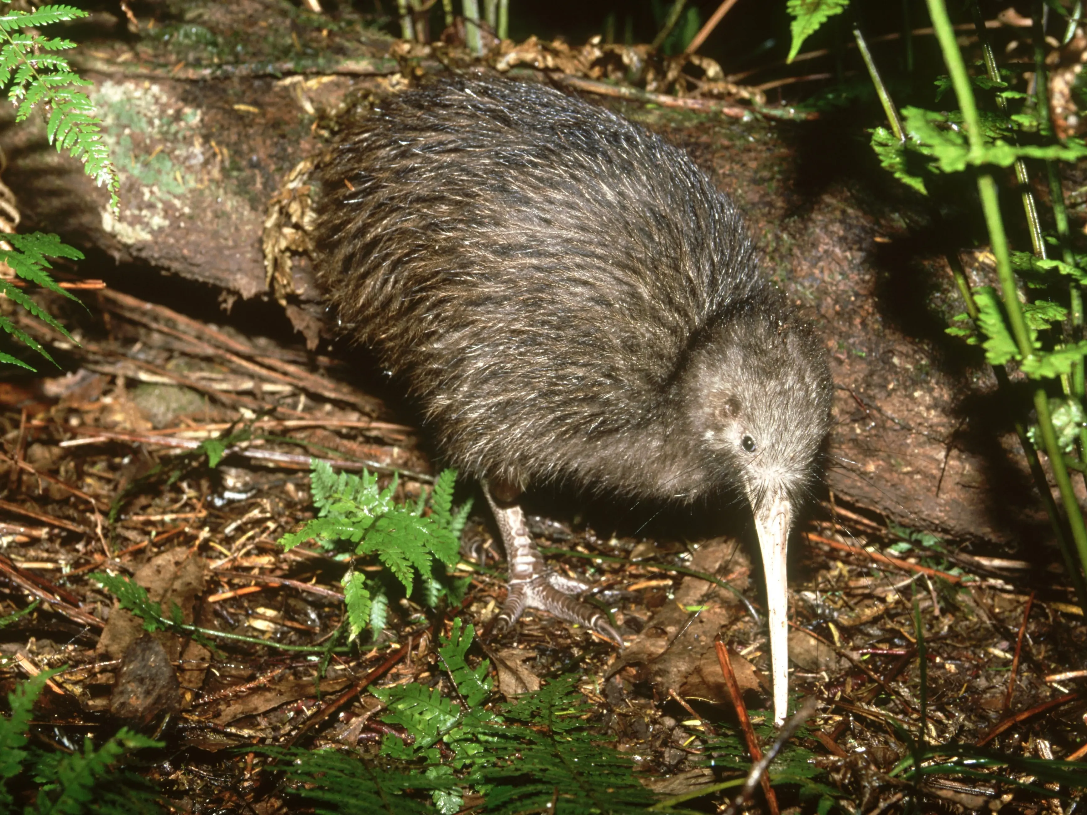
Come nightfall, when you’re relaxing in one of the cheerful huts or campsites en route, the repeated whistling of a male kiwi tells you that New Zealand’s national bird is foraging nearby. Immersion in nature never felt so accessible or rewarding.
Hearing the call of kiwi foraging nearby your tent at night is one of the joys of the Lake Waikaremoana hike. PHOTO: GETTY IMAGESAccommodation: Heated huts with bunks, toilets and water, plus campsites.
Food: Bring supplies; purify drinking water.
Getting there: You’ll need to organise transport to your chosen start point; parking is most convenient near Onepoto. Water taxis (see ngaituhoe.iwi.nz) link both ends of the trail between October and April.
Planning: Book campsites or huts (via bookings.doc.govt.nz) as early as possible.
Safety: Pack for rapidly changing weather and be aware of potentially slippery trails.
Info: doc.govt.nz
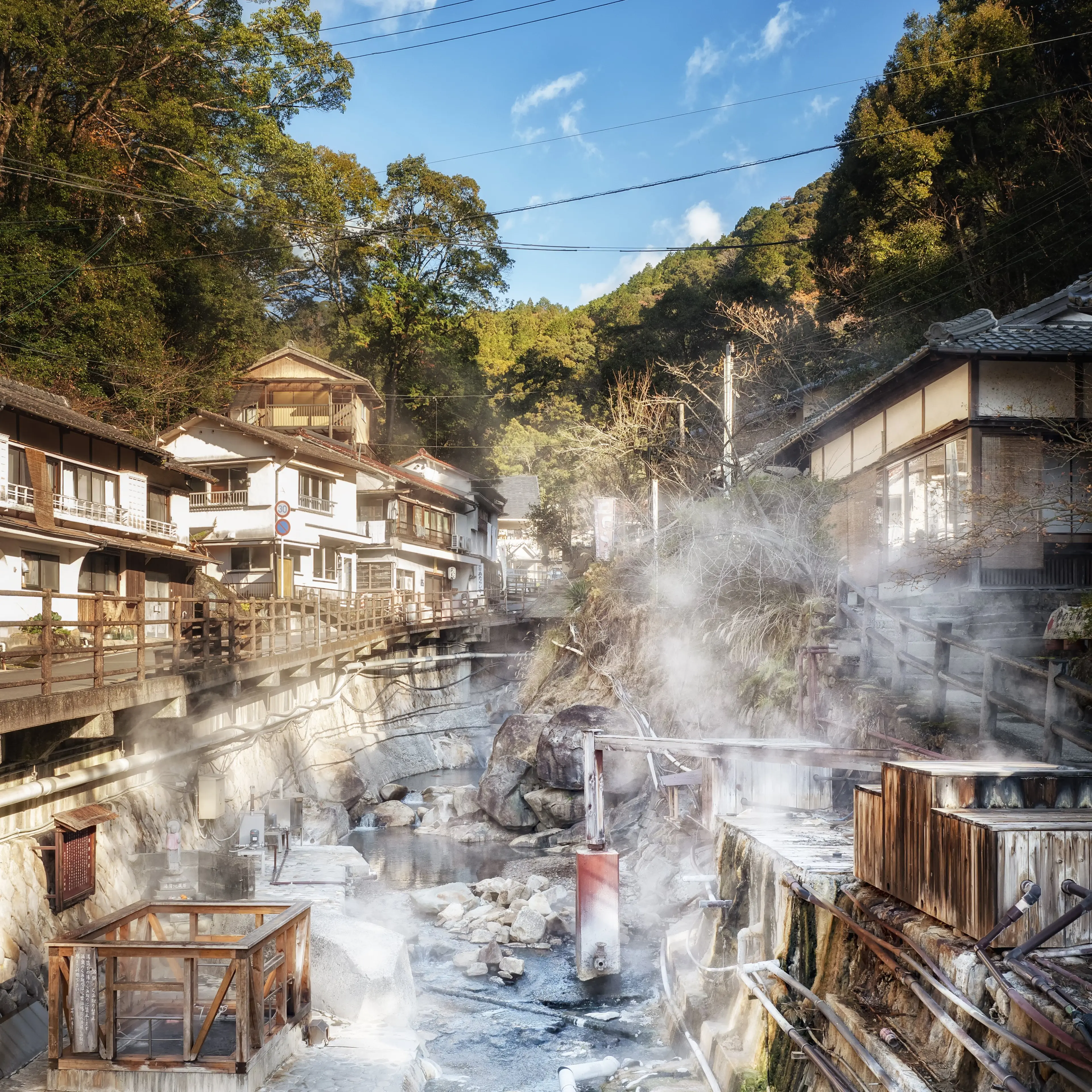
Many pilgrims stay at nearby Yunomine Onsen (hot-spring village) for a soothing soak.
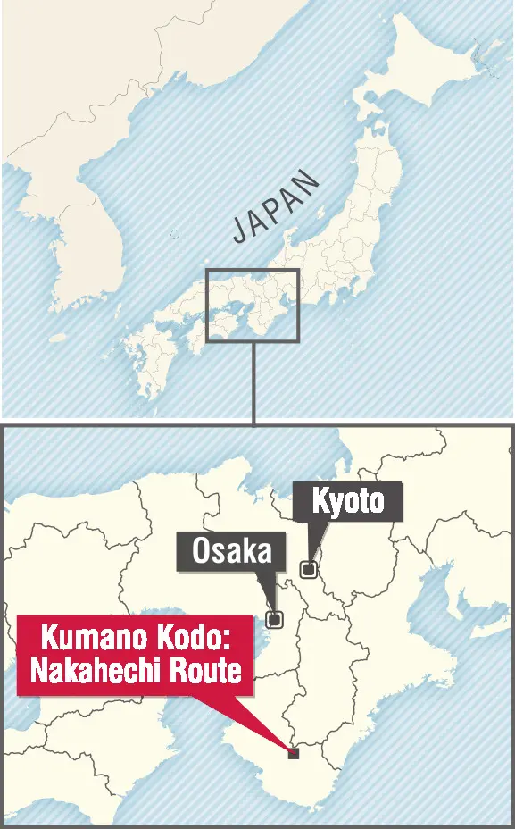
PHOTO: GETTY IMAGESKumano Kodo: Nakahechi Route
HONSHU, JAPAN START: Takijiri-oji FINISH: Nachi Taisha DISTANCE: 66km DURATION: Four to five days CHALLENGE LEVEL: 3 stars WHEN TO WALK: March-May and September-November
Follow in the footsteps of countless Shinto and Buddhist pilgrims on an ancient trail through the forest-cloaked mountains of the Kii Peninsula.
Even emperors enjoy a good hike. OK, we’re massaging the facts a little — but the point remains that over 1100 years ago, it was Japanese Emperor Uda who travelled to the Buddhist shrines of Kumano on the mountainous Kii Peninsula, setting a trend that saw dozens more imperial pilgrimages here over the following four centuries.
The region was sacred to Shinto before Buddhism took hold in Japan: yamabushi (ascetics) have trekked here from Yoshino since at least the late 7th century, and Kumano is believed to have had religious significance stretching back into prehistory, when it was thought to be inhabited by many deities.
Today, the objectives of the many who still tramp the Kumano Kodo — ‘‘Old Roads to Kumano’’ — remain the three grand Kumano Sanzan shrines: Kumano Hayatama Taisha, Kumano Nachi Taisha and Kumano Hongu Taisha, that last devoted to Izanagi-Okami, a goddess said to have created Japan.
Rather like the Camino de Santiago in Spain, and also Unesco World Heritage-listed, the Kumano Kodo isn’t one route but several paths. Five interconnected pilgrimage trails evolved over the centuries after Uda’s visit, spidering out from (or, rather, up to and connecting) the three shrines and largely revived since the 1990s. Fewer emperors and aristocrats make the trek today, but many other hikers are following in those imperial footsteps. Some come to explore spiritual beliefs, but most simply walk to experience the glorious landscapes and traditional customs, to bathe in onsen (natural hot springs) and sample local cuisine — specialties include shishi-nabe (wild boar hotpot), river fish and mehari sushi (rice wrapped in takana, pickled mustard leaves).
Most popular of the trails is the Nakahechi, known as the Imperial Route. With its start a short bus ride from Kii-Tanabe Train Station, and its end even closer to Shingu Station, it’s accessible, attractive and achievable for hikers with a moderate level of fitness and experience. Clearly waymarked and made up of mostly well-maintained paths (with plenty of steps), this stretch is open year-round — though both hot, humid, rainy summer and chilly winter are less than perfect times to trek. Autumn’s ideal.
From the trailhead at the shrine of Takijiri-oji, the path first climbs to Takahara village and continues to Chikatsuyu, home to the Kumanokodo Nakahechi Museum of Art. Beyond, tree-lined steps lead up to the Tsugizakura-oji; nearby inns and guesthouses make this a convenient overnight stop. The following day switchbacks through wooded hills, sometimes emerging into fields or tea plantations, passing beneath wooden torii (gates) and visiting the prestigious Hosshinmon-oji before reaching Kumano Hongu Taisha shrine in the valley. Many pilgrims stay at nearby Yunomine Onsen (hot-spring village) for a soothing soak.
Prepare for another testing climb the following day through cedar and cypress forest to Hyakken-gura Peak, offering amazing mountain vistas; then, it’s a long descent to the village of Koguchi on the Akagi River.
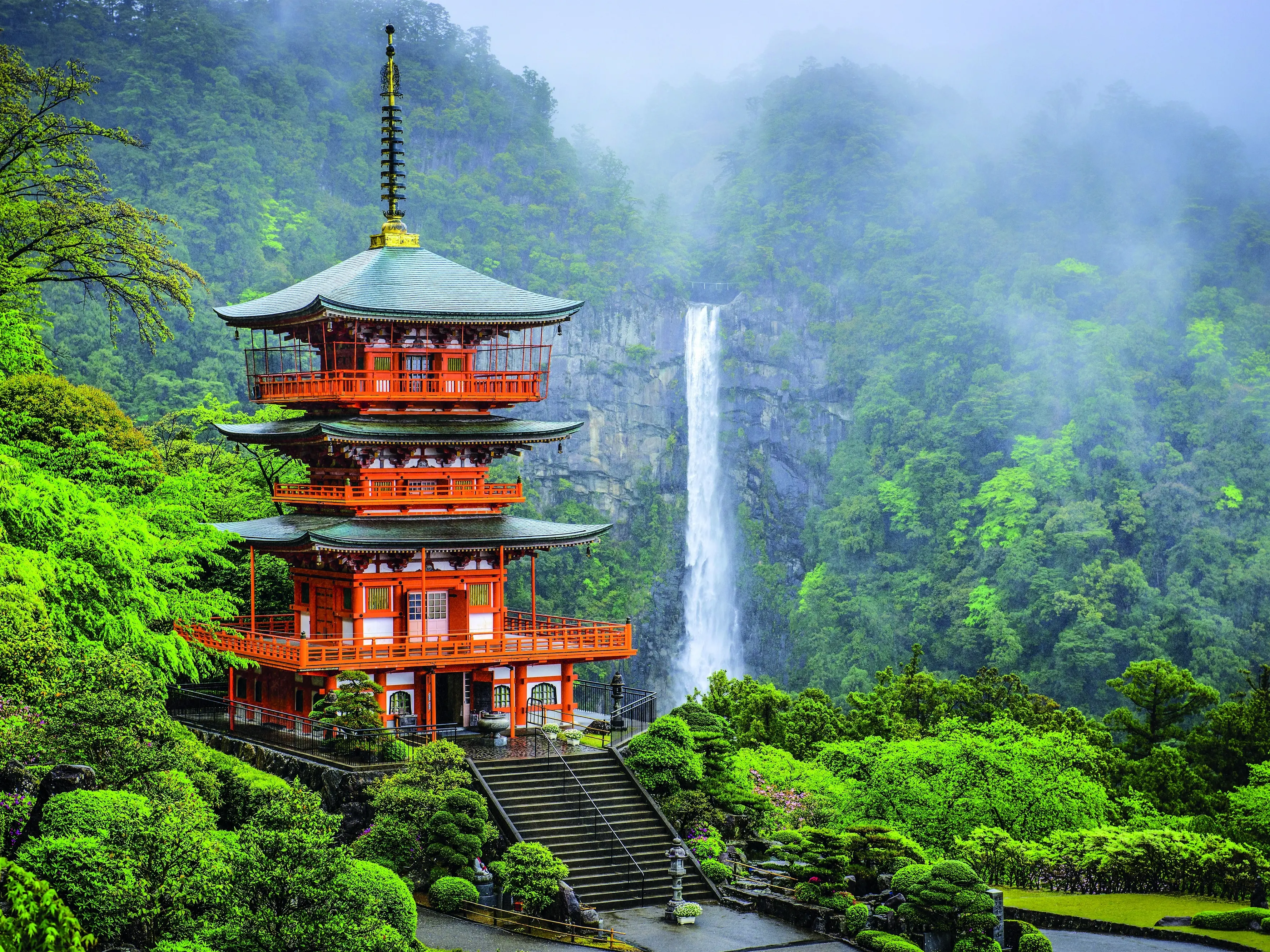
The final day’s route rises and then drops to the Kumano Nachi Taisha shrine, picturesquely perched before 133m-high Nachi, Japan’s tallest single-drop waterfall — its clear cascades a suitably cleansing end to a purifying pilgrimage.
Last day sight: the Kumano Nachi Taisha shrine is picturesquely perched before 133m-high Nachi, Japan’s tallest single-drop waterfall. PHOTO: GETTY IMAGESAccommodation: Ryokan (traditional inns), minshuku (simpler guesthouses) and hostels near the trail, often in onsen (natural hot-spring resorts).
Food: Many pilgrims eat at their accommodation, which will likely also provide picnic lunches; there are some stores and teahouses near the route.
Getting there: The start at Takijiri-oji is a short bus ride from Kii-Tanabe Train Station, which is 2½ hours from Osaka. Buses run from the end at Nachi Taisha to Shingu Station, 3½ hours from Nagoya.
Planning: Book accommodation well in advance on this popular route.
Safety: Prepare for variable weather and steep climbs.
 encounter unfamiliar cultures, spy animals in their natural habitat and savour solitude or the company of other hikers.