PHOTO
While a 4WD is not essential for this short trip, those undertaking it need to be at home travelling on unsealed roads, starting with Domain Rd - the first right turn after the bridge into Lake Hawea and leading you round the back of the town - which starts as tarmac and turns into gravel.
You will come to a T-intersection at the Hawea Flat 3km sign.
Take a right on to Gladstone Rd and follow it past Hawea Flat School on to Kane Rd.
The elevation gives you a panoramic mountain view back towards Wanaka and forward past Luggate.
Take a left at the Omarama, Mt Cook sign (Luggate Tarras Rd) and keep an eye out for the gravel shortcut to the right along Maori Point Rd.
Then turn right again towards Cromwell and after crossing the bridge, the Bendigo (loop) Rd is only about 1.6km along on your left.
An unseasonal sprinkling of December snow catches the weak morning sun as we drive up the gravel road and pass some of the sub region's 10 vineyards.
Where the road forks there is an information stand detailing the gold fields' history.
From 1862 to 1900, alluvial mining of gold attracted the adventurous seeking wealth from the ground.
Numbers living on the site swelled to 500 during the peak years.
Turn right up the road that reads "Old mine workings 3km".
I would suggest by-passing the Bendigo School site (1880 - 1914) as all that remains is the stone fireplace.
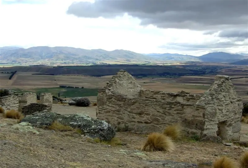
Far more fascinating ruins await further up from where the sign directs you to the Bendigo Historic Reserve.
Pull into Logantown and try to conjure up images of a once-bustling settlement that included no fewer than seven hotels, four general stores, a bakery and drapery.
Spare a thought also for the hopeful miner back in the 1860s.
He had to walk, ride or drive from Cromwell via Lowburn.
Or if it was after mid-1870, he might be lucky enough to catch the new once-a-week carriage service.
From Lowburn, the miners made their way along the Clutha's west bank until they reached the punt across the river at Rocky Point.
Modern-day explorers can simply drive up the road to the parking area and wander around Welshtown (1869-1880), where the cluster of huts, stables and gardens are now reduced to still-recognisable rubble.
I recommend taking advantage of the walking tracks: Matilda Battery 45 minutes-1 hour round trip or Aurora Creek 1-1.5 hours.
Clambering around the spoil heaps, battery ruins, dray tracks, water systems and abandoned mine shafts, you can't help but admire the determination and ingenuity of the miners who laboured to extract gold from this inhospitable terrain.